

1946 Station Map of Central London
SKU: 8717
Title:
1946 Station Map of Central London
Date of publication:
Printed Measurement:
Colour:
Mapmaker:
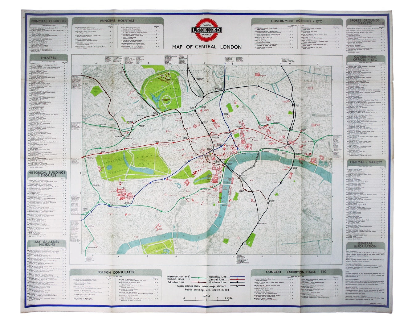
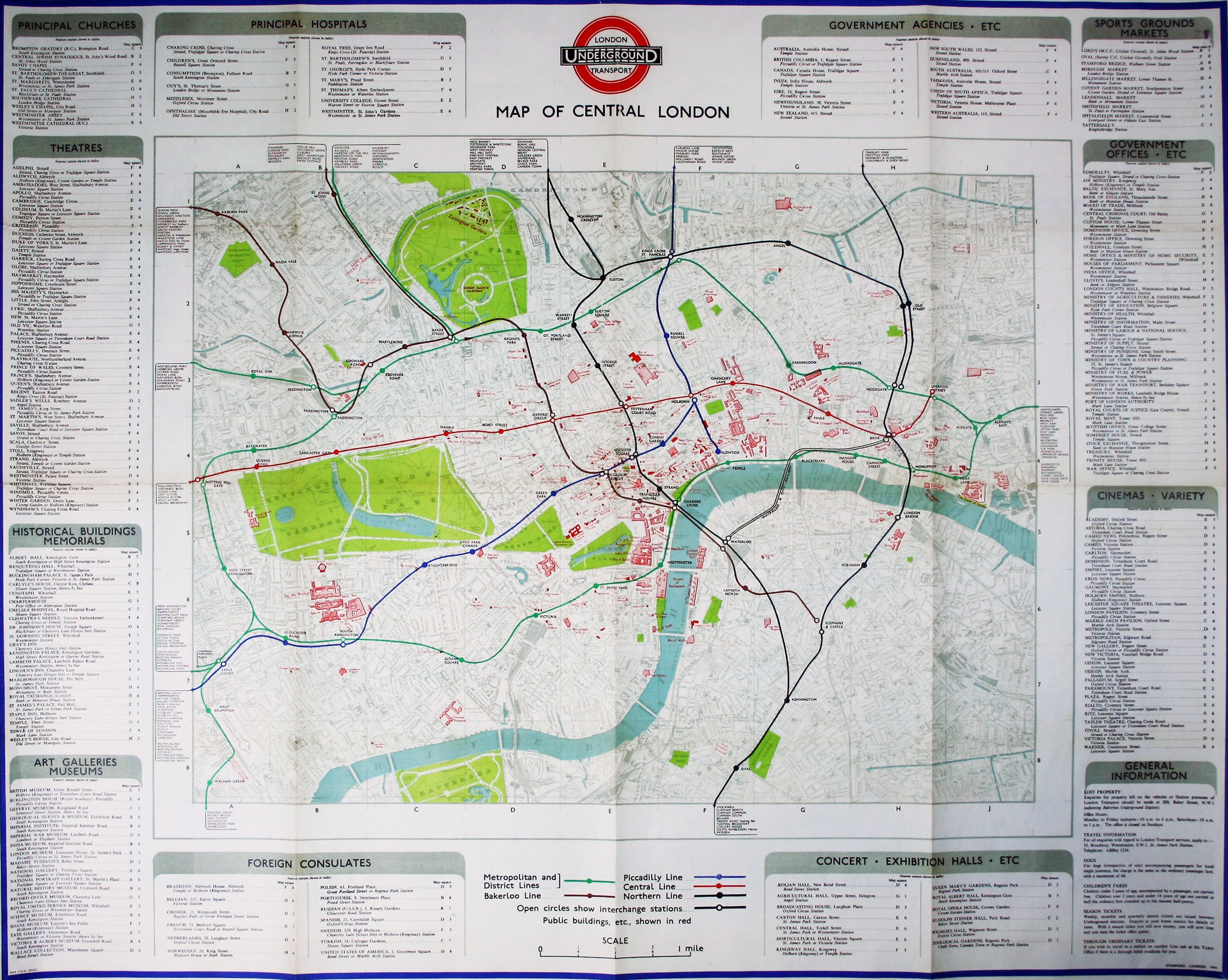
The introduction of Beck's diagram did not obviate the need for geographically accurate maps, which pinpointed the location of Underground stations in the central area in relation to the surface topography.
The lines themselves, though colour-coded, are given minimal prominence on this map so as not to disrupt the street plan. Public buildings are picked out in red, and the roundel in the border is flanked by details of theatres, cinemas, hospitals, government offices, foreign consulates and other places of interest, listed with coordinates which correspond with the grid on the map.
Read more
Condition & Materials
Quad royal station wall map, 105 x 126 cm printed in colours, one or two trivial marginal nicks and tears, blank verso.
A Note on Shipping
Shipping rates are not available for this item. Select ‘pick up’ at checkout to collect it from the shop, or contact us for a custom quote. We will email you an invoice for the item price plus shipping, and you can complete the transaction securely online. Read less