

Admiralty Chart Barbados
SKU: 8555
Title:
Admiralty Chart Barbados
Date of publication:
Printed Measurement:
Colour:
Engraver:
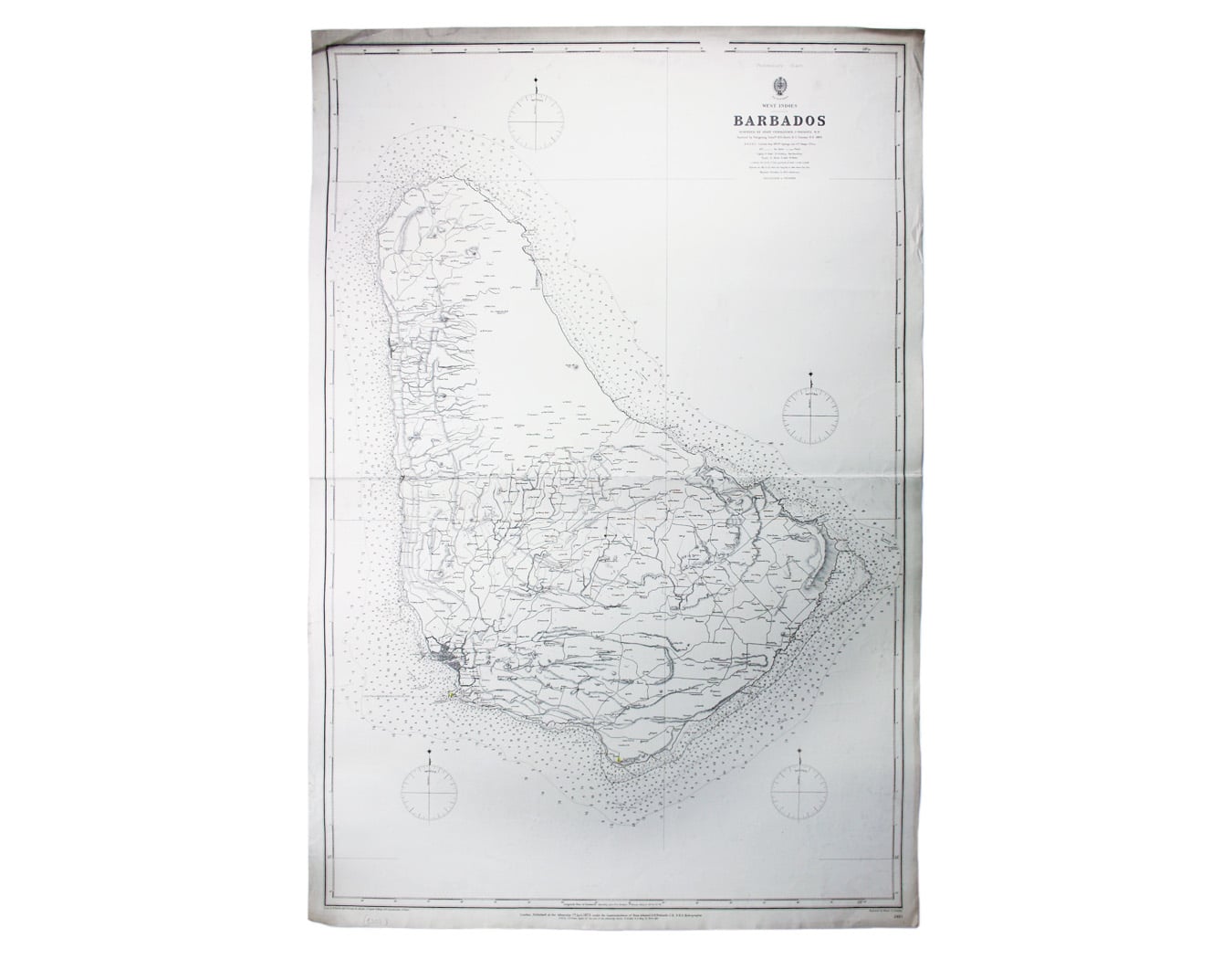
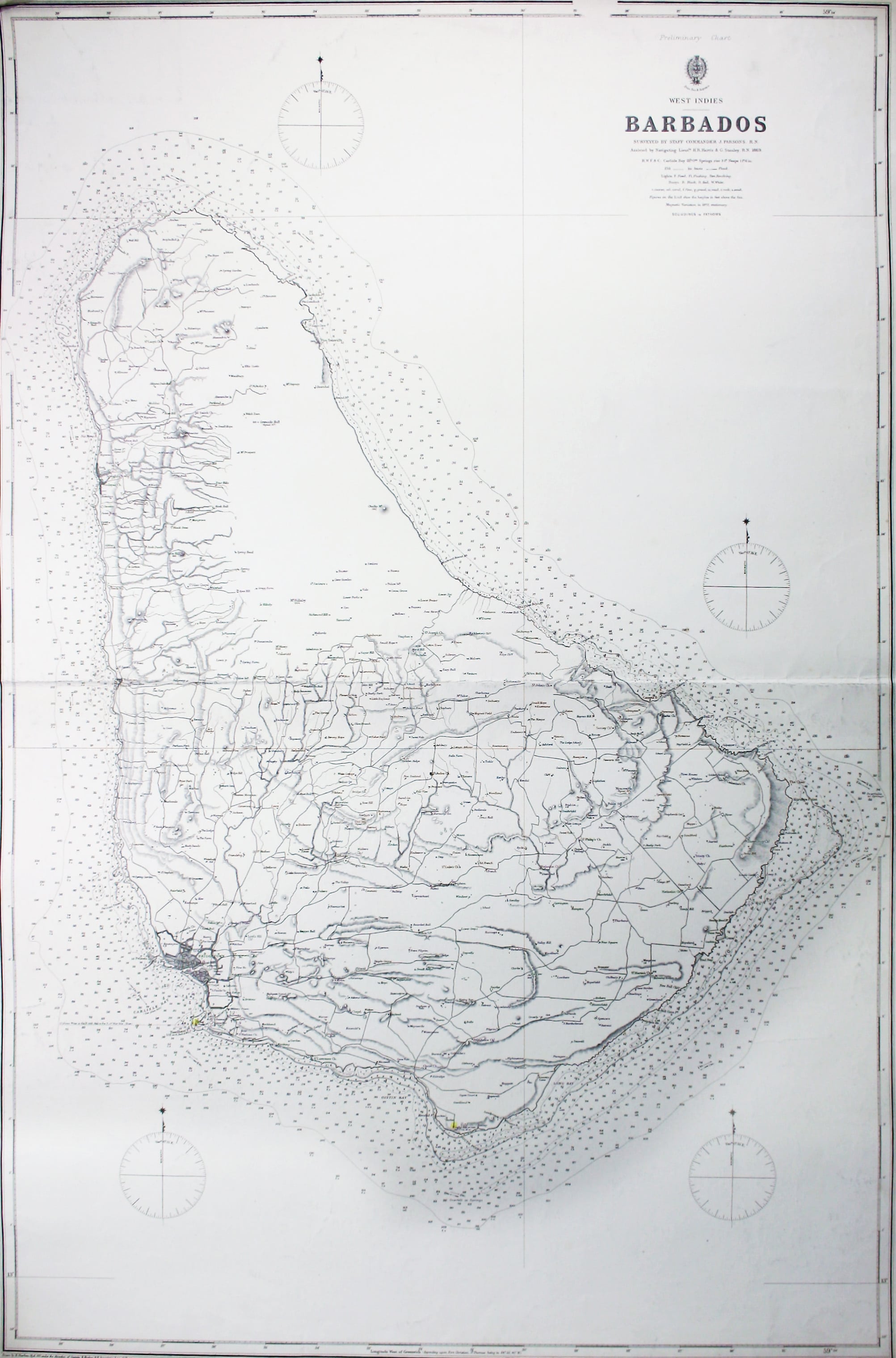
Preliminary Chart – West Indies – Barbados
This chart of Barbados shows sands and soundings etc, with interior detail of relief, roads and settlements. Read more
Surveyed by Staff Commander J Parsons in 1869, assisted by Navigating Lieutenants H R Harvey and G Staines, this appears to be the first published edition with no revisions or corrections. Later editions saw the addition of two coastal profiles at the foot of the chart.
Condition & Materials
Sea chart, 102 x 68.5 cm, engraved by Davies and Company after H. Sharbau, black and white, centrefold, margins a little dusty and with a couple of creases at corners, blank verso; lighthouses/beacons highlighted in colour. Read less