

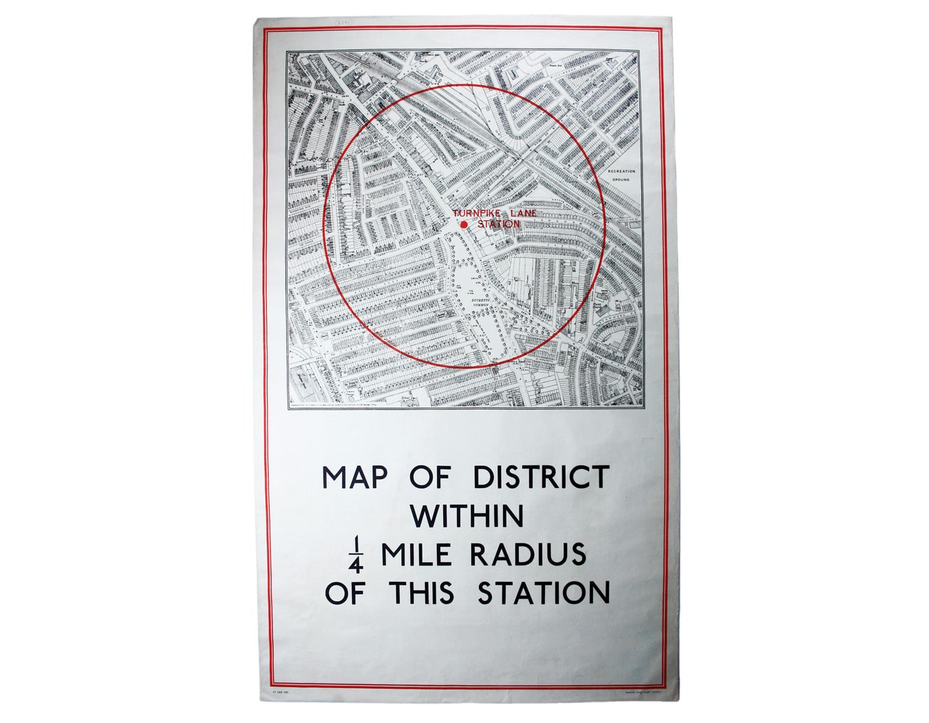
Quarter Mile Radius Map of Turnpike Lane Station
SKU: 8892
Title:
Quarter Mile Radius Map of Turnpike Lane Station
Date of publication:
Printed Measurement:
Colour:
District within ¼ mile radius [of] Turnpike Lane
Stanford’s was a firm of map publishers as well as map retailers until after the Second World War, with a lucrative Ordnance Survey contract. In the late 1920s Stanford’s began supplying the Underground with small runs of maps for local display, based on the Ordnance Survey and confined to a quarter-mile radius from each station. They were printed in very low numbers: in this instance just 100 examples. Read more
Condition & Materials
Double royal quarter mile radius map centred on Turnpike Lane Station, 105 x 62.5 cm, printed in red and black, laid on linen as issued. Read less