

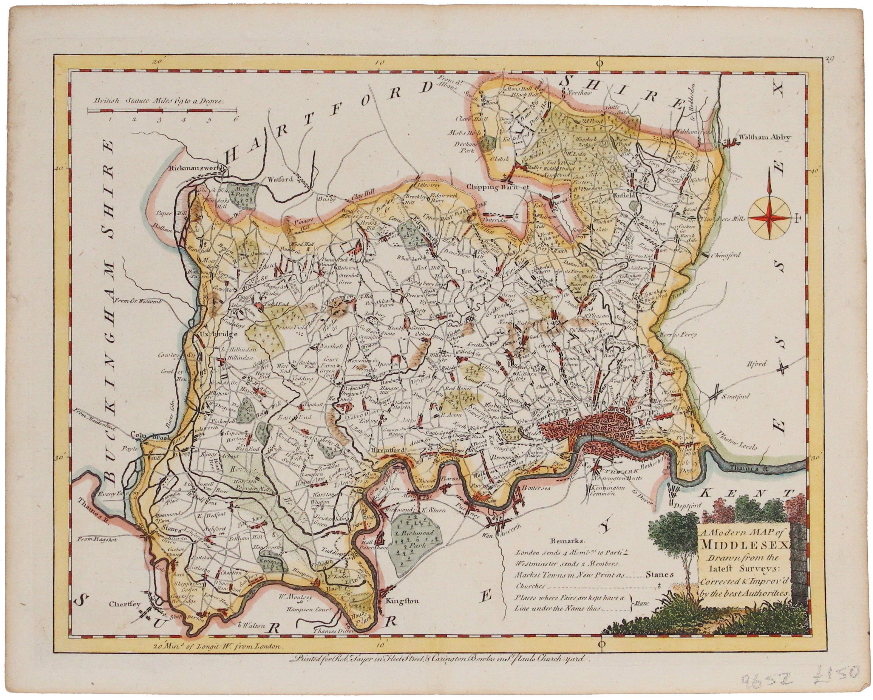
Ellis' Map of Middlesex
SKU: 9652Ellis' map of Middlesex conveys a wealth of detailed information: borough towns are shown with stars identifying the number of Members returned to Parliament, and "Places where Fairs are kept have a Line under the Name".
Ellis (d.1796) was a prolific English engraver of the late eighteenth century who joined with William Palmer to produce a set of English county maps, published as Ellis' 'New English Atlas', in 1765. Read more
The maps were later used in Ellis' 'English Atlas; or a Complete Cartography of England and Wales' published in 1766, and reprinted in 1768: our map comes from the 1768 edition. Ellis engraved some of the maps himself, while others were engraved by Louis de la Rochette, Palmer and W Fowler. The maps themselves were closely based on Kitchin's maps from Dodsley's England Illustrated'.
Condition & Materials
Copper engraving, 20 x 26.5 cm, modern hand colour, blank verso. Read less