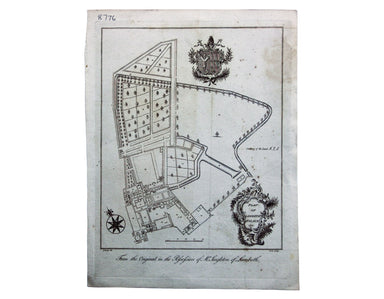
18th Century Plan of Lambeth Palace
Plan of Lambeth Palace 1750… from the original in the possession of Mr Singleton of Lambeth This plan of Lambeth Palace published in Ducarels’s ‘Th...
View full details

Plan of Lambeth Palace 1750… from the original in the possession of Mr Singleton of Lambeth This plan of Lambeth Palace published in Ducarels’s ‘Th...
View full details
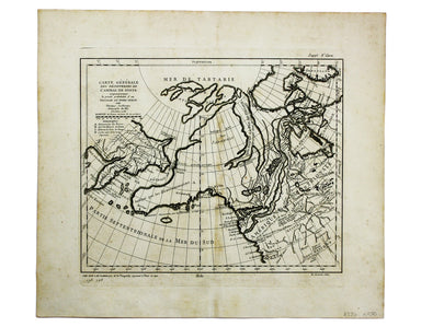
Carte générale des découvertes de l’Amiral de Fonte, representant le grande probabilité d’un Passage au Nord Ouest Maps depicting the purported voy...
View full details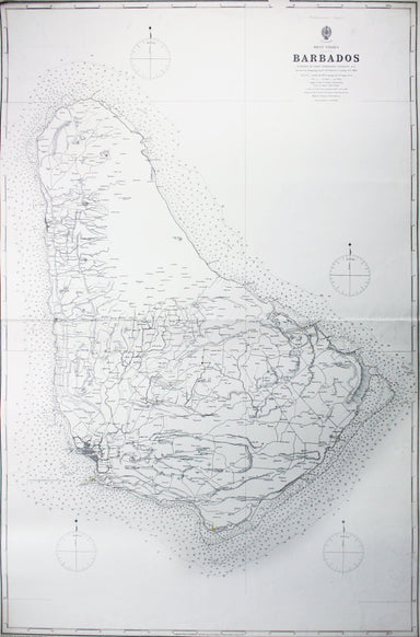
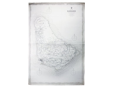
Preliminary Chart – West Indies – Barbados This chart of Barbados shows sands and soundings etc, with interior detail of relief, roads and settleme...
View full details
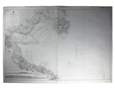
This chart of Dublin bay shows soundings etc, with interior detail of relief and settlements (including eastern Dublin), and inset coastal profiles...
View full details

This British chart of Durban port was engraved by John and Charles Walker. It shows soundings etc, interior detail of relief and settlements includ...
View full details
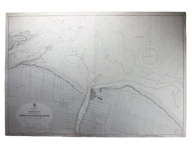
South America – British Guiana – Georgetown and mouths of Demerara and Essequibo Rivers This British chart of Georgetown shows soundings etc, with ...
View full details
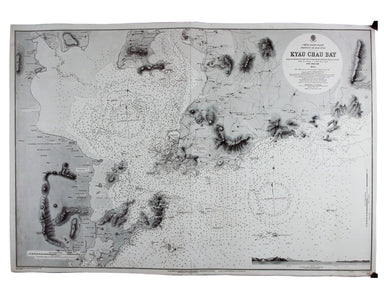
China – East Coast – Province of Shan Tung – Kyau Chau Bay This is a British chart of Jiaozhou Bay on the southern coast of the Shandong Peninsula....
View full details
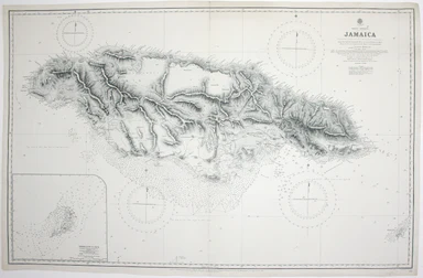
This chart of Jamaica shows soundings etc, with interior detail of relief, roads and settlements, and an inset of Morant Cays. First published in 1...
View full details
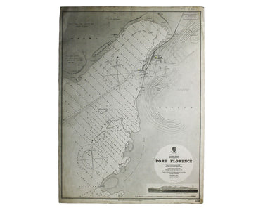
Port Florence [Kisumu, Kenya] Kisumu, a port on Lake Victoria, was surveyed as a terminus for the Uganda Railway in 1898. The railway was completed...
View full details
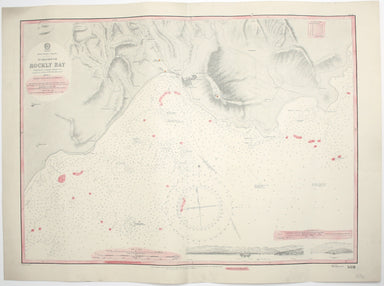
West Indies – Tobago – Scarborough – Rockly Bay This chart of Rockly Bay shows soundings etc, with interior detail of relief, roads and settlements...
View full details
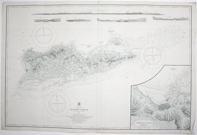
West Indies – Santa Cruz [Saint Croix] This chart of Saint Croix shows soundings etc, with interior detail of relief, roads and settlements, coasta...
View full details
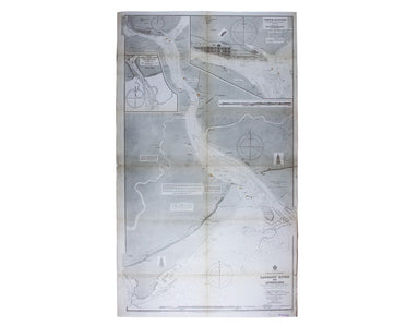
Burma – Gulf of Mataban – Rangoon River and Approaches This chart covers the mouth of the river between Rangoon (Yangon) and the sea. It shows vill...
View full details
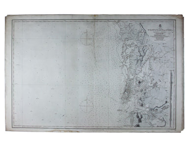
Sheet III – West Coast of India – from Arnol I. to Kundari I This chart shows the approaches to Bombay harbour, modern Mumbai, with significant det...
View full details
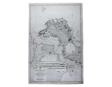
China Sea – Banka Strait This chart of the Bangka Strait was first published in 1858, but revised from British and Dutch surveys. Bangka and Sumatr...
View full details
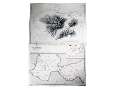
South Pacific Ocean – Santa Cruz Islands – Vanikoro Islands (La Pérouse) This British chart of Vanikoro was first published in 1873, with correctio...
View full details
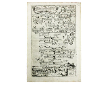
The Babenburg Family Tree The March or Margraviate of Austria had been governed by the Babenburg family since the late tenth century. In 1156 Austr...
View full details
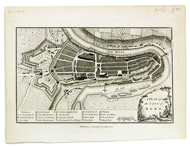
This map of Berne was first published in 'A collection of plans of the capital cities of Europe' in 1771. The plates seem to have been acquired by ...
View full details
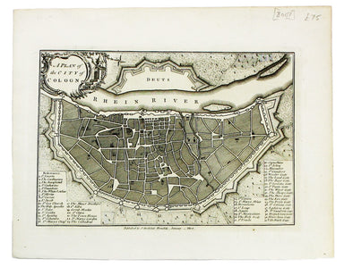
This plan of Cologne was first published in 'A collection of plans of the capital cities of Europe' in 1771. The plates seem to have been acquired ...
View full details
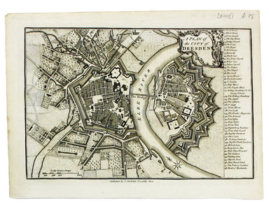
Thus plan of Dresden was first published in 'A collection of plans of the capital cities of Europe' in 1771. The plates seem to have been acquired ...
View full details
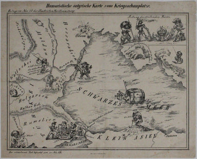
Humoristiche satyrische Karte von Kriegsschauplatze This Austrian pictorial map satirising the Crimean War was published in July 1854 in No. 55 the...
View full details
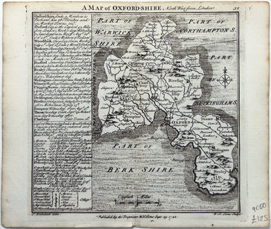
This map of Oxfordshire was engraved by Toms for Thomas Badeslade’s ‘Chorographia Britanniae’, an attractive pocket atlas which according to Badesl...
View full details
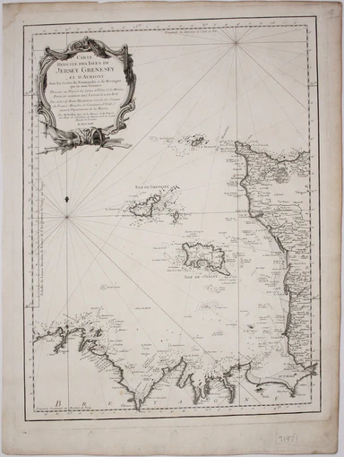
Carte reduite des Isles de Jersey Grenesey et d'Aurigny avec les Costes de Normandie et de Bretagne qui en sont voisines This chart covers the Chan...
View full details
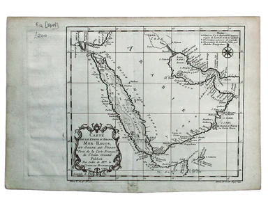
Carte de la Coste d’Arabie, Mer Rouge, et Golfe de Perse. A map of the Arabian peninsula. Jacques Nicolas Bellin the elder (1703-1772) was first ch...
View full details
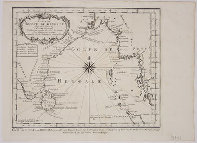
Carte de Golphe de Bengale This map of the Bay of Bengal was engraved by Schley after Bellin, Jacques Nicolas Bellin the elder (1703-1772) was fir...
View full details
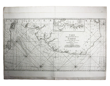
Carte de l’entrée de la Tamise, avec les Bancs, Passes, Isles et Costes comprises entre Sandwich et Clay This is a revised version of a chart which...
View full details
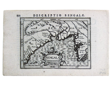
This map of the Bay of Bengal is from the first edition of Tabularum geographicarum contractarum libri, a geographical work which is normally catal...
View full details
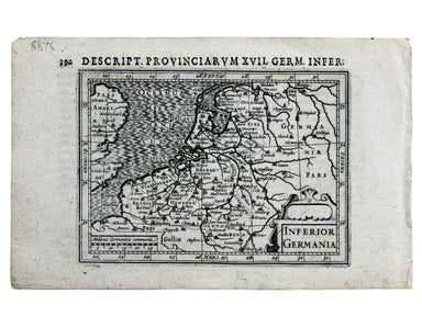
This miniature map of the Low Countries was published in the first edition of Tabularum geographicarum contractarum libri, a geographical work whic...
View full details
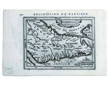
This map of Southern India and Sri Lanka on an east-west alignment is from the French text edition of Tabularum geographicarum contractarum libri, ...
View full details
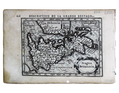
This map of the British Isles with west at the top was published in the French text edition of Tabularum geographicarum contractarum libri, a geogr...
View full details
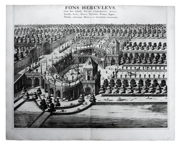
Fons Herculeus: Cum Suis Colosso, Cryptoporticu, Antris, Sacellis, Scalis, Dioetis, Tricliniis, Statuis, Signis, Tabulis, Coeterisque Musivis, ac m...
View full details
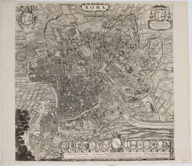
Pierre Mortier acquired the copper printing-plates for Blaeu's great town books of Italy, which were originally published from the 1660s onwards, a...
View full details
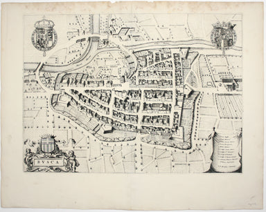
Busca, near Cuneo in Piedmont. Blaeu’s townbook of Savoy and Piedmont was first published by the Blaeu heirs in 1682, but the plates were purchased...
View full details
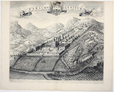
Camaldulensium, nondum omnino absoluta ad Lancei oppidum eremus This is the Camaldolese hermitage near Lanzo Torinese in Piedmont (which is visible...
View full details
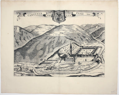
Cartusia Vallis Pisii, fundata 1173 This is the Charterhouse of Pesio, a Carthusian foundation near Cuneo in Piedmont. Blaeu’s townbook of Savoy an...
View full details
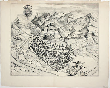
This is a map of Ormea, near Cuneo in Piedmont. Blaeu’s townbook of Savoy and Piedmont was first published by the Blaeu heirs in 1682, but the plat...
View full details
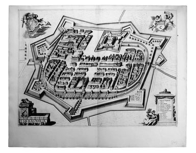
Carmagnola, just south of Turin in Piedmont, was fought over and extensively remodelled in the mid seventeenth-century; it was briefly recaptured b...
View full details
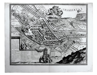
Camberium / Chambery Blaeu’s townbook of Savoy and Piedmont was first published by the Blaeu heirs in 1682, but the plates were purchased and reiss...
View full details
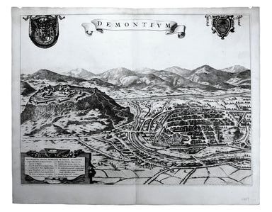
This map of Demonte in Piedmont was engraved by Juvenal Boetto. Blaeu’s townbook of Savoy and Piedmont was first published by the Blaeu heirs in 16...
View full details
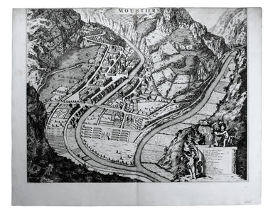
Moustiers Blaeu’s townbook of Savoy and Piedmont was first published by the Blaeu heirs in 1682, but the plates were purchased and reissued (with B...
View full details
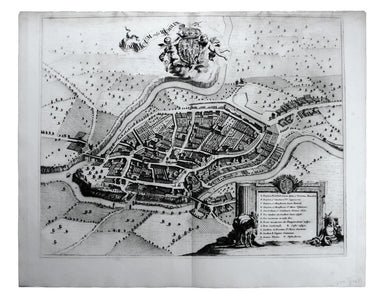
Rumiliacum vulgo Rumilly Blaeu’s townbook of Savoy and Piedmont was first published by the Blaeu heirs in 1682, but the plates were purchased and r...
View full details
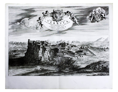
Exigua & celeberrima Verruca […] This is a map of Verrua Savoia, north east of Turin in Piedmont. Blaeu’s townbook of Savoy and Piedmont was fi...
View full details
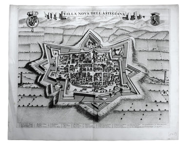
Villa Nova dell’ Astegiana This is a map of Villanova d’Asti, in Piedmont. Blaeu’s townbook of Savoy and Piedmont was first published by the Blaeu ...
View full details
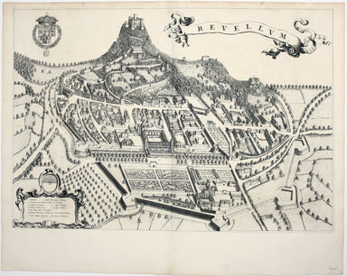
This is a map of Revello, near Cuneo in Piedmont. Blaeu’s townbook of Savoy and Piedmont was first published by the Blaeu heirs in 1682, but the pl...
View full details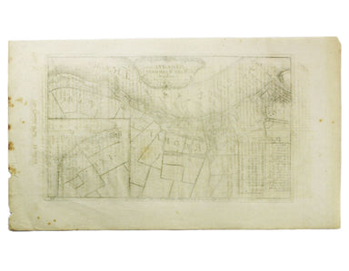
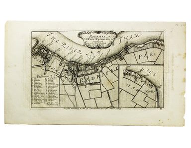
John Stow's A Survey of the Cities of London and Westminster was originally published in 1598 and 1603, but revised and expanded works under his na...
View full details
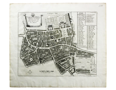
John Stow's A Survey of the Cities of London and Westminster was originally published in 1598 and 1603, but revised and expanded works under his na...
View full details
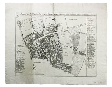
John Stow's A Survey of the Cities of London and Westminster was originally published in 1598 and 1603, but revised and expanded works under his na...
View full details
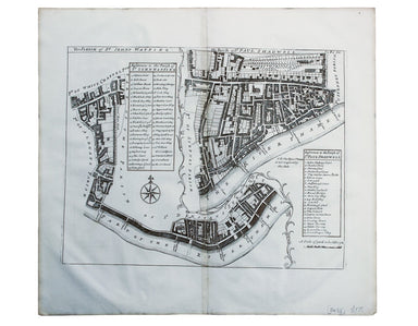
The Parish of St Johns Wapping; The Parish of St. Paul Shadwell This detailed ward plan of Wapping and Shadwell includes Execution Dock, where sent...
View full details
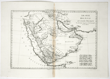
Carte de L’Arabie, du Golfe Persique et de la Mer Rouge, avec L’Egypte, La Nubie et L’Abissinie This map of Arabia was published in an Italian edit...
View full details
