

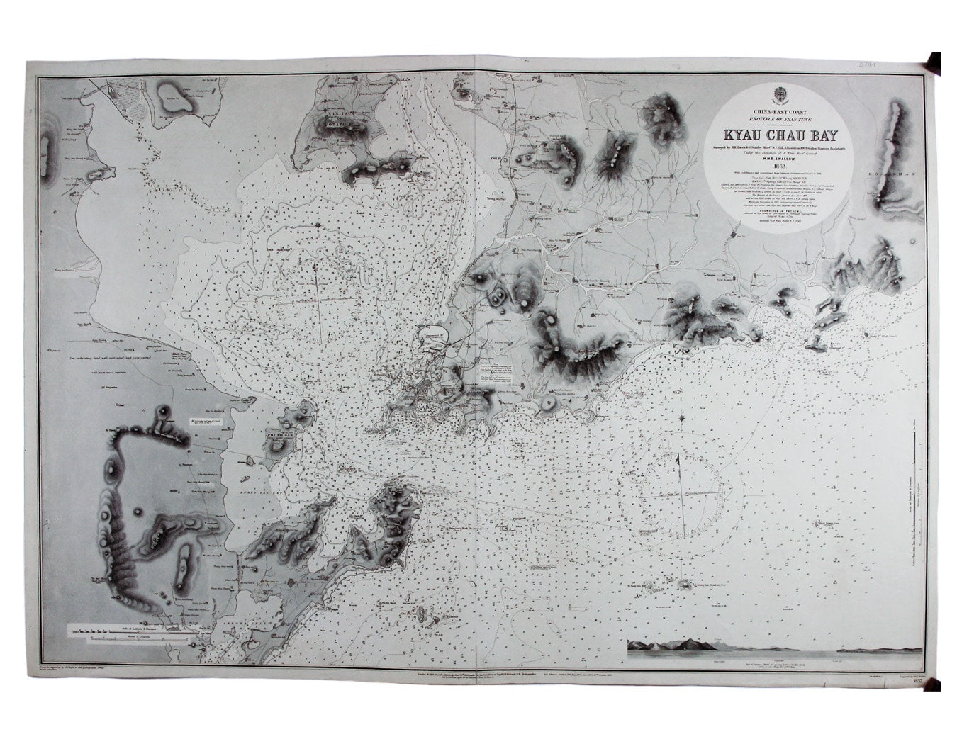
Admiralty Chart of Germany’s Kiautschou Bay Concession
SKU: 8741
Title:
Admiralty Chart of Germany’s Kiautschou Bay Concession
Date of publication:
Printed Measurement:
Colour:
Mapmaker:
China – East Coast – Province of Shan Tung – Kyau Chau Bay
This is a British chart of Jiaozhou Bay on the southern coast of the Shandong Peninsula. Surveyed by the sloop HMS Swallow in 1863 and first published in 1865, our example of the chart incorporates additions and corrections to 1912 from various sources, including German charts to 1911. Read more
Jiaozhou Bay was a German colonial concession, the Kiautschou Bay concession, between 1898 and 1914, with its adminstrative centre at Tsingtau, or Quingdeo. The layout of the town, rapidly expanded by the Germans, is shown in detail at the centre of the chart.
Condition & Materials
Engraved sea chart, 66 x 100 cm, black and white, engraved by John and Charles Walker after A.J. Boyle, centrefold; shows soundings etc, with interior detail of relief, roads and settlements.
A Note on Shipping
Shipping rates are not available for this item. Select ‘pick up’ at checkout to collect it from the shop, or contact us for a custom quote. We will email you an invoice for the item price plus shipping, and you can complete the transaction securely online. Read less