

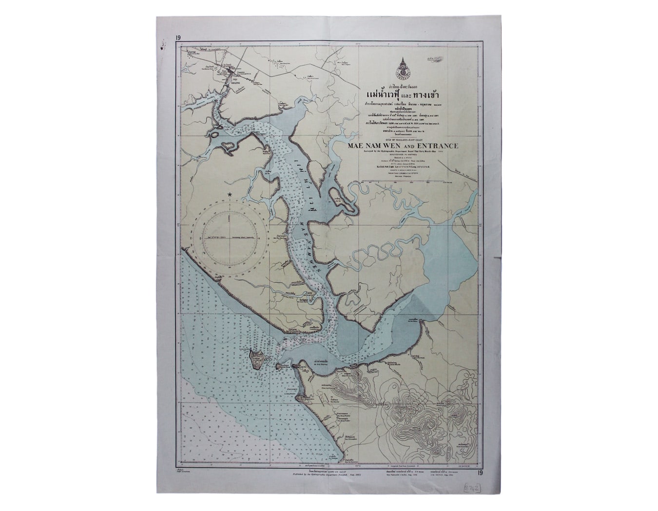

Thai Chart of the Mae Nam Welu Estuary
SKU: 8742
Title:
Thai Chart of the Mae Nam Welu Estuary
Date of publication:
Printed Measurement:
Colour:
Mapmaker:
Mae Nam Wen and Entrance, Surveyed by the Hydrographic Department, Royal Thai Navy, March-May 1944
This is a Thai chart of the Mae Nam Welu estuary in southeastern Thailand. Read more
Condition & Materials
Sea chart, 85 x 60 cm, printed in colours, blank verso, old vertical and horizontal folds. Read less