

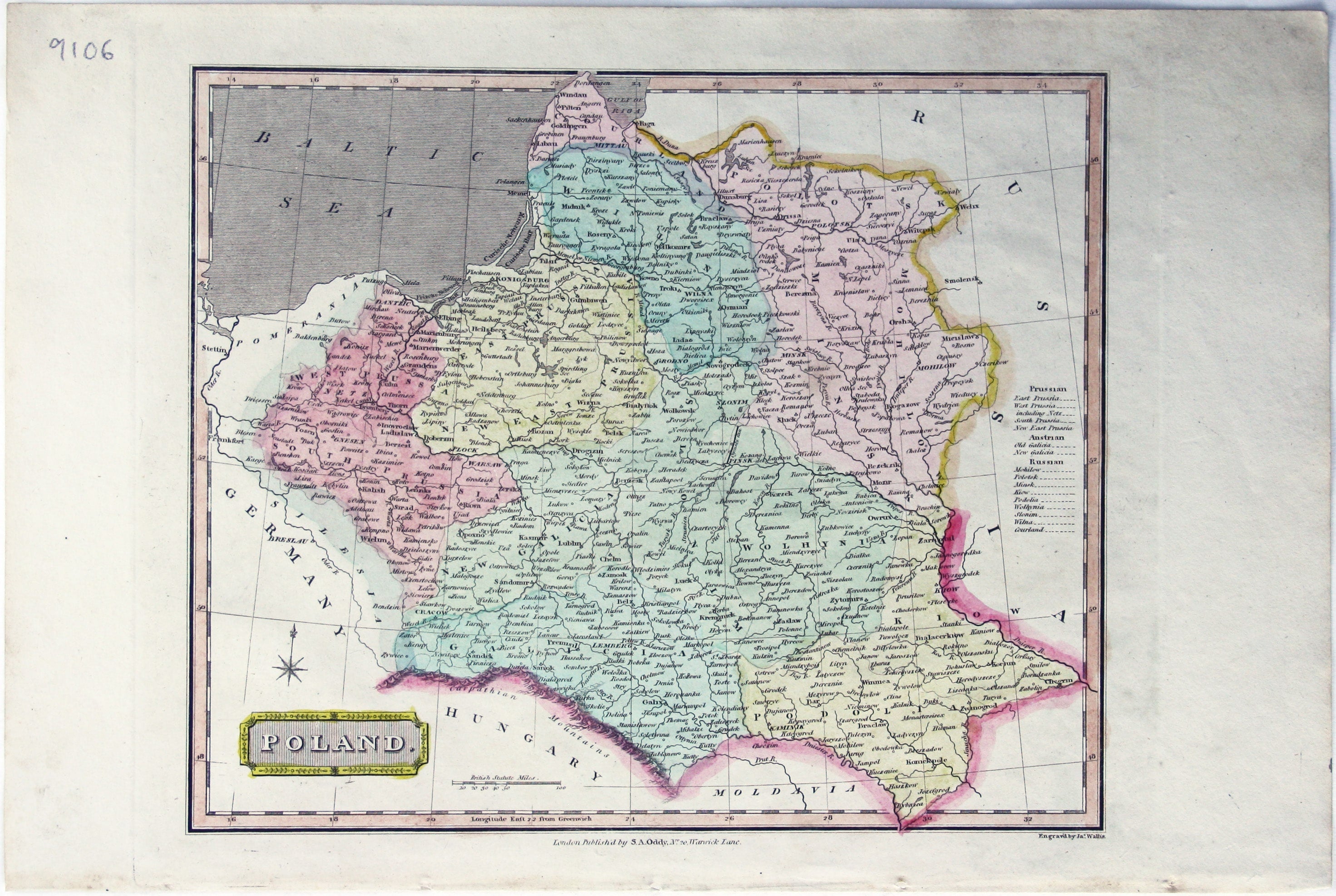
Wallis’ Map of Poland
SKU: 9106
Title:
Wallis’ Map of Poland
Date of publication:
Printed Measurement:
Publisher:
Colour:
Mapmaker:
This map of Poland was published in ‘Oddy’s New General Atlas of the World’.
It is coloured according to the third partition of 1795, by which the Polish–Lithuanian Commonwealth was divided between Prussia, Austria and Russia. Read more
James Wallis (fl. 1810-1825) was born in Southampton in 1784, the son of a bricklayer. Apprenticed to John Roper in 1799, he learned the art of engraving. In later life he is variously recorded as a commission and discount agent (imprisoned for debt in 1835), a stationer, and a dealer in beer and wine.
Condition & Materials
Copper engraving, 25.5 x 30 cm, original hand-colour, blank verso. Read less