

Mercator's Map of Southwestern England & Wales
SKU: 8368
Title:
Mercator's Map of Southwestern England & Wales
Date of publication:
Printed Measurement:
Colour:
Mapmaker:
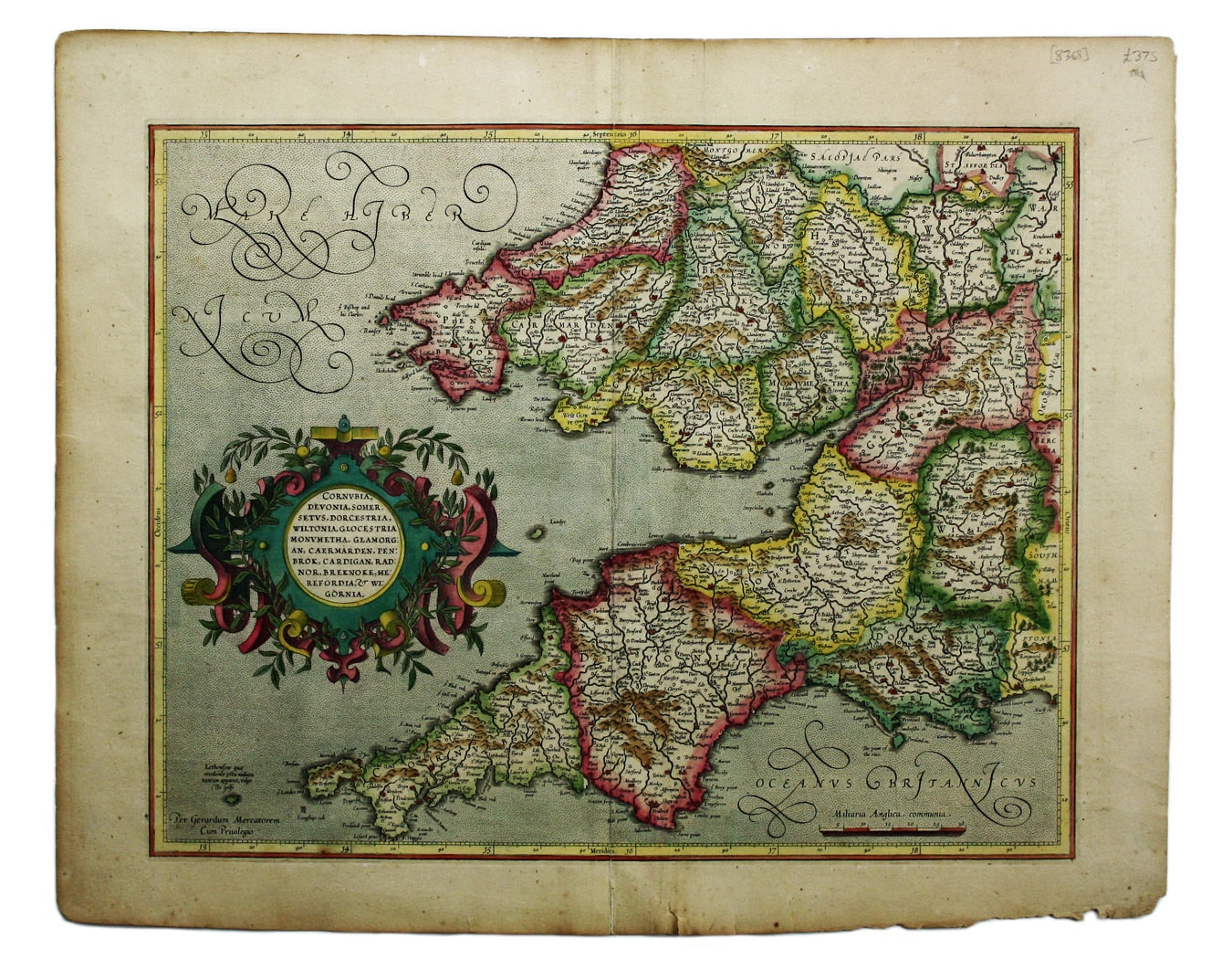
This is the southwestern sheet of Mercator’s five regional maps of England and Wales; Janssonius revised the decorative elements in the 1630s, but the series was superseded by the British volume of the Atlas Novus in the 1640s.
The Hondius-Janssonius map publishing business traced its roots back to Gerardus Mercator. Mercator coined the term ‘atlas’ (after the wise, mythical, Mauritanian king rather than the weary titan) and the original Mercator Atlas (published in parts between 1585 and 1595) was an enormous advance in scientific terms: like Abraham Ortelius, Mercator edited his maps from the best available sources, but he advanced a step further and mapped the world on a standard projection. Read more
However, the Atlas was not an immediate commercial success; the copper printing plates were purchased by Jodocus Hondius c. 1604, and a large number of maps were added for his first edition of 1606, which still traded on Mercator’s name.
His son-in-law Janssonius took over the business in the mid 1630s. He began to erase Hondius’ name and replace it with his own at this time, and eventually expanded the atlas to create an Atlas major which rivalled Blaeu’s.
Condition & Materials
Copper engraving, 36.5 x 47 cm, modern hand-colour, closed centrefold split, one or two marginal nicks and tears, Latin text on verso.
References
Koeman, Atlantes Neerlandici, Me 27A Read less