

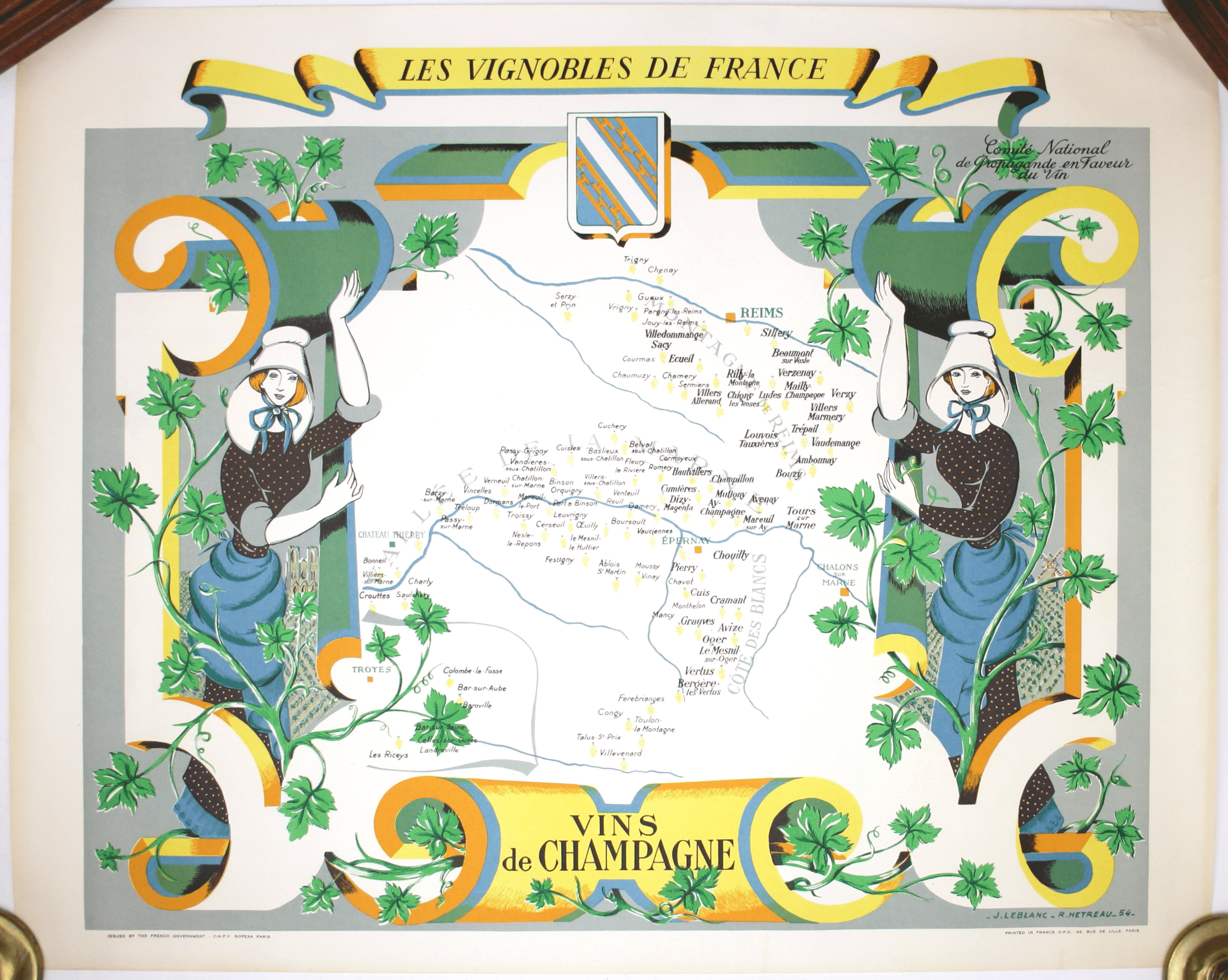
Hétreau’s Map of the Vineyards of Champagne
SKU: 9287
Title:
Hétreau’s Map of the Vineyards of Champagne
Date of publication:
Printed Measurement:
Colour:
Mapmaker:
Les Vignobles de France – Vins de Champagne
Government and national wine trade bodies sponsored Louis Larmat’s regional wine atlases in the 1940s and continued to promote French wines through cartography in the 1950s. The Comité National de Propagande en Faveur du Vin sponsored a delightful series of 11 pictorial maps of the vineyards of France by artist Remy Hétreau (1913-2001), of which this is an example.
Read more
Hétreau was the subject of a 2008 retrospective, ‘Un monde enchanté’, at the Centre Charles Péguy, Orleans. He studied art in Orleans and then at the École Boulle in Paris, a college of arts and crafts and applied arts. He was a versatile painter, sculptor and engraver, turning his hand to a wide range of projects, from set design to ceramics and from book illustration to poster design. He was President of the Société des Artistes Orléanais between 1964 and 1984.
Condition & Materials
Pictorial wine map of the Champagne region, 68 x 84.5 cm, printed in colours, blank verso. Read less