

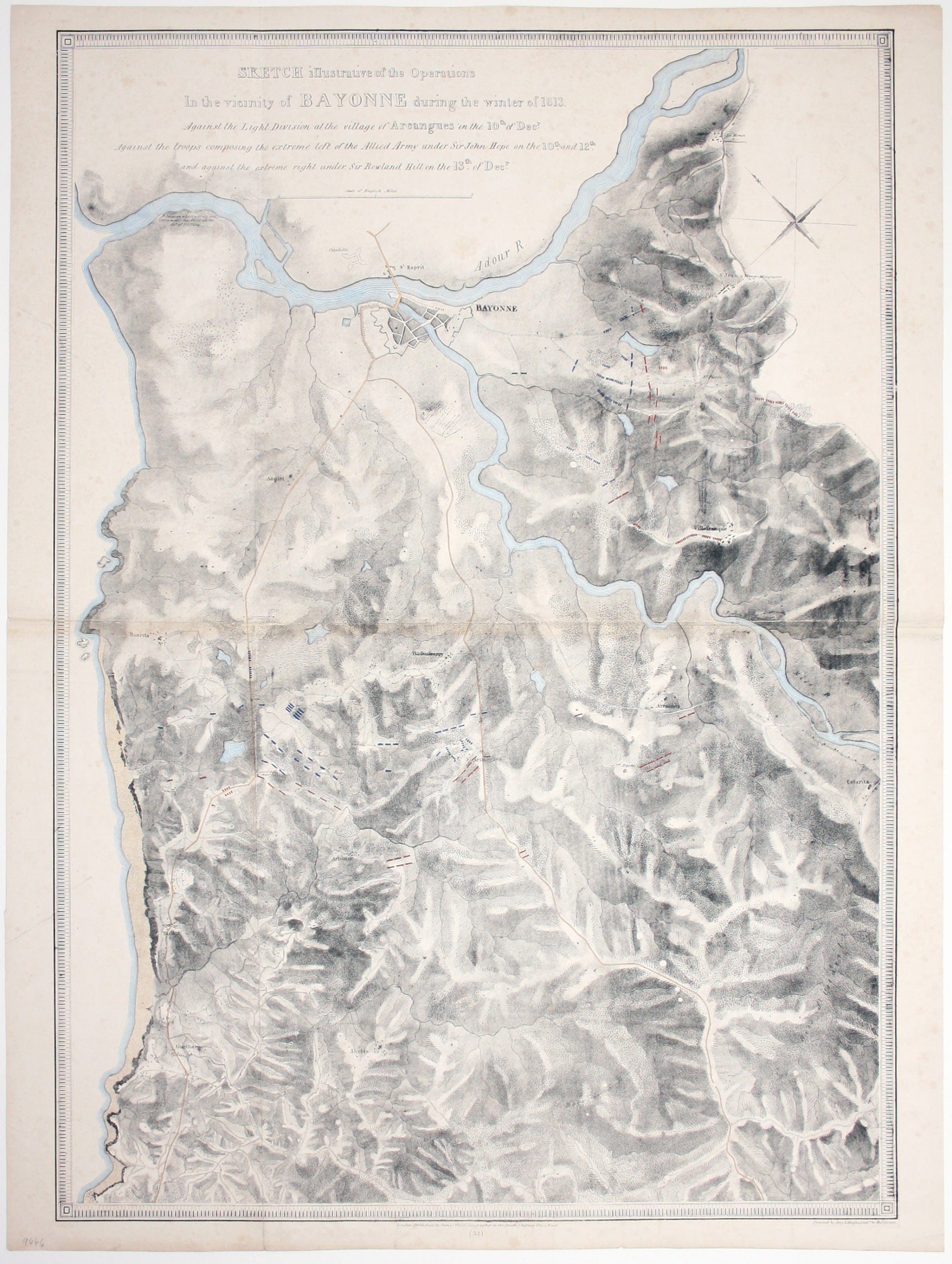
Wyld’s Map of the Battles of the Nive
SKU: 9444
Title:
Wyld’s Map of the Battles of the Nive
Date of publication:
Printed Measurement:
Colour:
Mapmaker:
Sketch illustrative of the operations in the vicinity of Bayonne during the winter of 1813. Against the Light Division at the village of Arcangues on the 10th of Dec[embe]r, against the troops composing the extreme left of the Allied Army under Sir John Hope on the 10th and 12th, and against the extreme right under Sir Rowland Hill on the 13th of Dec[embe]r.
Lithographed by Day & Haghe, our map was published by Wyld in ‘Maps & plans showing the principal movements, battles and sieges in which the British Army was engaged during the war from 1808 to 1814 in the Spanish Peninsula and the south of France’. Read more
By December 1813 the French Army had been driven from Spain, across the Pyrenees and into southwestern France. In the series of actions depicted here, fought between December 9-13 and known collectively as the Battles of the Nive, Wellington’s forces defeated Marshal Soult on French soil.
Condition & Materials
Lithograph, 84 x 64 cm, original hand colour heightening troop dispositions, roads etc, slight spotting, one or two short, closed tears, blank verso. Read less