

Ortelius' Miniature Epitome Map of Normandy
This miniature map of Normandy was engraved by brothers Ambrose and Ferdinand Arsenius circa 1601 for a third ‘epitome’ (or pocket version) of Orte...
View full details

This miniature map of Normandy was engraved by brothers Ambrose and Ferdinand Arsenius circa 1601 for a third ‘epitome’ (or pocket version) of Orte...
View full details

The Road from Oxford to Coventry continued to Darby... This map was published as sheet 82 in the 1698 folio edition of Ogilby’s pioneering road atl...
View full details

The Extended Road from Oakham to Richmond... commencing at Oakham aforesaid & extending to Barnsley in Yorkshire This map was published as she...
View full details

The Continuation of the Road from London to Holy-Head... Plate 3d., commencing at the City of Lichfield & extending to the City of Chester This...
View full details

Robert Morden's county maps, like this one of Northumberland, were engraved to illustrate Gibson's edition of William Camden's Britannia, first pub...
View full details

Bowen’s New General Map of America appeared in a number of publications, and features widely held cartographic misconceptions of the time, such as ...
View full details

This map shows Lisbon on the banks of the River Tagus, still at the height of her prosperity as the hub of a Portuguese empire and trade network wh...
View full details

A Mapp of the Parish of St Giles’s in the Fields John Stow's A Survey of the Cities of London and Westminster was originally published in 1598 and ...
View full details

This map of Dorset was published in Philip Lea’s edition of Christopher Saxton’s county atlas, commonly known as the Lea-Saxton or Saxton-Lea. Chr...
View full details

Cassell's 'immense map' of London, of which this is the central sheet, was prepared for the Weekly Dispatch and published in nine parts between Jan...
View full details

Cassell's 'immense map' of London, of which this is the south sheet, was prepared for the Weekly Dispatch and published in nine parts between Janua...
View full details

This miniature map of Gujarat and northern India was published in one of the earlier editions of Bertius’ Tabularum Geographicarum Contractum issue...
View full details

Fessae et Marocci Regna – a miniature map of Morocco. Condition & MaterialsCopper engraving, printed area measurement 7.8 x 10.6 cm. Modern ha...
View full details

This miniature map of Austria was engraved by brothers Ambrose and Ferdinand Arsenius circa 1601 for a third ‘epitome’ (or pocket version) of Ortel...
View full details

Robert Morden's county maps, like this one of Cornwall, were engraved to illustrate Gibson's edition* of William Camden's Britannia. Camden was an ...
View full details

Robert Morden's country maps, like this one of Suffolk, were engraved to illustrate Gibson's edition* of William Camden's Britannia. Camden was an ...
View full details

Robert Morden's county maps, like this one of Surrey, were engraved to illustrate Gibson's edition* of William Camden's Britannia. Camden was an El...
View full details

Plan du Port et de la Ville de Nangasaki This is a plan of the port city of Nagaski, one of Japan’s chief points of contact with the outside world ...
View full details

Carte de Isles du Japont et la presqu' Isle de Coree avec les costes de la Chine depuis Pekin jusqua Canton . . . Bellin compiled maps like this on...
View full details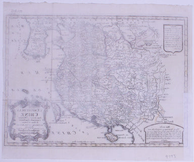
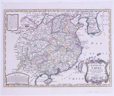
L’Empire du Chine pour servir a l’Histoire Universelle, d’une Societe de Gens de Lettres Our example of Bellin’s map of China, with text in French ...
View full details

Thousands of miles of roads were surveyed for John Ogilby’s pioneering road atlas, the ‘Britannia’. The decorative cartouche on this map of the roa...
View full details

Thousands of miles of roads were surveyed for John Ogilby’s pioneering road atlas, the ‘Britannia’. This sheet shows the roads between the Cumbrian...
View full details

Thousands of miles of roads were surveyed for John Ogilby’s pioneering road atlas, the ‘Britannia’. This sheet covers the road between High Barnet ...
View full details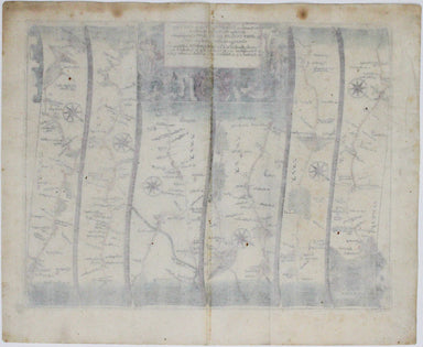
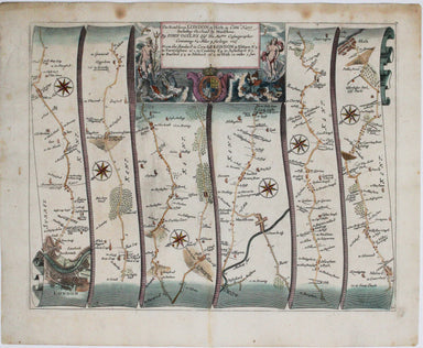
Our journey to Hythe begins in London and follows the road through East Peckham and Eltham, reaching Hythe via Maidstone. Thousands of miles of roa...
View full details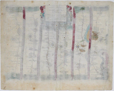
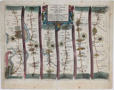
Our journey to Dover begins in London and follows the road through Deptford, Blackheath, Shooter’s Hill, and Dartford, reaching Dover via Rochester...
View full details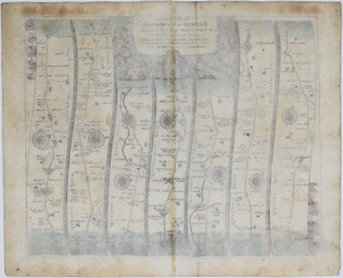
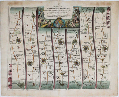
Our journey takes us along the road between the university towns of Oxford and Cambridge, via Bedford. Thousands of miles of roads were surveyed fo...
View full details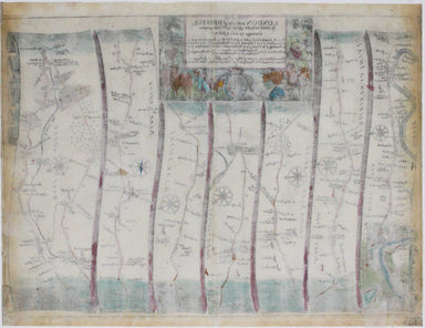
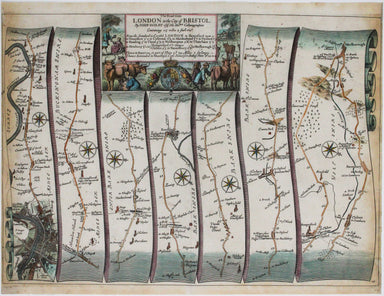
Our journey begins in London and follows the road west through Knightsbridge and Kensington (with Hyde Park to one side), Hammersmith and Turnham G...
View full details
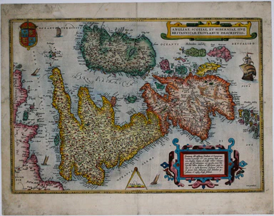
This map of the British Isles is aligned with west at the top of the map and north on the right, which makes better use of the available space on t...
View full details
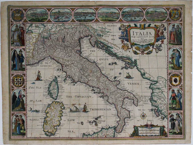
This 'carte à figure' map of Italy includes eight costume vignettes and six city views around the edges, with the coats of arms of Corsica and Sard...
View full details
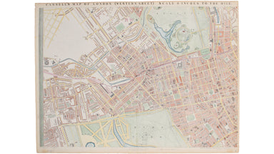
Cassell's 'immense map' of London was prepared for the Weekly Dispatch and published in nine parts between January 1861 and April 1862. This exampl...
View full details
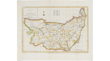
This map of Suffolk is from a series of maps engraved between 1787-1791 by Edward Sudlow after John Haywood. It was subsequently published in atlas...
View full details
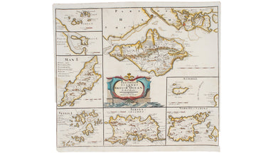
Robert Morden's maps were engraved to illustrate Gibson's edition of William Camden's Britannia, first published in 1695 and reprinted in 1722 and ...
View full details
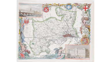
This map of Middlesex is illustrated with vignettes of Buckingham Palace (before its early 20th century re-modelling) and the ‘new’ Houses of Parli...
View full details
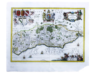
Suthsexia, vernacule Sussex Condition & Materials Copper engraving, 38.5 x 50.5 cm, modern hand-colour, closed centrefold split with some margi...
View full details
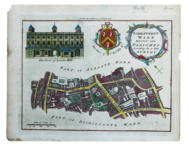
Limestreet Ward divided into Parishes according to a late Survey Possibly engraved by Thomas Bowen and first published in the London Magazine, this...
View full details
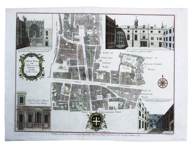
Cheap Ward with its Divisions into Parishes according to a New Survey This ward plan of Cheap was published in the greatly expanded second edition ...
View full details

Pomerania, running along the Baltic coast between Rostock and Gdansk, is now divided between Germany and Poland. The 'Atlas Minor’ was a pocket atl...
View full details
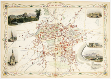
This map of Edinburgh is one of the town plans in Tallis’ hugely popular ‘Illustrated Atlas’ which was published serially from the mid 1840s onward...
View full details
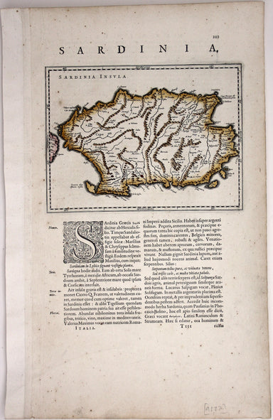
This is a map of the Italian island of Sardinia, oriented with north to the left of the map. Condition & Materials Copper engraving, sheet size...
View full details

[Title-page] Atlas Novus This title-page shows Europe, seated, accepting tribute from the other continents: Asia, Africa and America. In the foregr...
View full details
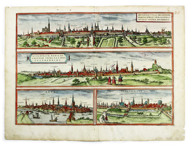
Brunopolis [with] Luneburgum [and] Brema [and] Aldenburgum Holsatiae Four north German towns are shown here on one sheet: Braunschweig, Lüneburg an...
View full details
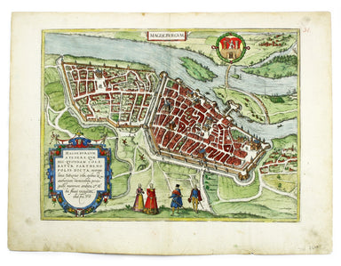
Magdeburgum, a Venere quae hic quondam colebatur Parthenopolis dicta, metropolitica Saxoniae urbs The cartouche on this plan of Magdeburg refers to...
View full details
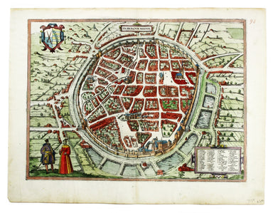
Fribergum Misinae The Civitates Orbis Terrarum was one of the most significant cartographic works of the late sixteenth-century, printed over 45 ye...
View full details
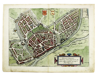
Wesalia in Ducatu Clivensi Urbs Clara Opibus The Civitates Orbis Terrarum was one of the most significant cartographic works of the late sixteenth...
View full details
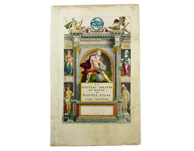
[Title-page] Le Nouveau Theatre du Monde ou Nouvel Atlas, Tome Troisieme Copper engraved title-page, 37.5 x 23.5 cm, later hand-colour, blank verso...
View full details
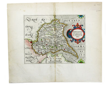
Eboracensis Comitatus […] pars Orientalis, vulgo East Riding. This map of the East Riding is from the second edition of Philemon Holland’s translat...
View full details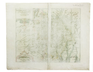
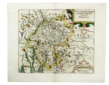
Wesmorlandia e comitatis. This map of Westmorland is from the second edition of Philemon Holland’s translation of Camden’s Britannia into English, ...
View full details
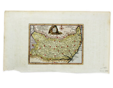
This map of Sussex was first issued in The London Magazine, which between 1747 and 1754 published a complete set of English county maps by Thomas K...
View full details
