


French Chart of Isla Culebra
SKU: 9508
Title:
French Chart of Isla Culebra
Date of publication:
Printed Measurement:
Colour:
Mapmaker:
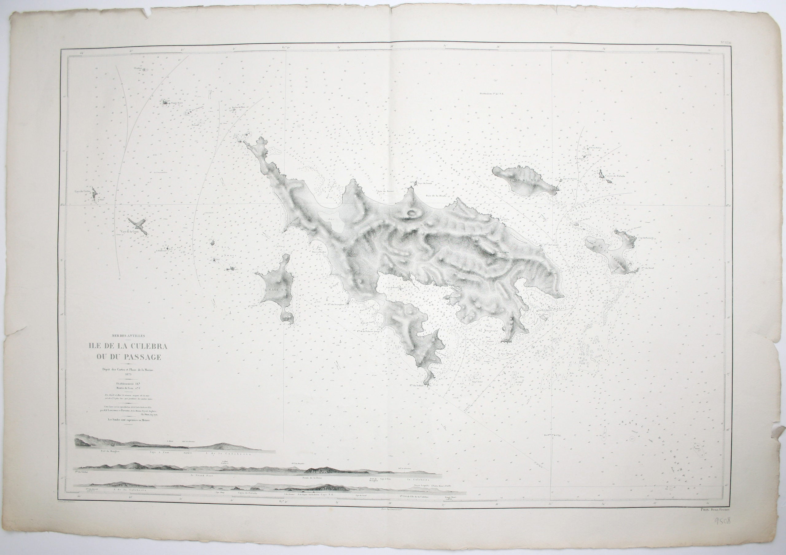
Antilles – Ile de Culebra ou du Passage
This detailed chart of Isla Culebra (now an island-municipality of Puerto Rico) was derived from British Admiralty surveys. With no permanent population for centuries, the island was settled by the Spanish in the 1880s, and ceded to the United States after the Spanish-American War. Read more
Condition & Materials
French naval chart, sheet 3256, sheet size 72.5 x 105 cm, engraved by Delamare, black and white, with coastal profiles in the lower part of the chart, centrefold, one or two marginal nicks and tears, blank verso. Read less