

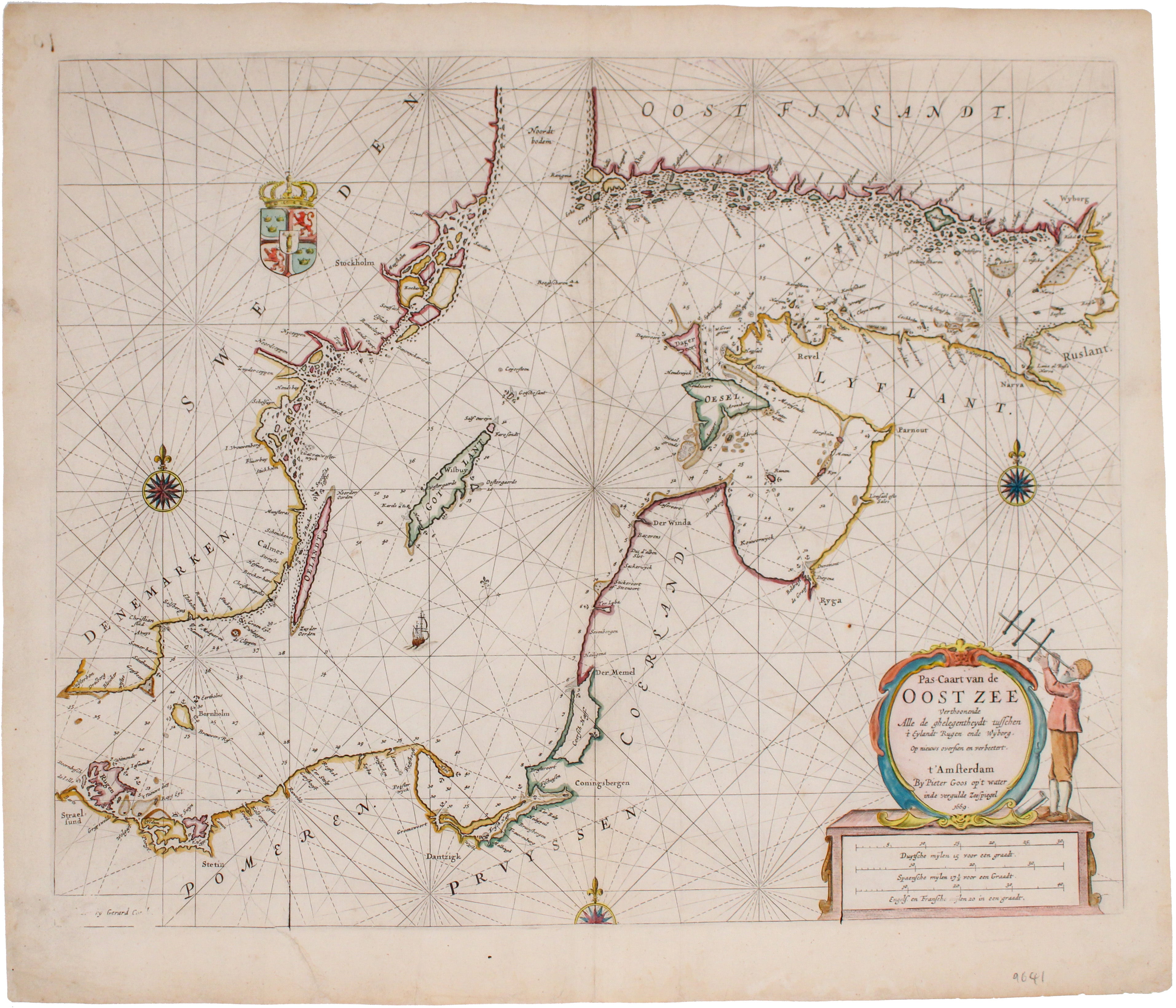
Goos' Sea Chart of the Baltic
SKU: 9641
Title:
Goos' Sea Chart of the Baltic
Date of publication:
Place of publication:
Colour:
Mapmaker:
Pas-Caart van de Oost Zee Verthoonende alle de Ghelegentheydt tusschen t'Eylandt Rugen ende Wyborg
From one of the finest Dutch marine atlases of the era comes this chart of the Baltic and the Gulf of Finland. It covers the coastlines of northeastern Europe, including those of present day Poland, Latvia and Lithuania, Russia, Finland, Sweden and Denmark. Read more
Koeman considers Pieter Goos’ 'Zee-Atlas' a beautiful work, reflecting "a high professional standard" which appealed to contemporary bibliophiles. It was always intended for "gentlemen and merchants" as well as "sailors and pilots". Selling well, it ran into several editions.
Condition & Materials
Copper engraving, 44 x 55 cm, engraved by Gerard Coerk, modern hand-colour, 15 cm closed tear extending into the image lower left, some abrasion to engraved surface extreme lower left corner, blank verso.
References
Koeman, Atlantes Neerlandici, Goos 1B #4 Read less