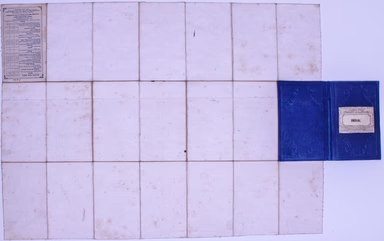
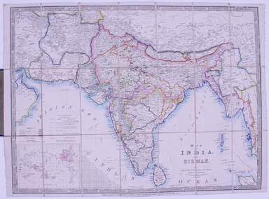
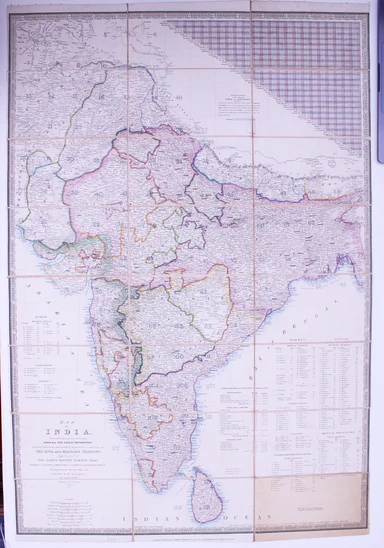
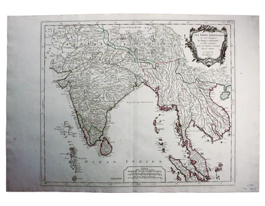
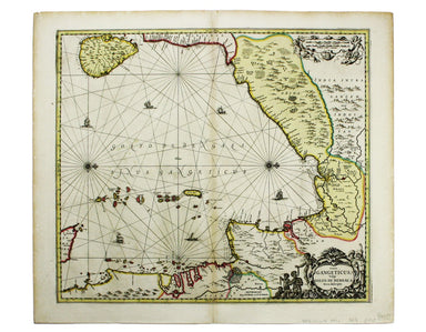
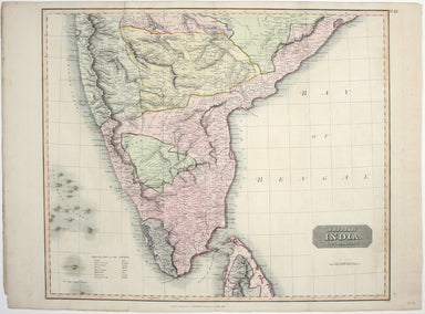
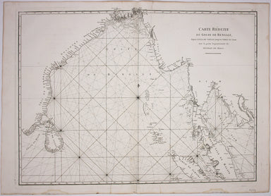
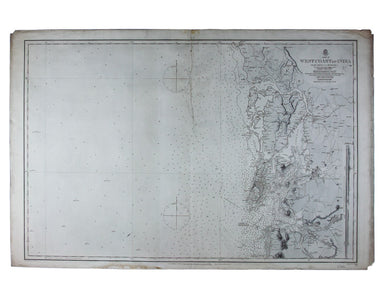
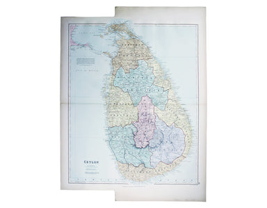
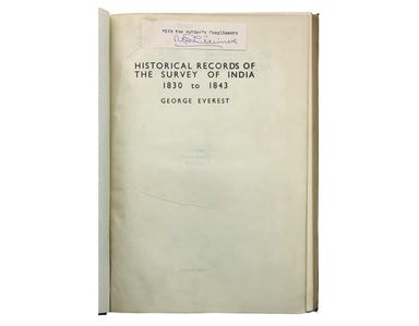
Robertson's Ancient India
An historical disquisition concerning the knowledge which the ancients had of India; and the progress of trade with that country prior to the disco...
View full details
An historical disquisition concerning the knowledge which the ancients had of India; and the progress of trade with that country prior to the disco...
View full details
This map of Calcutta includes inset views of the Writers’ Buildings, Government House and Esplanade Row. Calcutta expanded rapidly under the Gover...
View full details
This map of Malaya has an inset regional map locating Malaya in the context of ‘adjacent terrritories’. A previous owner of this, map Lieutenant D...
View full details
This miniature map of Gujarat and northern India was published in one of the earlier editions of Bertius’ Tabularum Geographicarum Contractum issue...
View full details
Map of India and Birmah This map of India and Burma features an inset location map with British possessions coloured red, next to a distance table...
View full details
Map of India, constructed with great care and research from all the Latest Authorities and intended more particularly to facilitate a reference to ...
View full details
Les Indes Orientales This is Santini’s edition of Robert de Vaugondy’s map of the Indian subcontinent and mainland southeast Asia. Venetian map-mak...
View full details
Burma – Gulf of Mataban – Rangoon River and Approaches This chart covers the mouth of the river between Rangoon (Yangon) and the sea. It shows vill...
View full details
[Map of] Afghanistan, political, phisical [sic], roads and distances, important historical sites According to the online resource Encyclopaedia Ira...
View full details
This map of the Mughal Empire is dedicated by the Blaeu brothers to Joan Huydecoper van Maarsseveen (1599–1661), a prosperous dealer in pelts and a...
View full details
This map of Persia, Afghanistan and Balochistan is part of the Authentic Imperial Maps series published by the London Geographical Institute. Condi...
View full details
Sinus Gangeticus; vulgo Golfo de Bengale nova descriptio This is a map of the Bay of Bengal with north oriented to the right. Petrus Schenk and Ger...
View full details
This map covers the southern part of the subcontinent (Mumbai is near the upper border), and includes the northern part of Sri Lanka. Pink denotes ...
View full details
Bradshaw’s Railway Manual, Shareholder’s Guide and Official Directory for 1868. Containing the History and Financial Position of Every Company, Bri...
View full details
Carte Reduite du Golfe de Bangale D’Après de Mannevillette (1707-1780) was a practical seaman as well as a mapmaker; his sea atlas was published in...
View full details
Sheet III – West Coast of India – from Arnol I. to Kundari I This chart shows the approaches to Bombay harbour, modern Mumbai, with significant det...
View full details
This map of Sri Lanka was published in the first trade edition of Stanford’s ‘London Atlas’. Edward Stanford (senior) acquired Arrowmsith's stock i...
View full details
Port Louis is the capital and principal port of Mauritius, which remained a British colony until 1968. Condition & Materials Engraved British c...
View full details
Carte du Grand Thibet. Pour Servir à l’Histoire Generale des Voyages. Tirée des Auteurs Anglois… Bellin notes that his map of Tibet was compiled fr...
View full details
Phillimore, Colonel Reginald Henry: Historical Records of the Survey of India. Volumes 1 to 4... alas not including the suppressed fifth volume Col...
View full details
This map of Burma was published in the second trade edition of Stanford’s London Atlas. Edward Stanford (senior) acquired Arrowmsith's stock in 187...
View full details