

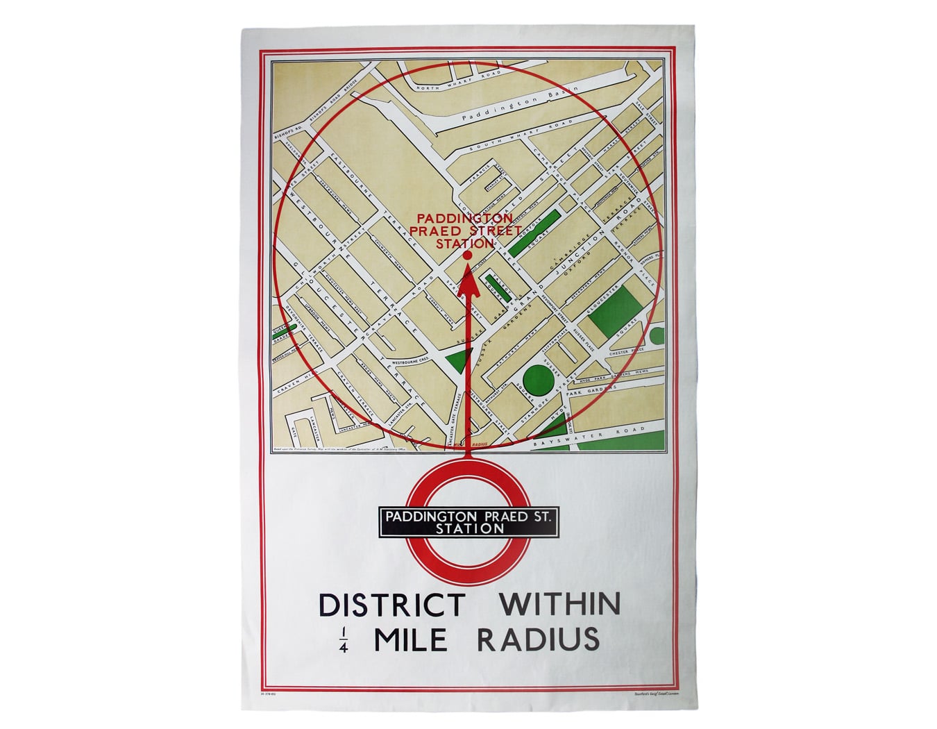
Quarter Mile Radius Map of Paddington Station
SKU: 8715
Title:
Quarter Mile Radius Map of Paddington Station
Date of publication:
Printed Measurement:
Colour:
Mapmaker:
District within ¼ mile radius [of] Paddington Praed Street
Stanford’s was a firm of map publishers as well as map retailers until after the Second World War, with a lucrative Ordnance Survey contract. Read more
In the late 1920s Stanford’s began supplying the Underground with small runs of maps for local display, based on the Ordnance Survey and confined to a quarter-mile radius from each station. They were printed in very low numbers: in this instance just 100 examples.
Condition & Materials
Quarter mile radius map of the area around Paddington Station, 76 x 50.5 cm, a fraction smaller than the usual double royal size, printed in colours, laid on linen as issued. Read less