

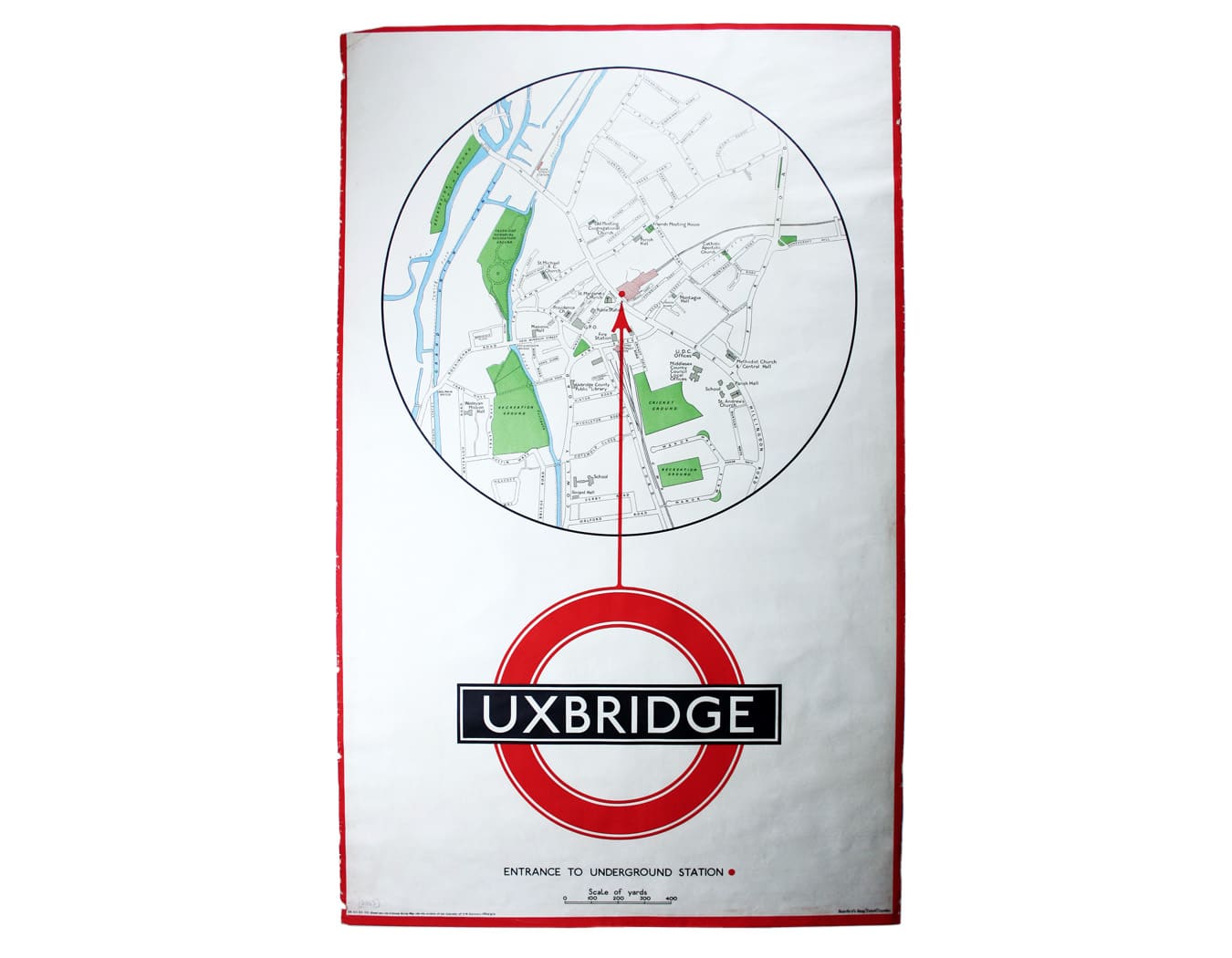
Quarter Mile Radius Map of Uxbridge Station
SKU: 8883
Title:
Quarter Mile Radius Map of Uxbridge Station
Date of publication:
Printed Measurement:
Colour:
District within ¼ mile radius [of] Uxbridge
Stanford’s was a firm of map publishers as well as map retailers until after the Second World War, with a lucrative Ordnance Survey contract. Read more
In the late 1920s Stanford’s began supplying the Underground with small runs of maps for local display, based on the Ordnance Survey and confined to a quarter-mile radius from each station. They were printed in very low numbers: in this instance just 100 examples. The design also makes striking use of the bar and circle roundel and Edward Johnston typeface.
Condition & Materials
Double royal quarter mile radius map centred on Uxbridge Station, 105 x 62.5 cm, printed in colours, a little marginal fraying, laid on linen as issued. Read less