

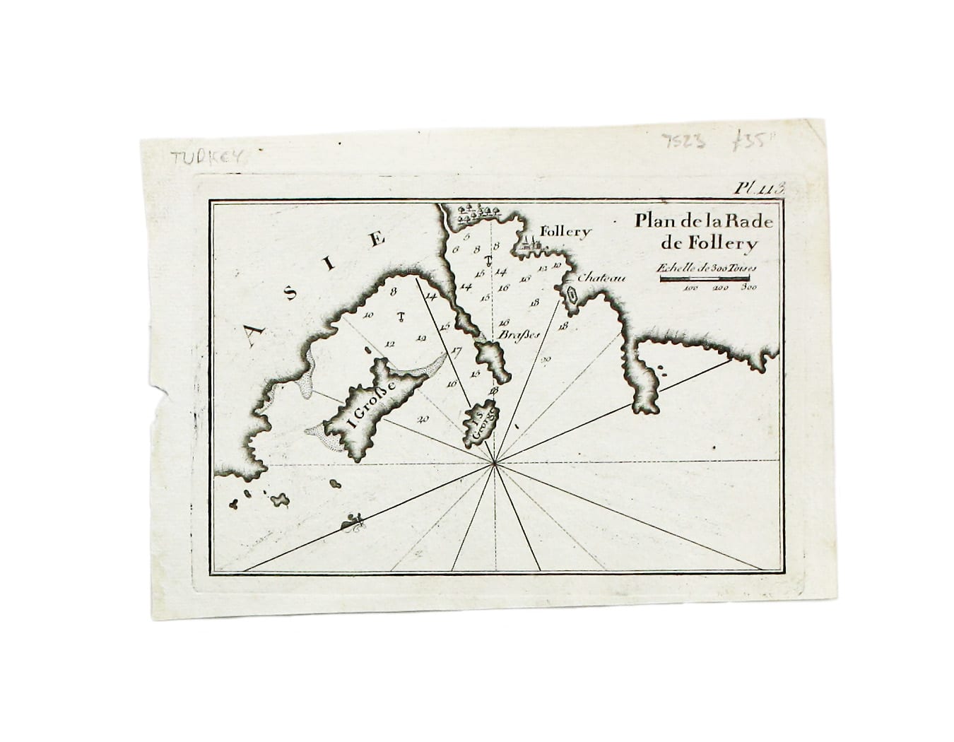
Roux’s Small Chart of Foça
SKU: 7523
Title:
Roux’s Small Chart of Foça
Date of publication:
Printed Measurement:
Publisher:
Colour:
Mapmaker:
A sea chart of Foça, Turkey; near Smyrna.
The practical pocket sea atlas by Marseilles hydrographer Joseph Roux, charting the ports and harbours of the Mediterranean, remained popular half a century after its first appearance in 1764. Read more
This edition, expanded to 163 charts, was published by a French bookseller in Napoleon’s short-lived client state, the Ligurian Republic.
Condition & Materials
Copper engraving, 14 x 20 cm, black and white as issued, blank verso. Read less