

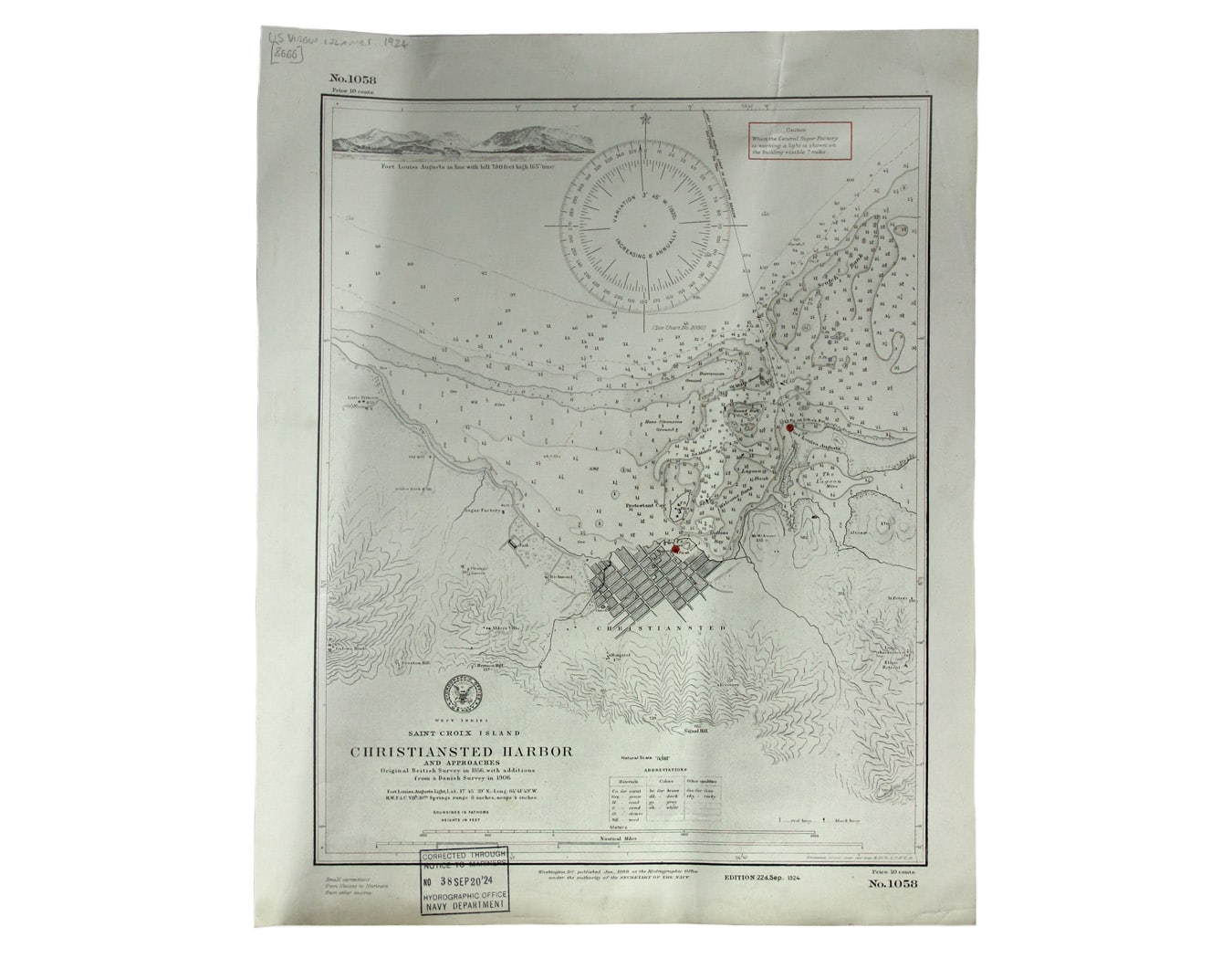
US Naval Chart of Christiansted, St Croix
SKU: 8666
Title:
US Naval Chart of Christiansted, St Croix
Date of publication:
Printed Measurement:
Colour:
Mapmaker:
West Indies – St Croix Island – Christiansted Harbour
This is a US naval chart of Christiansted, the largest town on St Croix in the United States Virgin Islands, formerly the capital of the Danish West Indies. American since 1917, this chart relies on earlier British and Danish surveys. Read more
Condition & Materials
Sheet 1058, sheet size 47 x 38.5 cm, a couple of light vertical creases, black and white, ink stamp confirming corrections to September 1924, blank verso. Read less