

Van Keulen’s Chart of the Sussex Coast
SKU: 9405
Title:
Van Keulen’s Chart of the Sussex Coast
Date of publication:
Printed Measurement:
Colour:
Mapmaker:
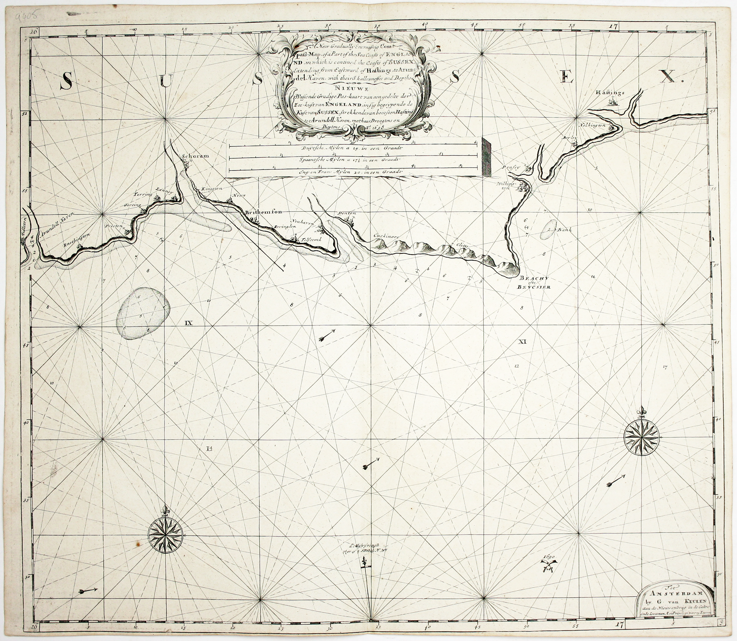
A new gradually encreasing Compass-Map of part of the Sea Coasts of England, in which is contained the Coasts of Sussex, extending from Eastwards of Hastings to Arundel Haven, with their shallownesses and Depths…
This chart of the Sussex coast includes Brighton (‘Brithemson’, then a fishing village), Hastings, and Beachy Head. A pair of crossed swords in the Channel marks the location of the Battle of Beachy Head in 1690, a significant French tactical victory over the English and their Dutch allies during the Nine Years’ War. Read more
Gerard van Keulen took over the family business in 1704, but ‘charts from his hand started to appear in 1698... charts with English text are characteristic for Gerard’s work’
Condition & Materials
Copper engraved sea chart, 52 x 60 cm, black and white, printed on thick chart paper, blank verso. Probably published in 'De Nieuwe Groote Ligtende Zee-Fakkel' (the van Keulen firm was also known for composite atlases, made to order), the title is given in English and Dutch, and the date of engraving is given as 1698.
References
Koeman, Atlantes Neerlandici, IV p. 303 Read less