

German Invasion Plans for England & Wales
SKU: 9321
Title:
German Invasion Plans for England & Wales
Date of publication:
Binding:
Publisher:
Author:
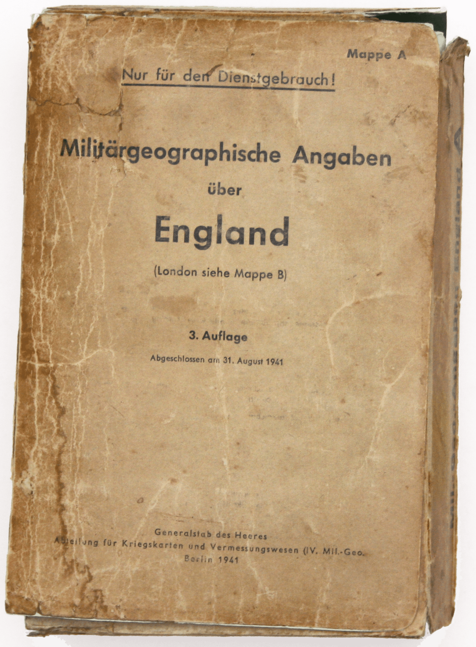
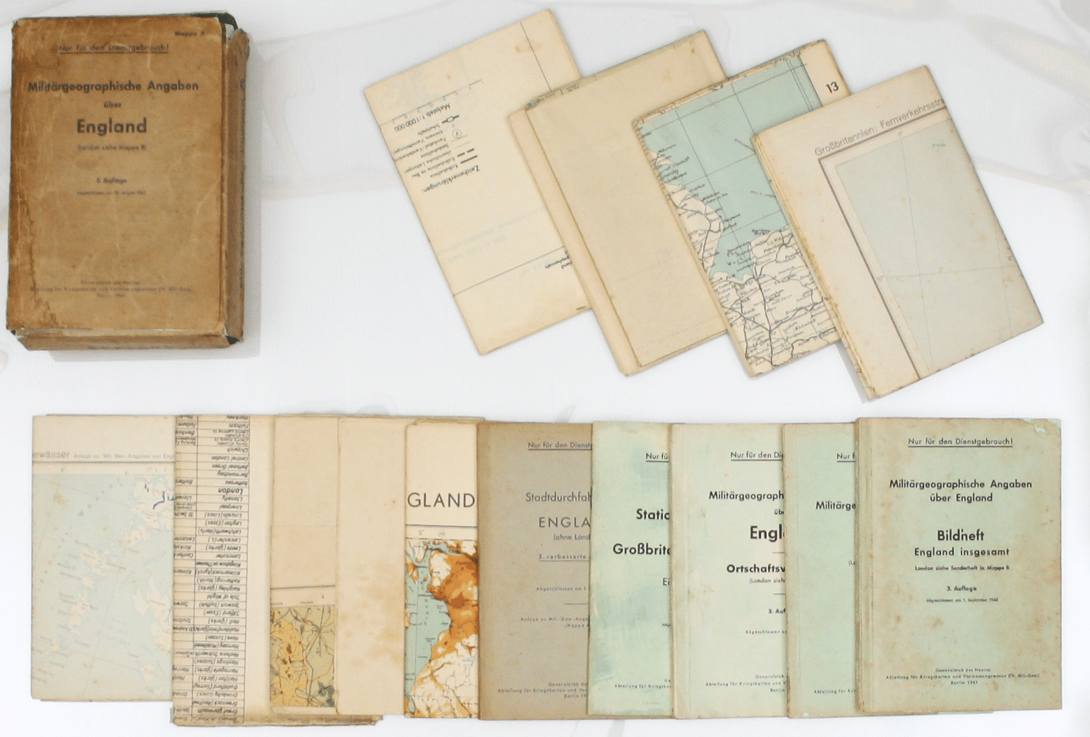
Mappe A […] Militärgeographische Angaben über England […] 3 Auflage, Abgeschlossen am 31 August 1941. Berlin: Generalstab des Heeres, Abteilung für Kriegskarten und Vermessungswesen
This is a scarce item, forming a substantial part of the German invasion plans for Britain, published by the German Army General Staff, department of military mapping and surveying. Most maps and books are headed ‘Nur für den Dienstgebrauch!’, ‘for official use!’. The plans were divided between two thick A5 folders and a booklet: our folder, A, covers England and Wales; folder B covered London and booklet C covered the coast, with potential invasion beaches. A series of larger A4 folders contained large-scale town plans and photographs. Read more
Condition & Materials
Folder A, 3rd edition (completed 31 August 1941), a complete set comprising:
1. Textheft: booklet, pp. 106 + 3 folding maps, 1 coloured showing British industries
2. Ortschaftsverzeichnis: booklet, pp. 165, gazetteer
3. Bildheft England insgesamt (typiche lanschaftsbilder): booklet, pp. 177, photographs of typical English landscapes
4. Übersichtskarte: map, physical features
5. Militärgeographische Operationskarte Süd und Mittlelengland: map, planning, south and midlands
6. Eisenbahnnetz mit stationsverzeichnis: map, railways
7. booklet, Stationsverzeichis, an index to the railway stations on map 6
8. Fernverkehrsstrassen: map, roads
9. Übersicht der Gewässer: map, waterways [canals and trunk roads etc]
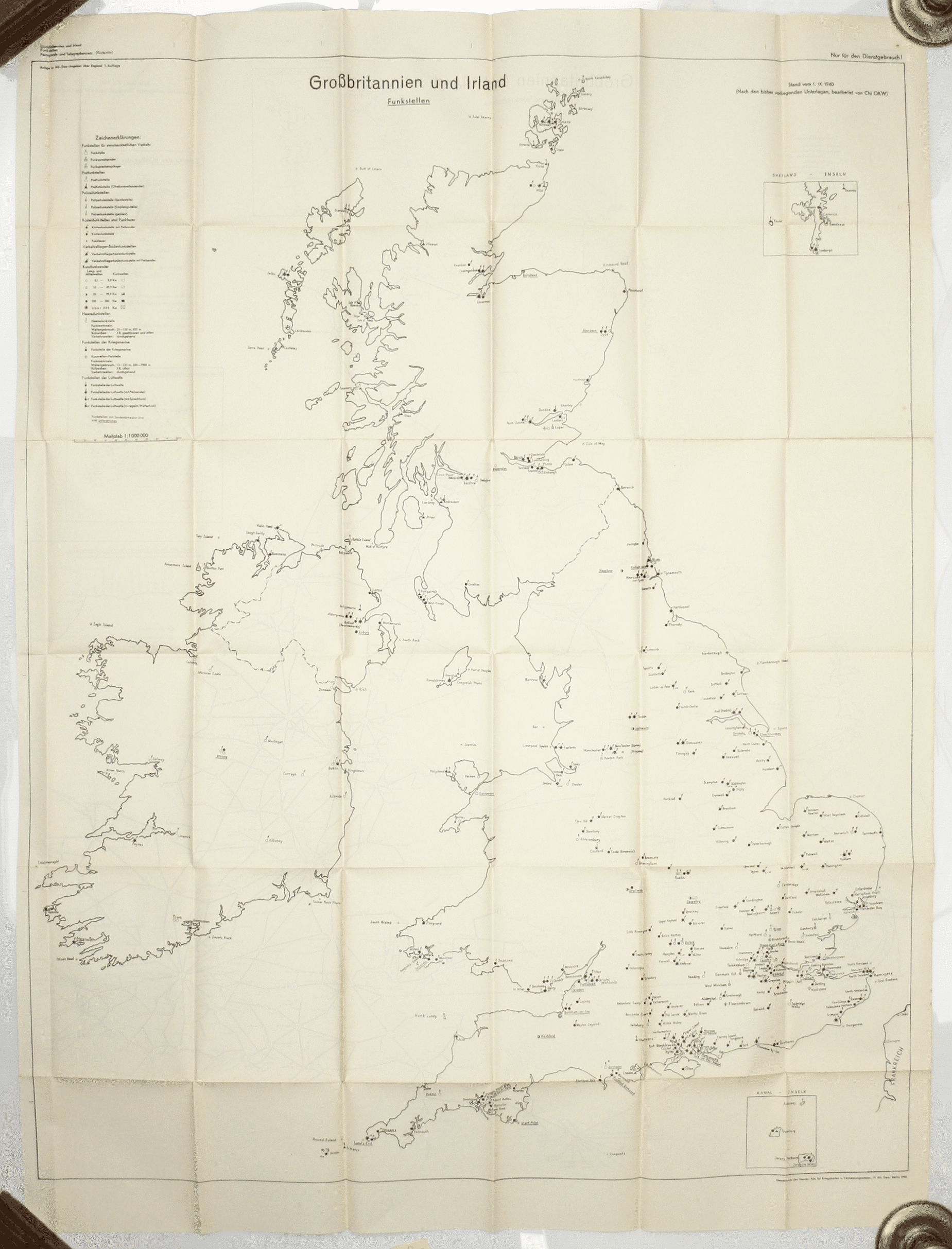
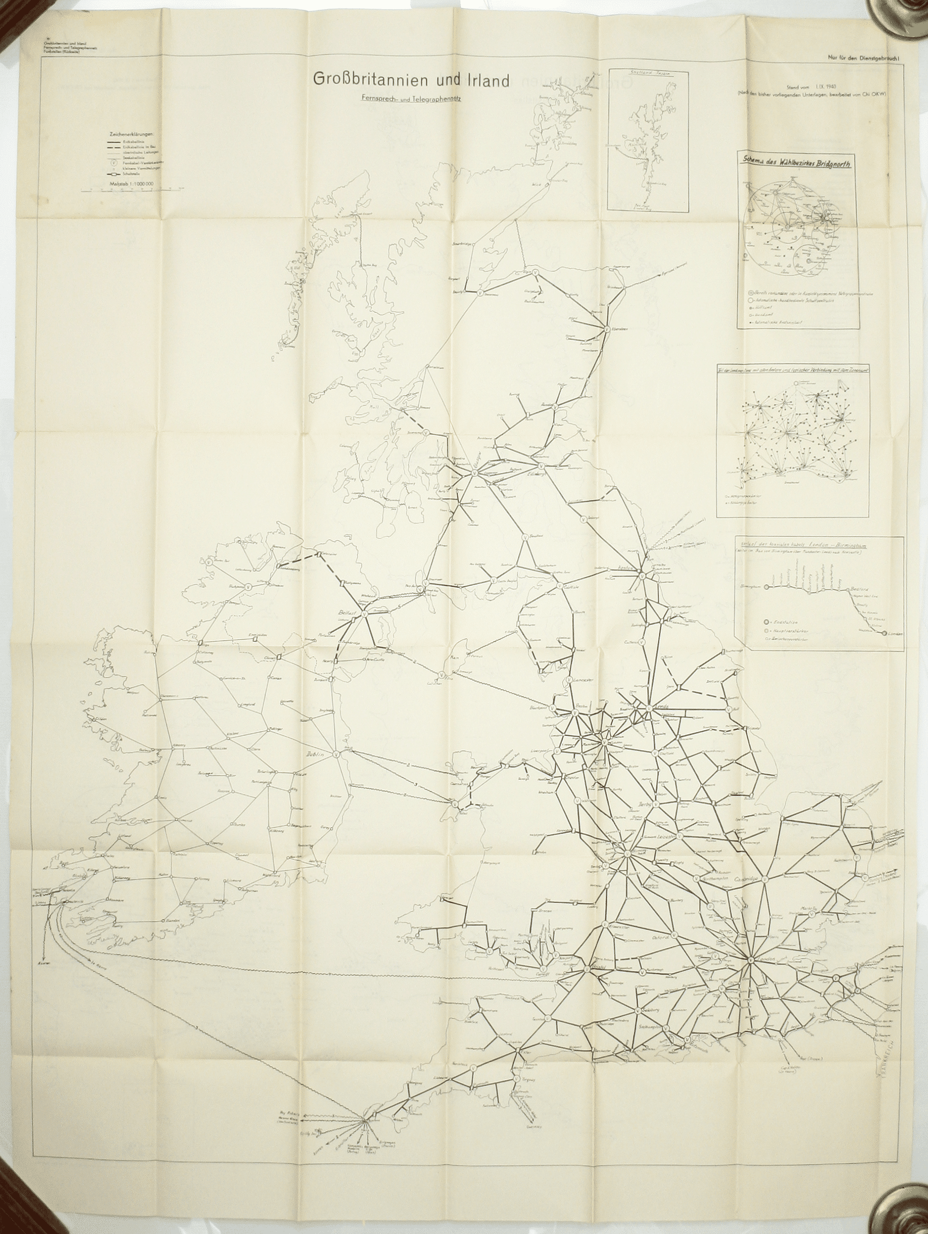
10. Fernsprech- und Telegraphennetz; Funkstellen (Rückseite): map, telephone and telegraph offices, radio installations
11. Elektrizitätsversorgung: map, electricity supply
12. Bevölkerungsverteilung 1931, popluation distribution in 1931
13. Stadtdurchfahrtpläne England: booklet, pp. 162, 160 town plans with index map and alphabetical index.
The worn folder shows significant signs of use: the pale-green card wallet is faded and stained, and has a number of closed tears and tape marks, and has been laid down on pale green card; front covers of two booklets (Textheft and Bildheft England insgesamt) also laid down on thin card; occasional spotting, and wear where the maps have been re-folded. Read less