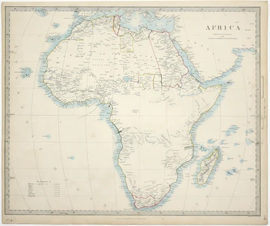
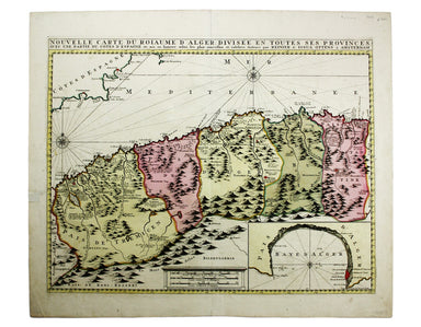
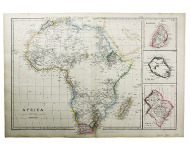
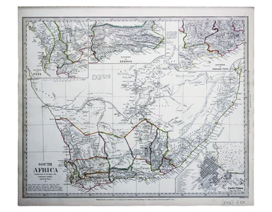
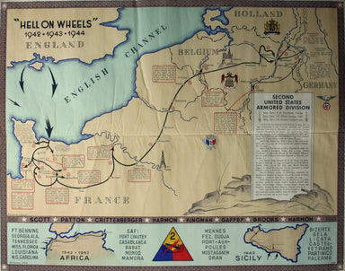
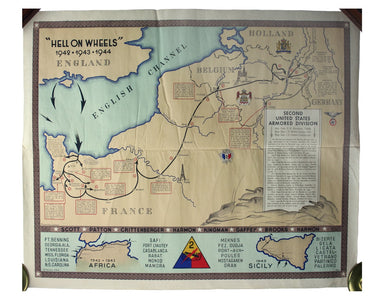
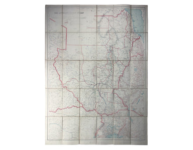
Royal East Africa Automobile Association Road Map
Sketch Map of Northern and Central East Africa / [Cover title:] Road Map of East Africa This map was ‘compiled with the help of the Public Works an...
View full details
Sketch Map of Northern and Central East Africa / [Cover title:] Road Map of East Africa This map was ‘compiled with the help of the Public Works an...
View full details
Map showing the Western/Eastern Half of Equatorial Africa and the Explorations by Land and Water of Henry M. Stanley in the Years 1874-77 This map ...
View full details
Also published in Stanford’s London Atlas, our example of this map of Africa was separately issued and illustrates the speed and scale of the Scram...
View full details
This steamship route map of the western Mediterranean and Northwest Africa shows the routes from Marseille and Bordeaux to Tunisia, Algeria and Mor...
View full details
This route map advertises passenger, postal and cargo steamship services between Marseille and West Africa. The SS Canada was built for the Fabre L...
View full details
This map of Morocco was one of only two original maps engraved by the son of Johann Baptist Homann, Johann Christoph, in his short life (1701-30). ...
View full details
The Empire of Morocco, since 1912, had been divided between the Spanish and French. Our map dates to the period of the Rif War, 1921-26, in which a...
View full details
This map of South Africa was published by The Times during the Second Anglo-Boer War, for the benefit of members of the British public following th...
View full details
This map of Africa reflects the state of European knowledge of the interior before the mid 19th century search for the sources of the Nile. It mark...
View full details
This map of Africa features was published in ‘Oddy’s New General Atlas of the World’. It features an inset of the Azores and Cape Verde islands. Mu...
View full details
This map of Algeria features an inset of the Bay of Algiers. Ottoman Algeria was a hub of privateering and the Mediterranean slave trade. Well know...
View full details
This map of Africa was drawn and engraved by Edward Weller, and includes insets of Mauritius, Réunion and Natal, Some of the most recent geographi...
View full details
This map of ancient Egypt is from Butler's Atlas of Ancient Geography and was engraved by Sidney Hall. Condition & Materials Copper engraving,...
View full details
This map of South Africa, including an inset of Cape Town, was engraved by John & Charles Walker. It was published by the SDUK. The Society for...
View full details
Blatt 29. Warmbad This map covers the Karas region in modern Namibia (then German South West Africa), which was the scene of one of the earliest at...
View full details
Topographia Repraesentio Barbarici Portus et Urbis Munitae Oran … Oran, an important trading port and now Algeria’s second city, was governed by th...
View full details
“Hell on Wheels” War Against the Axis 1942 – 1943 – 1944 The lower panel of this map deals with operations in North Africa and Sicily, with the uni...
View full details
First published in 1914, this revised edition highlights administrative boundaries. Though technically administered jointly by Egypt and Britain be...
View full details