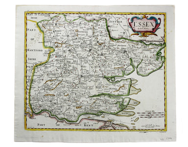
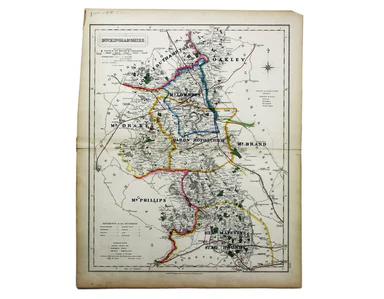
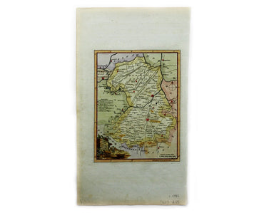
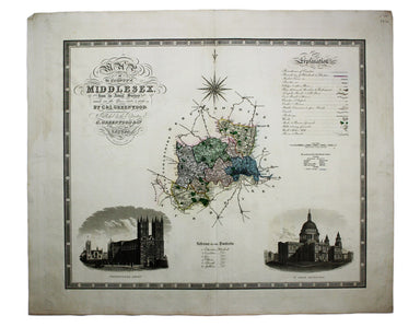
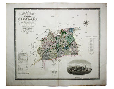
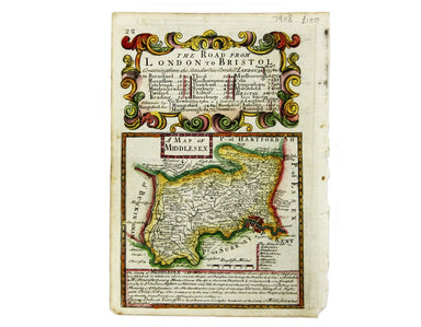
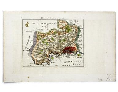
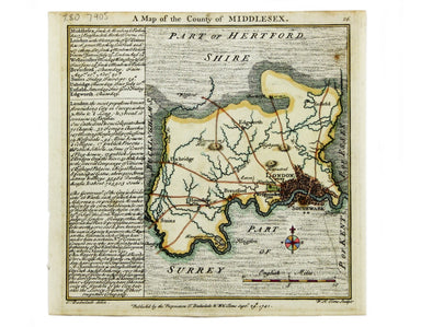
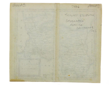
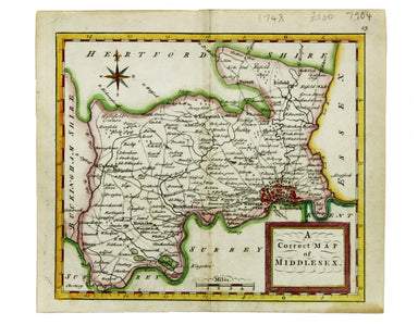
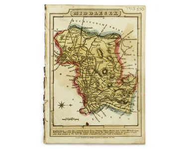
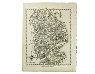
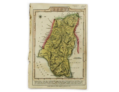
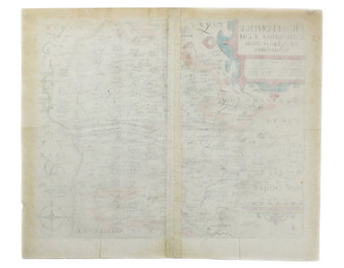
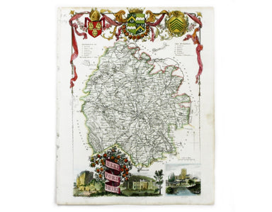
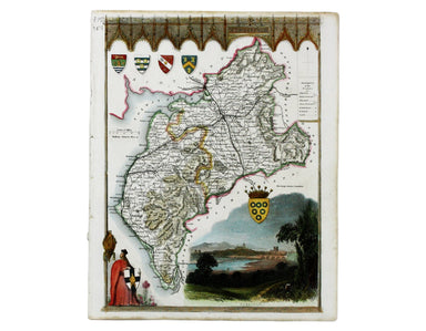
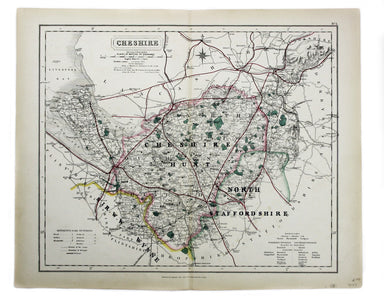
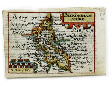
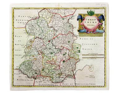
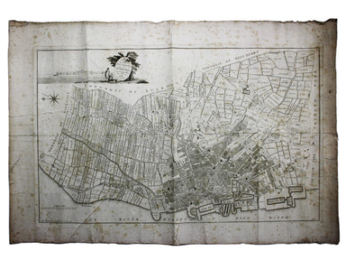
Blaeu’s Map of Lincolnshire
Blaeu and the rival Golden Age Dutch cartographic publishing house of Janssonius raced to bring out atlases of the British Isles in the 1630s and e...
View full details
Blaeu and the rival Golden Age Dutch cartographic publishing house of Janssonius raced to bring out atlases of the British Isles in the 1630s and e...
View full details
Blaeu and the rival Golden Age Dutch cartographic publishing house of Janssonius raced to bring out atlases of the British Isles in the 1630s and e...
View full details
Map of the County of Middlesex from an Actual Survey The Greenwood brothers were land-surveyors from Yorkshire who compiled one of the last indepen...
View full details
Map of the County of Surrey from an Actual Survey The Greenwood brothers were land-surveyors from Yorkshire who compiled one of the last independen...
View full details
This map of Gloucester was engraved by Johannes Kip for 'The Ancient and Present State of Glostershire'. It is one of the earliest views of the cit...
View full details
England, with all the railways… This edition of Lizars’ railway map was published c. 1845, featuring lines such as the Maryport & Carlisle Rail...
View full details
Cruchley’s Improved Geographical Companion throughout England & Wales including part of Scotland In this map of England and Wales, we have an i...
View full details
A Map of the County Palatine of Lancaster Divided into Hundreds and Parishes from an accurate Survey made in the years 1828 and 1829, For Hennet’s ...
View full details
Mappe A […] Militärgeographische Angaben über England […] 3 Auflage, Abgeschlossen am 31 August 1941. Berlin: Generalstab des Heeres, Abteilung für...
View full details
A Travelling County Atlas: With all the Coach and Rail Roads accurately laid down and coloured and carefully corrected to the present time. London:...
View full details
If thou art worn and hard beset with sorrows that thou wouldst forget… Go to the woods and hills; no tears dim the sweet look that nature wears. He...
View full details
Jacques Nicolas Bellin the elder (1703-1772) was first chief hydrographic engineer of the "Dépôt des cartes, plans et journaux du Ministère de la M...
View full details
Carte de l’entrée de la Tamise, avec les Bancs, Passes, Isles et Costes comprises entre Sandwich et Clay This is a revised version of a chart which...
View full details
Comitatus Dorcestria vulgo Anglice Dorsetshire Joannes Janssonius II (1588-1664) married into the Hondius family and, with Henricus Hondius, worked...
View full details
Mogg’s New Map of the Roads. A New Travelling Map of England, Wales and Scotland […] Condition & Materials Copper engraving, 77 x 63.5 cm, a ro...
View full details
This map of Oxfordshire was engraved by Emanuel Bowen for John Owen’s Britannia Depicta, a pocket road book derived from Ogilby’s innovative atlas ...
View full details
Northumbria, Cumberlandia et Dunelmensis Episcopatus This map of northern England is from the first edition of Tabularum geographicarum contractaru...
View full details
This map of Middlesex was engraved by Emanuel Bowen for John Owen’s Britannia Depicta, a pocket road book derived from Ogilby’s innovative atlas of...
View full details
This map of Middlesex was first published in 1746 to accompany Thomas Read’s English Traveller. The the plates were acquired by John Rocque and re-...
View full details
Condition & Materials Copper engraving, 15.5 x 15.5 cm, modern hand-colour, blank verso; a map of Middlesex engraved by Toms for Thomas Badesla...
View full details
This map of Middlesex was published in Geographia Magnae Britanniae, or, Correct Maps of all the Counties in England, Scotland and Wales. It was pr...
View full details
This map of Middlesex is from Wallis' Pocket Edition of the English Counties. James Wallis (fl. 1810-1825) was born in Southampton in 1784, the son...
View full details
This characteristically clear and elegant map of Lincolnshire is by John Cary, one of the leading cartographic engravers, publishers and globe-make...
View full details
Lincolniae Comitatus ubi olim insederunt Coritani This map of Lincolnshire is from the second edition of Philemon Holland’s translation of Camden’s...
View full details
This map of Kent is from Wallis' Pocket Edition of the English Counties. James Wallis (fl. 1810-1825) was born in Southampton in 1784, the son of a...
View full details
Hertfordiae Comitatus This map of Hertfordshire is from the second edition of Philemon Holland’s translation of Camden’s Britannia into English, th...
View full details
This map of Herefordshire is by Moule, a bookseller, writer on heraldry and publisher who commissioned what is generally considered to be the last ...
View full details
This map of Gloucestershire was engraved by Emanuel Bowen for John Owen’s Britannia Depicta, a pocket road book derived from Ogilby’s innovative at...
View full details
Condition & Materials Copper engraving, 36 x 42 cm, recent hand-colour, spotting top left, blank verso. A map of Essex engraved to accompany Gi...
View full details
This map of Buckinghamshire was prepared for William Colling Hobson’s Fox-Hunting Atlas. It is overprinted with the names of the hunts and the plac...
View full details
This map of Cambridgeshire was first issued in The London Magazine, which between 1747 and 1754 published a complete set of English county maps by ...
View full details
This map of Cumberland is by Moule, a bookseller, writer on heraldry and publisher who commissioned what is generally considered to be the last rea...
View full details
This map of Berskhire was engraved by Emanuel Bowen for John Owen’s Britannia Depicta, a pocket road book derived from Ogilby’s innovative atlas of...
View full details
This map of Cheshire wasprepared for William Colling Hobson’s Fox-Hunting Atlas. It is overprinted with the names of the hunts and the places of th...
View full details
This map of County Durham was engraved by J & C Walker after Creighton for Lewis’ Topographical Dictionary. Condition & Materials Steel eng...
View full details
This map of Buckinghamshire is from the so-called miniature Speed. This miniature atlas used maps by van den Keere to illustrate a pocket edition o...
View full details
This map of Shropshire was engraved to accompany Gibson’s edition of Camden’s Britannia, first published in 1695. Condition & Materials Copper ...
View full details
This map of Lincolnshire was engraved to accompany Gibson’s edition of Camden’s Britannia, first published in 1695. Condition & Materials Coppe...
View full details
This map of Northamptonshire was engraved by Emanuel Bowen for John Owen’s Britannia Depicta, a pocket road book derived from Ogilby’s innovative a...
View full details
This map of Norfolk was engraved by Emanuel Bowen for John Owen’s Britannia Depicta, a pocket road book derived from Ogilby’s innovative atlas of ...
View full details
This map of Herefordshire was engraved by Emanuel Bowen for John Owen’s Britannia Depicta, a pocket road book derived from Ogilby’s innovative atla...
View full details
Blome published the first new series of county maps since Speed. In the straightened financial environment of post-Restoration London he had to rep...
View full details
This is the southwestern sheet of Mercator’s five regional maps of England and Wales; Janssonius revised the decorative elements in the 1630s, but ...
View full details
A Plan of the Town and Township of Liverpool, from an actual survey taken in the year 1785 by C. Eyes This map of Liverpool was surveyed and publis...
View full details
Blaeu and the rival Golden Age Dutch cartographic publishing house of Janssonius raced to bring out atlases of the British Isles in the 1630s and e...
View full details
An Accurate Map of the County Palatine of Chester […] Condition & Materials Copper engraving, 41.5 x 50.5 cm, map of Cheshire with original han...
View full details
Cumbria & Westmoria. Vulgo Cumberland & Westmorland Joannes Janssonius II (1588-1664) married into the Hondius family and, with Henricus Ho...
View full details
Lincolnia Comitatus Anglis Lyncolneshire Joannes Janssonius II (1588-1664) married into the Hondius family and, with Henricus Hondius, worked on a ...
View full details