

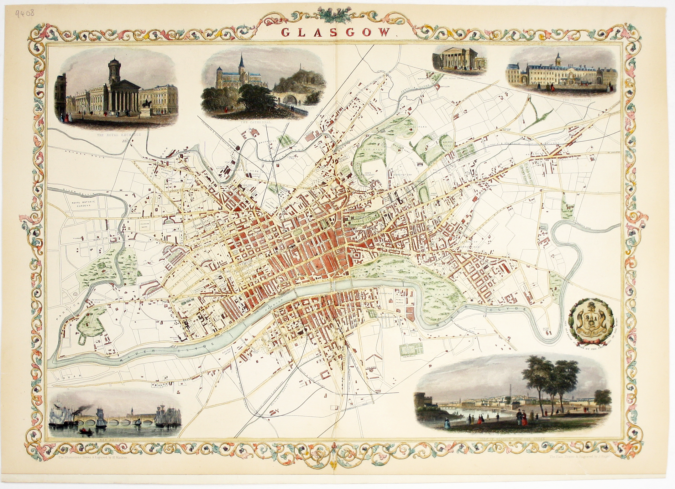
Tallis’ Map of Glasgow
SKU: 9408
Title:
Tallis’ Map of Glasgow
Date of publication:
Printed Measurement:
Colour:
Mapmaker:
Engraver:
This map of Glasgow is one of the town plans published in Tallis’ hugely popular ‘Illustrated Atlas’ which was published serially from the mid 1840s onwards, and in its complete form in 1851.
The map was engraved by John Rapkin. It includes a view of the city from the Green, and vignettes of the University and the Cathedral drawn and engraved by Henry Winkles. Read more
Condition & Materials
Steel engraving, sheet size 36.3 x 51.4 cm, modern hand colour, clear archival tape on verso where previously mounted and bottom margin extended for mounting, blank verso. Read less