

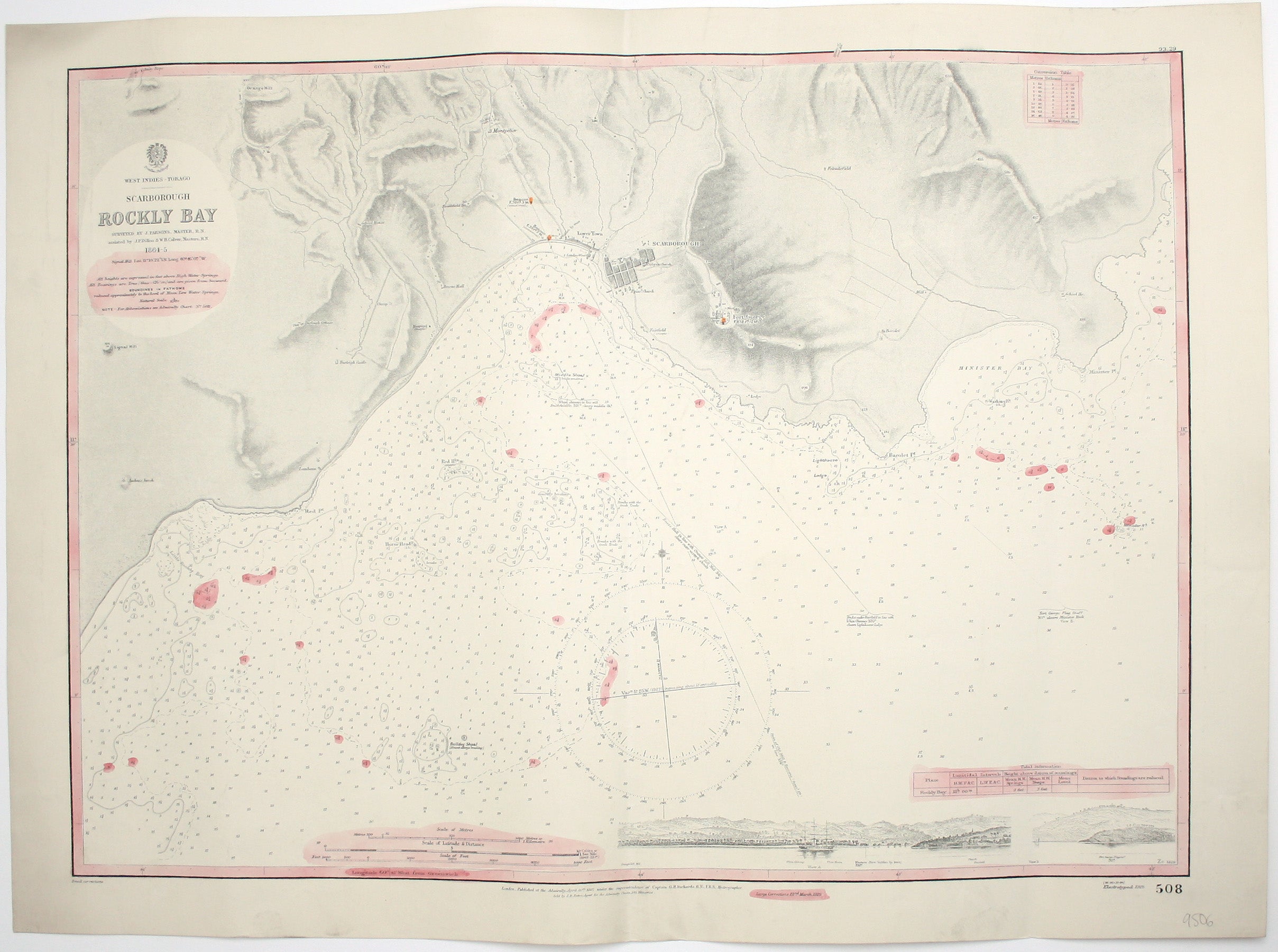
Admiralty Chart of Rockly Bay, Tobago
SKU: 9506
Title:
Admiralty Chart of Rockly Bay, Tobago
Date of publication:
Printed Measurement:
Publisher:
Colour:
West Indies – Tobago – Scarborough – Rockly Bay
This chart of Rockly Bay shows soundings etc, with interior detail of relief, roads and settlements, and inset coastal profiles. First published in 1867, our example has revisions and corrections to March 1929. Read more
Condition & Materials
Engraved British chart, sheet size 56 x 76 cm, black and white with pink wash added by hand, centrefold, blank verso. Read less