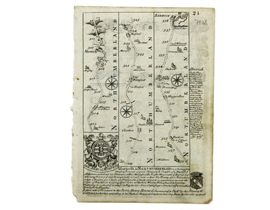
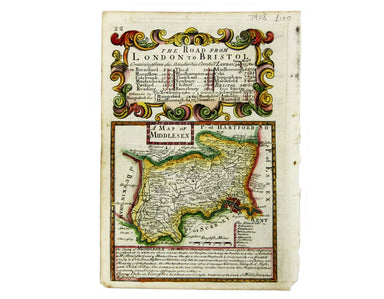
Bowen & Owen’s Map of Middlesex
This map of Middlesex was engraved by Emanuel Bowen for John Owen’s Britannia Depicta, a pocket road book derived from Ogilby’s innovative atlas of...
View full details

This map of Middlesex was engraved by Emanuel Bowen for John Owen’s Britannia Depicta, a pocket road book derived from Ogilby’s innovative atlas of...
View full details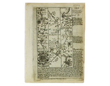
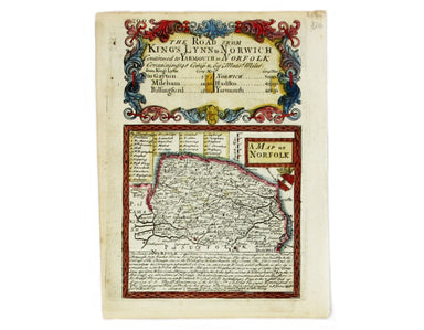
This map of Norfolk was engraved by Emanuel Bowen for John Owen’s Britannia Depicta, a pocket road book derived from Ogilby’s innovative atlas of ...
View full details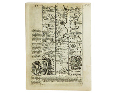
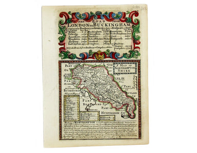
This map of Northamptonshire was engraved by Emanuel Bowen for John Owen’s Britannia Depicta, a pocket road book derived from Ogilby’s innovative a...
View full details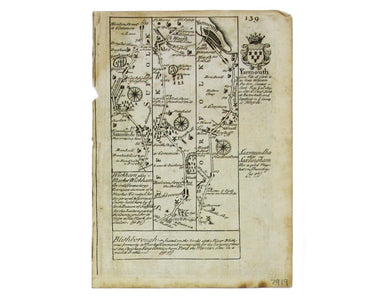
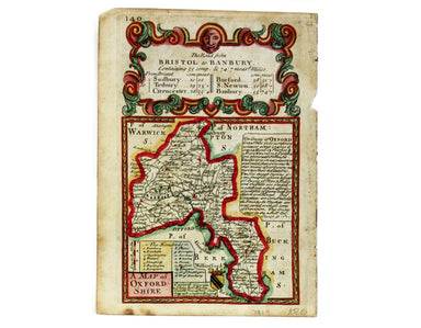
This map of Oxfordshire was engraved by Emanuel Bowen for John Owen’s Britannia Depicta, a pocket road book derived from Ogilby’s innovative atlas ...
View full details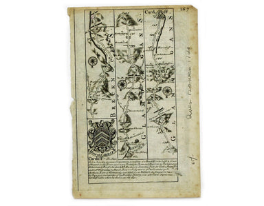
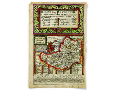
This map of Somerset was engraved by Emanuel Bowen for John Owen’s Britannia Depicta, a pocket road book derived from Ogilby’s innovative atlas of ...
View full details

Bowen’s New General Map of America appeared in a number of publications, and features widely held cartographic misconceptions of the time, such as ...
View full details
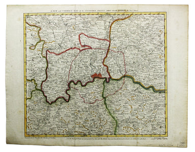
A New and Correct Map of the Countries Twenty Miles round London Condition & Materials Copper engraving, 34 x 39 cm, recent hand-colour, blank ...
View full details
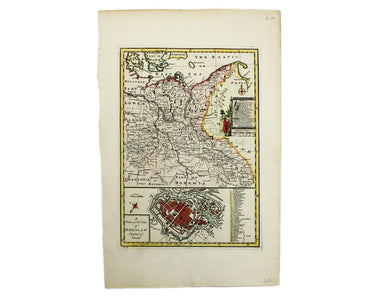
Condition & Materials Copper engraving, 23 x 32.5 cm, recent hand-colour, blank verso.
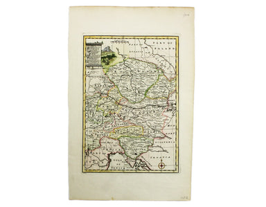
Condition & Materials Copper engraving, 23 x 32.5 cm, recent hand-colour, blank verso.
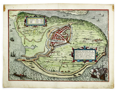
Brilium, Holandiae Opp. Ob Intestinum Batavicum Bellum, Quod Anno Partae Salutis, M.D.LXXII. Calend Aprlis, Hic Initium Sumpsit, Famosum. [Brielle,...
View full details
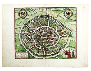
Aquisgranum A plan of Aachen, or Aix-la-Chapelle, Germany. The Civitates Orbis Terrarum was one of the most significant cartographic works of the l...
View full details
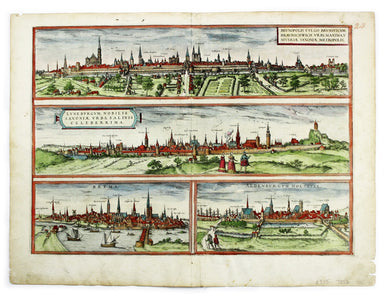
Brunopolis [with] Luneburgum [and] Brema [and] Aldenburgum Holsatiae Four north German towns are shown here on one sheet: Braunschweig, Lüneburg an...
View full details
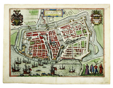
Emuda vulgo Embden A plan of Emden in northern Germany. The Civitates Orbis Terrarum was one of the most significant cartographic works of the lat...
View full details
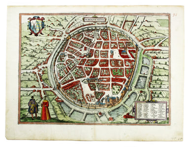
Fribergum Misinae The Civitates Orbis Terrarum was one of the most significant cartographic works of the late sixteenth-century, printed over 45 ye...
View full details
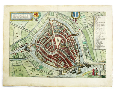
This plan of Gouda in the Netherlands is from the Civitates Orbis Terrarum, one of the most significant cartographic works of the late sixteenth-ce...
View full details
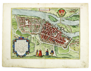
Magdeburgum, a Venere quae hic quondam colebatur Parthenopolis dicta, metropolitica Saxoniae urbs The cartouche on this plan of Magdeburg refers to...
View full details
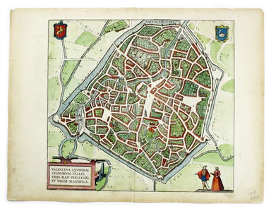
This plan of Valenciennes in northern France is from the Civitates Orbis Terrarum, one of the most significant cartographic works of the late sixte...
View full details
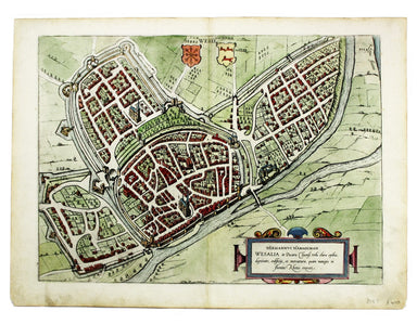
Wesalia in Ducatu Clivensi Urbs Clara Opibus The Civitates Orbis Terrarum was one of the most significant cartographic works of the late sixteenth...
View full details

Cassell's 'immense map' of London, of which this is the central sheet, was prepared for the Weekly Dispatch and published in nine parts between Jan...
View full details

Cassell's 'immense map' of London, of which this is the south sheet, was prepared for the Weekly Dispatch and published in nine parts between Janua...
View full details
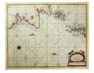
The East Coast of Scotland with the Isles of Orkney and Shetland This sea chart is from ‘Great Britain’s Coasting Pilot’, the first English Sea Atl...
View full details
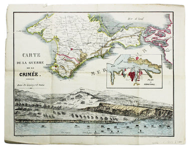
Carte de la Guerre de la Crimèe. Editèe par Lèmèrey et E. Gratier This Crimean War broadsheet map includes an inset of Sebastopol and a view of the...
View full details
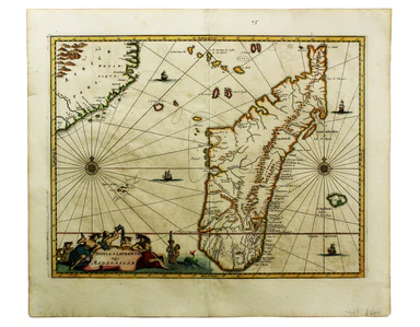
Insula S. Laurentii, vulgo Madagascar The name 'Isle of St Laurence' was given by the Portuguese, who landed on Madagascar on St Laurence's day (Fe...
View full details
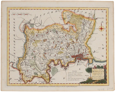
Ellis' map of Middlesex conveys a wealth of detailed information: borough towns are shown with stars identifying the number of Members returned to ...
View full details
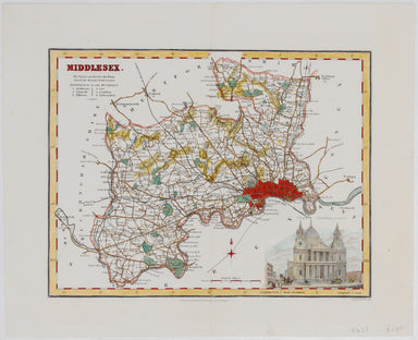
This map of Middlesex included a vignette of St. Paul's Cathedral. It was published in James Bell’s 'New and Comprehensive Gazetteer of England and...
View full details
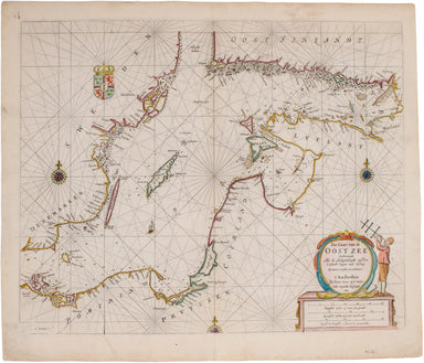
Pas-Caart van de Oost Zee Verthoonende alle de Ghelegentheydt tusschen t'Eylandt Rugen ende Wyborg From one of the finest Dutch marine atlases of t...
View full details
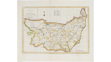
This map of Suffolk is from a series of maps engraved between 1787-1791 by Edward Sudlow after John Haywood. It was subsequently published in atlas...
View full details
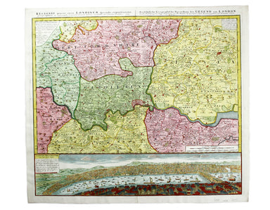
Regionis, quae est circa Londinum […] This map follows Thomas Bowles’ ‘A New and Correct Map of Thirty Miles round London’ published c. 1740. The f...
View full details
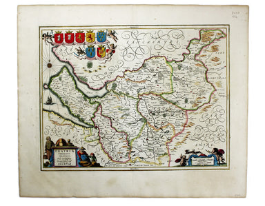
Cestria Comitatus Palatinatus. The Countye Palatine of Chester Joannes Janssonius II (1588-1664) married into the Hondius family and, with Henricus...
View full details
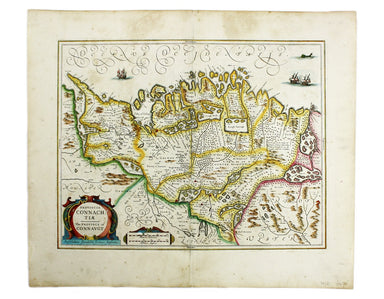
Provincia Connachtiae. The Province of Connaught Joannes Janssonius II (1588-1664) married into the Hondius family and, with Henricus Hondius, work...
View full details
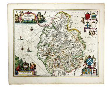
Cumbria & Westmoria. Vulgo Cumberland & Westmorland Joannes Janssonius II (1588-1664) married into the Hondius family and, with Henricus Ho...
View full details
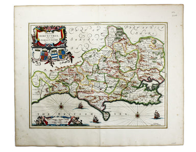
Comitatus Dorcestria vulgo Anglice Dorsetshire Joannes Janssonius II (1588-1664) married into the Hondius family and, with Henricus Hondius, worked...
View full details
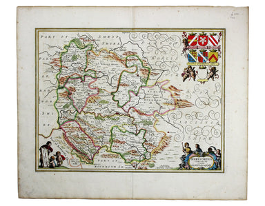
Joannes Janssonius II (1588-1664) married into the Hondius family and, with Henricus Hondius, worked on a revised edition of the Mercator-Hondius a...
View full details
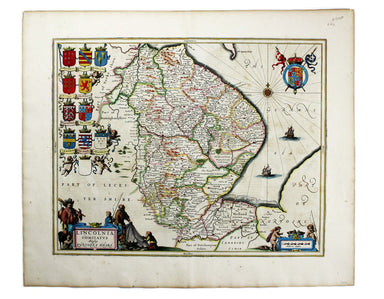
Lincolnia Comitatus Anglis Lyncolneshire Joannes Janssonius II (1588-1664) married into the Hondius family and, with Henricus Hondius, worked on a ...
View full details
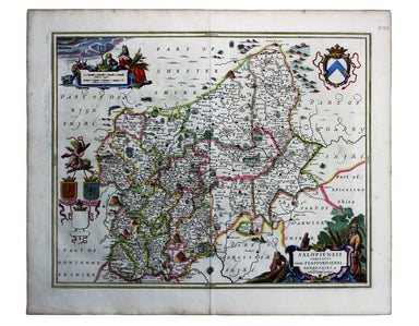
These maps of Staffordshire and Shropshire are presented on one sheet. Unlike Kip and Hole, Speed and Blaeu – who all devoted an entire map-sheet t...
View full details
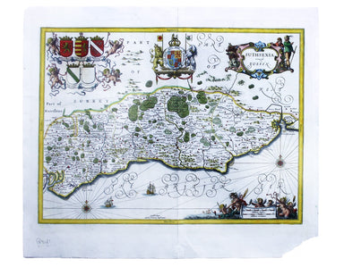
Suthsexia, vernacule Sussex Condition & Materials Copper engraving, 38.5 x 50.5 cm, modern hand-colour, closed centrefold split with some margi...
View full details
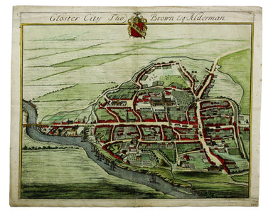
This map of Gloucester was engraved by Johannes Kip for 'The Ancient and Present State of Glostershire'. It is one of the earliest views of the cit...
View full details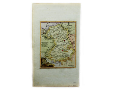
This map of Cambridgeshire was first issued in The London Magazine, which between 1747 and 1754 published a complete set of English county maps by ...
View full details
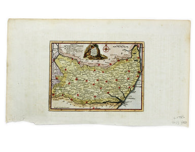
This map of Sussex was first issued in The London Magazine, which between 1747 and 1754 published a complete set of English county maps by Thomas K...
View full details
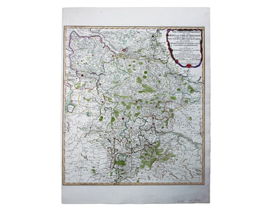
German Dominions of the King of Great Britain; Comprized under the name of Electorate of Brunswick-Luneburg and including the Dutchies of Bremen, V...
View full details
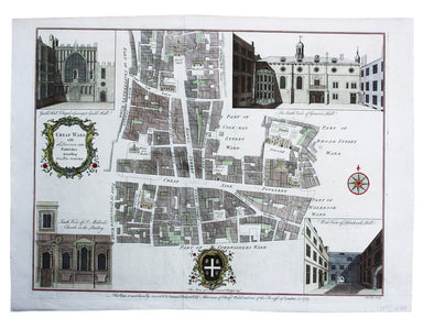
Cheap Ward with its Divisions into Parishes according to a New Survey This ward plan of Cheap was published in the greatly expanded second edition ...
View full details
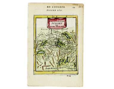
Les 13 Cantons Suisses et leurs Alliez This map of 13 Swiss Canton is from Mallet’s Description de l’Univers. Condition & Materials Copper engr...
View full details
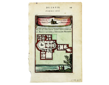
Chapelle du St Sepulchre de N.S. Jesus Christ à Jerusalem The Church of the Holy Sepulchre, Jerusalem, from Mallet’s Description de l’Univers. Cond...
View full details
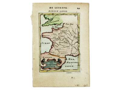
This map of France is from Mallet’s Description de l’Univers. Condition & Materials Copper engraving, 15 x 10.5 cm, recent hand-colour, French...
View full details
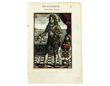
Here's King Christian V, as he appears in Mallet’s ‘Description de l’Univers. Condition & Materials Copper engraving, 15 x 10.5 cm, recent han...
View full details
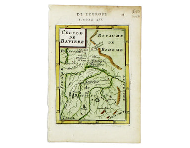
Cercle de Baverie This map of Bavaria is from Mallet’s Description de l’Univers. Condition & Materials Copper engraving, 15 x 11.5 cm, recent h...
View full details
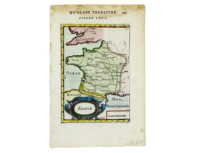
This map of France is from Mallet’s Description de l’Univers. Condition & Materials Copper engraving, 15 x 10.5 cm, recent hand-colour, light ...
View full details
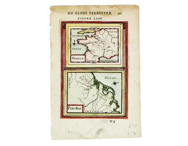
France/Paîs Bas This map of France and the Low Countries is from Mallet’s ‘Description de l’Univers. Condition & Materials Copper engraving, 15...
View full details
