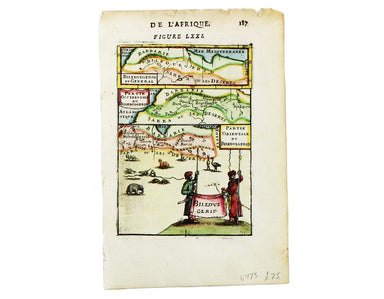
Mallet’s Map of North Africa
Biledulgerid en General This map of North Africa is from Mallet’s Description de l’Univers. Condition & Materials Copper engraving, 15 x 10.5 ...
View full details

Biledulgerid en General This map of North Africa is from Mallet’s Description de l’Univers. Condition & Materials Copper engraving, 15 x 10.5 ...
View full details
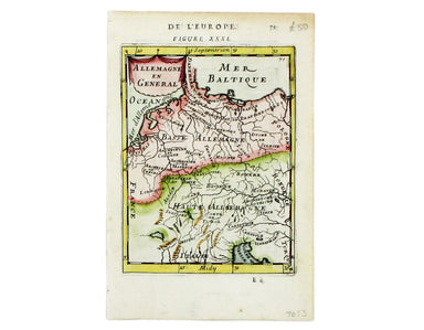
Allemagne en General This map of Northern Germany is from Mallet’s Description de l’Univers. Condition & Materials Copper engraving, 15.5 x 11....
View full details
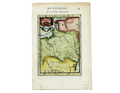
This map of Poland is from Mallet’s Description de l’Univers. Condition & Materials Copper engraving, 14.5 x 10.5 cm, recent hand-colour, Fren...
View full details
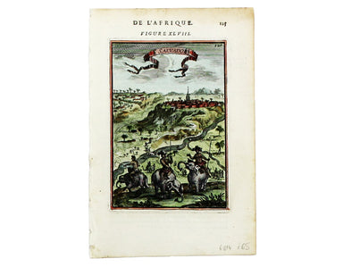
This map of São Salvador is from Mallet’s Description de l’Univers. São Salvador was once the capital of the kingdom of Congo, but as M’banza-Kongo...
View full details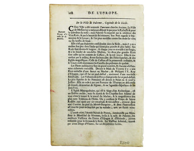
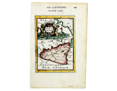
This map of Sicily is from Mallet’s Description de l’Univers, first published in Paris in 1683 and reprinted with German text in Frankfurt the foll...
View full details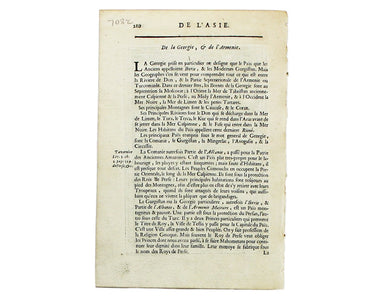
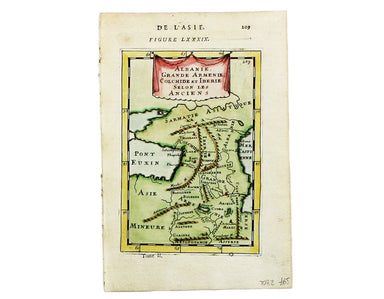
Albanie, Grand Armenie, Colchide et Iberie selon les anciens This map of the Ancient Caucasus is from Mallet’s Description de l’Univers. Condition ...
View full details
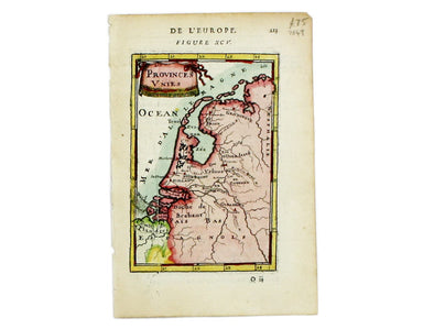
This map of the Netherlands is from Mallet’s Description de l’Univers. Condition & Materials Copper engraving, 15 x 10 cm, recent hand-colour, ...
View full details
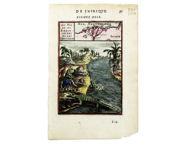
Du Nil et ses Embouchures et des Crocodiles This map of the Nile delta (with crocodiles) is from Mallet’s Description de l’Univers. Condition &...
View full details
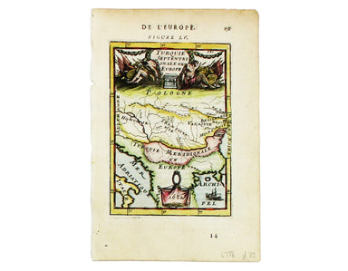
Turquie Septentrionale en Europe This map of the Northern Ottoman Territories is from Mallet’s Description de l’Univers. Condition & Materials ...
View full details
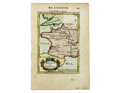
This regional map of France is from Mallet’s Description de l’Univers. Condition & Materials Copper engraving, 15 x 10.5 cm, recent hand-colo...
View full details
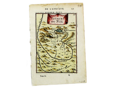
This map of the sources of the Nile is from Mallet’s Description de l’Univers. Condition & Materials Copper engraving, 14.5 x 10.5 cm, recent ...
View full details
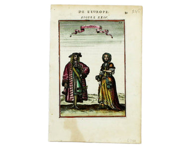
Here are some lovely Swedes, from from Mallet’s ‘Description de l’Univers. Condition & Materials Copper engraving, 15 x 10.5 cm, recent hand-co...
View full details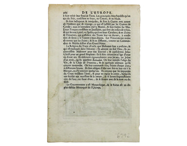
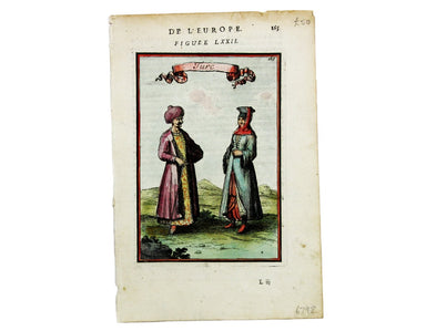
Condition & Materials Copper engraving, 15 x 10.5 cm, recent hand-colour, French text on verso, from Mallet’s Description de l’Univers.
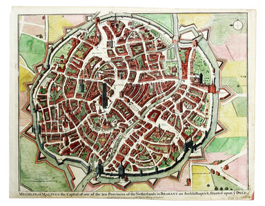
Mechelin, or Malines, the Capital of one of the ten Provinces of the Netherlands in Brabant This map of Mechelen was engraved by James Basire and p...
View full details
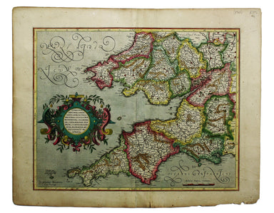
This is the southwestern sheet of Mercator’s five regional maps of England and Wales; Janssonius revised the decorative elements in the 1630s, but ...
View full details

Pomerania, running along the Baltic coast between Rostock and Gdansk, is now divided between Germany and Poland. The 'Atlas Minor’ was a pocket atl...
View full details
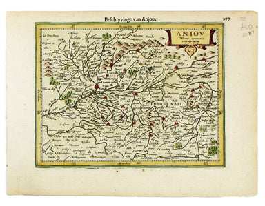
This map of Anjou is from the Atlas Minor. The original plates were engraved by Jodocus Hondius, but after these were sold to the London trade in t...
View full details
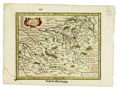
This map of the province of Berry in central France is from the Atlas Minor. The original plates were engraved by Jodocus Hondius, but after these ...
View full details
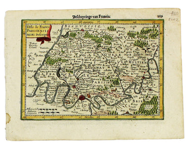
This map of Île-de-France, the Paris region north of the Seine, is from the Atlas Minor. The original plates were engraved by Jodocus Hondius, but ...
View full details
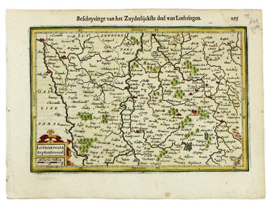
This map of Northern Lorraine is from the Atlas Minor. The original plates were engraved by Jodocus Hondius, but after these were sold to the Londo...
View full details
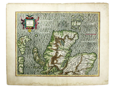
This map of the northern part of Scotland is from the Hondius-Janssonius map publishing business, which traced its roots back to Gerardus Mercator....
View full details
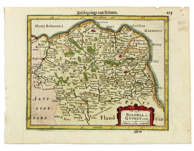
This is Mercator's map of Pays Boulonnais and Guînes from the Atlas Minor. The original plates were engraved by Jodocus Hondius, but after these we...
View full details
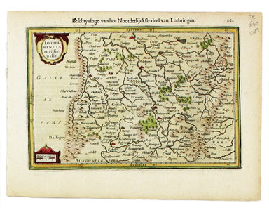
This map of Southern Lorraine is from the Atlas Minor. The original plates were engraved by Jodocus Hondius, but after these were sold to the Londo...
View full details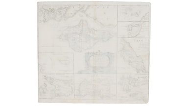
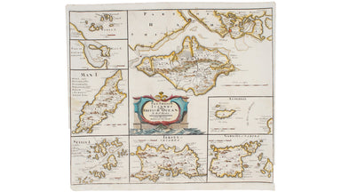
Robert Morden's maps were engraved to illustrate Gibson's edition of William Camden's Britannia, first published in 1695 and reprinted in 1722 and ...
View full details

Robert Morden's county maps, like this one of Cornwall, were engraved to illustrate Gibson's edition* of William Camden's Britannia. Camden was an ...
View full details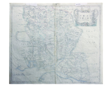
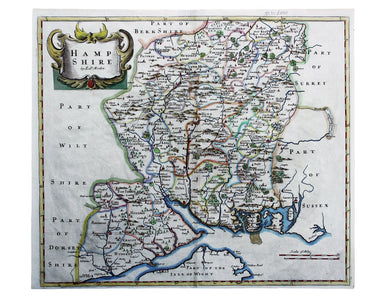
Robert Morden's maps were engraved to illustrate Gibson's edition of William Camden's Britannia, first published in 1695 and reprinted in various e...
View full details

Robert Morden's county maps, like this one of Lancashire (the county palatine of Lancaster), were engraved to illustrate Gibson's edition* of Willi...
View full details

Robert Morden's country maps, like this one of Suffolk, were engraved to illustrate Gibson's edition* of William Camden's Britannia. Camden was an ...
View full details

Robert Morden's county maps, like this one of Surrey, were engraved to illustrate Gibson's edition* of William Camden's Britannia. Camden was an El...
View full details
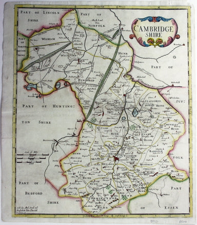
Robert Morden's maps were engraved to illustrate Gibson's edition of William Camden's Britannia, first published in 1695 and reprinted in various 1...
View full details
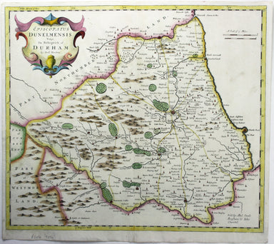
Robert Morden's maps were engraved to illustrate Gibson's edition of William Camden's Britannia, first published in 1695 and reprinted in various 1...
View full details
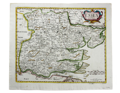
Condition & Materials Copper engraving, 36 x 42 cm, recent hand-colour, spotting top left, blank verso. A map of Essex engraved to accompany Gi...
View full details
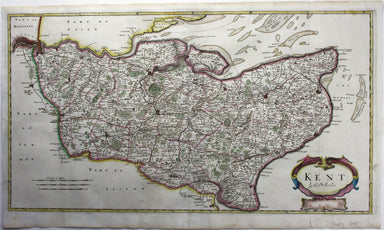
Robert Morden's maps were engraved to illustrate Gibson's edition of William Camden's Britannia, first published in 1695 and reprinted in various 1...
View full details
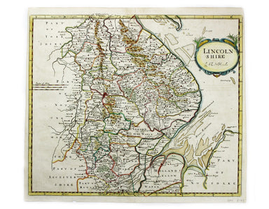
This map of Lincolnshire was engraved to accompany Gibson’s edition of Camden’s Britannia, first published in 1695. Condition & Materials Coppe...
View full details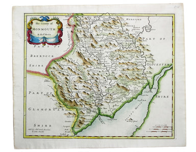
This map of Monmouthshire was engraved to accompany Gibson’s edition of Camden’s Britannia, first published in 1695. Condition & Materials Copp...
View full details
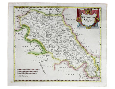
Robert Morden's map of Northumberland was engraved to illustrate Gibson's edition of William Camden's Britannia, first published in 1695 and reprin...
View full details
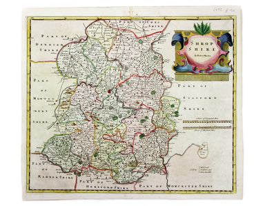
This map of Shropshire was engraved to accompany Gibson’s edition of Camden’s Britannia, first published in 1695. Condition & Materials Copper ...
View full details
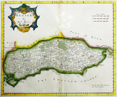
Robert Morden's map of Sussex was engraved to illustrate Gibson's edition of William Camden's Britannia, first published in 1695 and reprinted in 1...
View full details
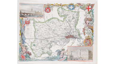
This map of Middlesex is illustrated with vignettes of Buckingham Palace (before its early 20th century re-modelling) and the ‘new’ Houses of Parli...
View full details
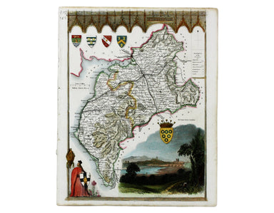
This map of Cumberland is by Moule, a bookseller, writer on heraldry and publisher who commissioned what is generally considered to be the last rea...
View full details
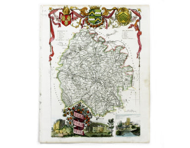
This map of Herefordshire is by Moule, a bookseller, writer on heraldry and publisher who commissioned what is generally considered to be the last ...
View full details
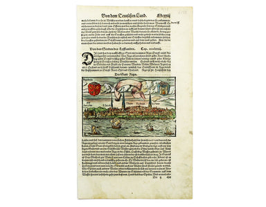
This view of the Latvian capital Riga is fromfrom Sebastian Münster's Cosmographia. A compendium of topographical information, folklore and travels...
View full details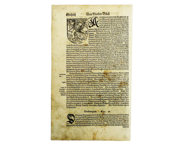
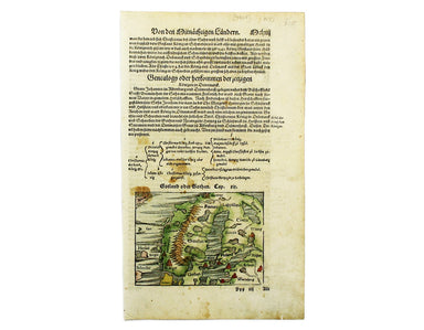
This map of Scandinavia is from Sebastian Münster's Cosmographia. A compendium of topographical information, folklore and travels, it was first pub...
View full details
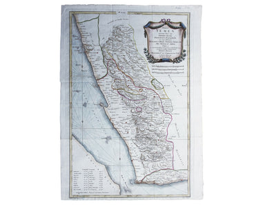
Terrae Yemen maxima Pars seu Imperii Imami, Principatus Kaukebân, nec non ditionum Haschid u Bekîl, Nehhm, Chaulân, Abu Arîsch Et Aden, Tabula ex o...
View full details
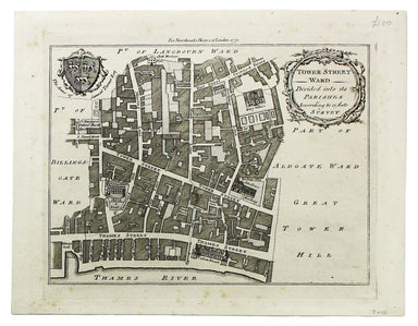
Condition & Materials Copper engraving, 19 x 25 cm, recent hand-colour, blank verso; a plan of Tower Ward published in Noorthouck’s History of ...
View full details
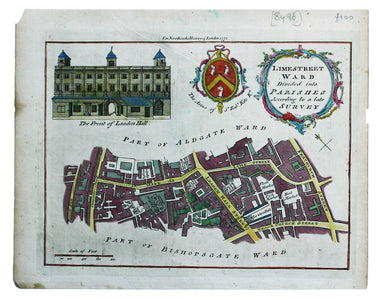
Limestreet Ward divided into Parishes according to a late Survey Possibly engraved by Thomas Bowen and first published in the London Magazine, this...
View full details

Thousands of miles of roads were surveyed for John Ogilby’s pioneering road atlas, the ‘Britannia’. This sheet covers the road between High Barnet ...
View full details
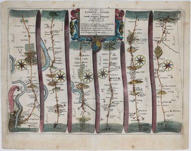
Our journey to Dover begins in London and follows the road through Deptford, Blackheath, Shooter’s Hill, and Dartford, reaching Dover via Rochester...
View full details
