

North's British Empire Exhibition Map
SKU: 9744
Title:
North's British Empire Exhibition Map
Date of publication:
Place of publication:
Publisher:
Colour:
Mapmaker:
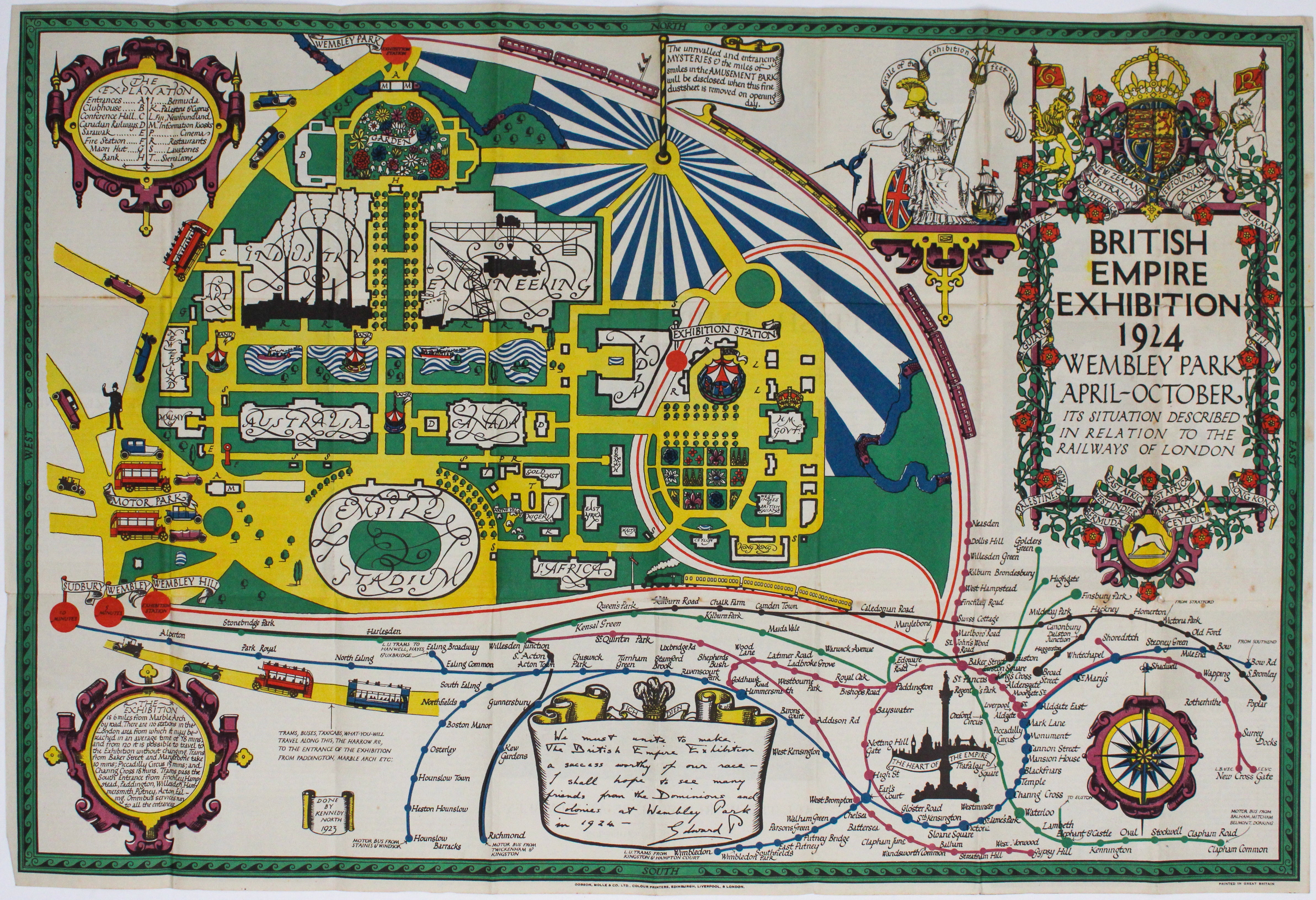
The British Empire Exhibition was, at the time, the largest exhibition staged anywhere in the world; a high profile, postwar statement of confidence in the future of Empire, it attracted 27 million visitors.
The focus of this map is the layout of the exhibition itself, with its pavilions for the dominions and colonies, the vast palaces of industry and engineering, and the newly built Wembley stadium, all described on the verso. Via a specially constructed loop line which ran from Marylebone, this feeds into a cleverly designed schematic diagram of the Underground network, centred on Trafalgar Square, ‘the heart of the Empire’. Read more
North was an artist, illustrator, picture restorer, socialist, folk dancer and general bohemian. Calligraphically he seems to have been inspired by MacDonald Gill, who had been designing the Underground map since 1920. The layout may have been influenced by the design of Metropolitan Railway carriage panels of the period, which are not dissimilar.
Condition & Materials
Folding pictorial passenger map, printed area 51.5 x 76 cm, printed on colours, with descriptive text in half tones on the verso, trivial wear at intersections of some of the folds, covers a little dusty, but in general a good, bright example. Read less