

Revolutionary France Invades the Low Countries
SKU: 8396
Title:
Revolutionary France Invades the Low Countries
Date of publication:
Printed Measurement:
Colour:
Mapmaker:
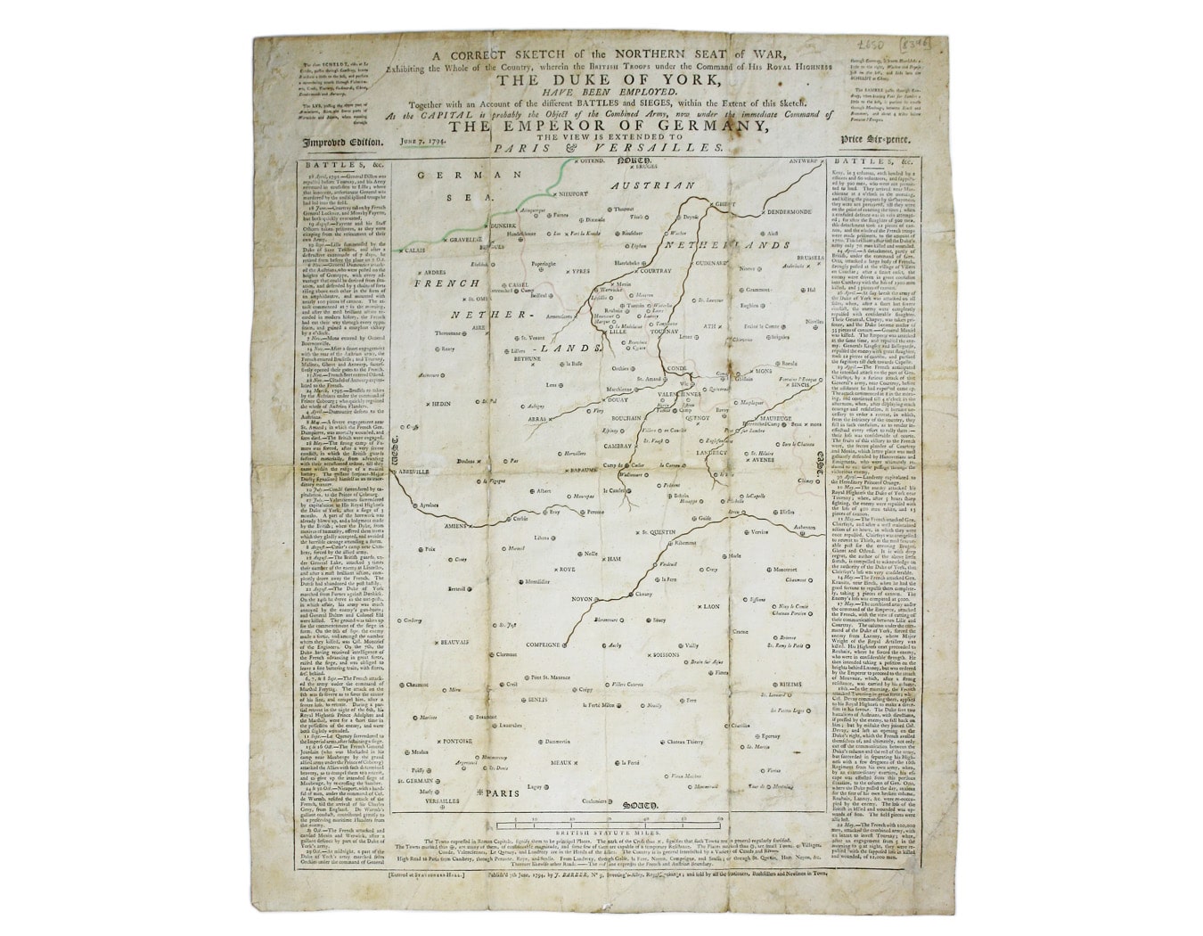
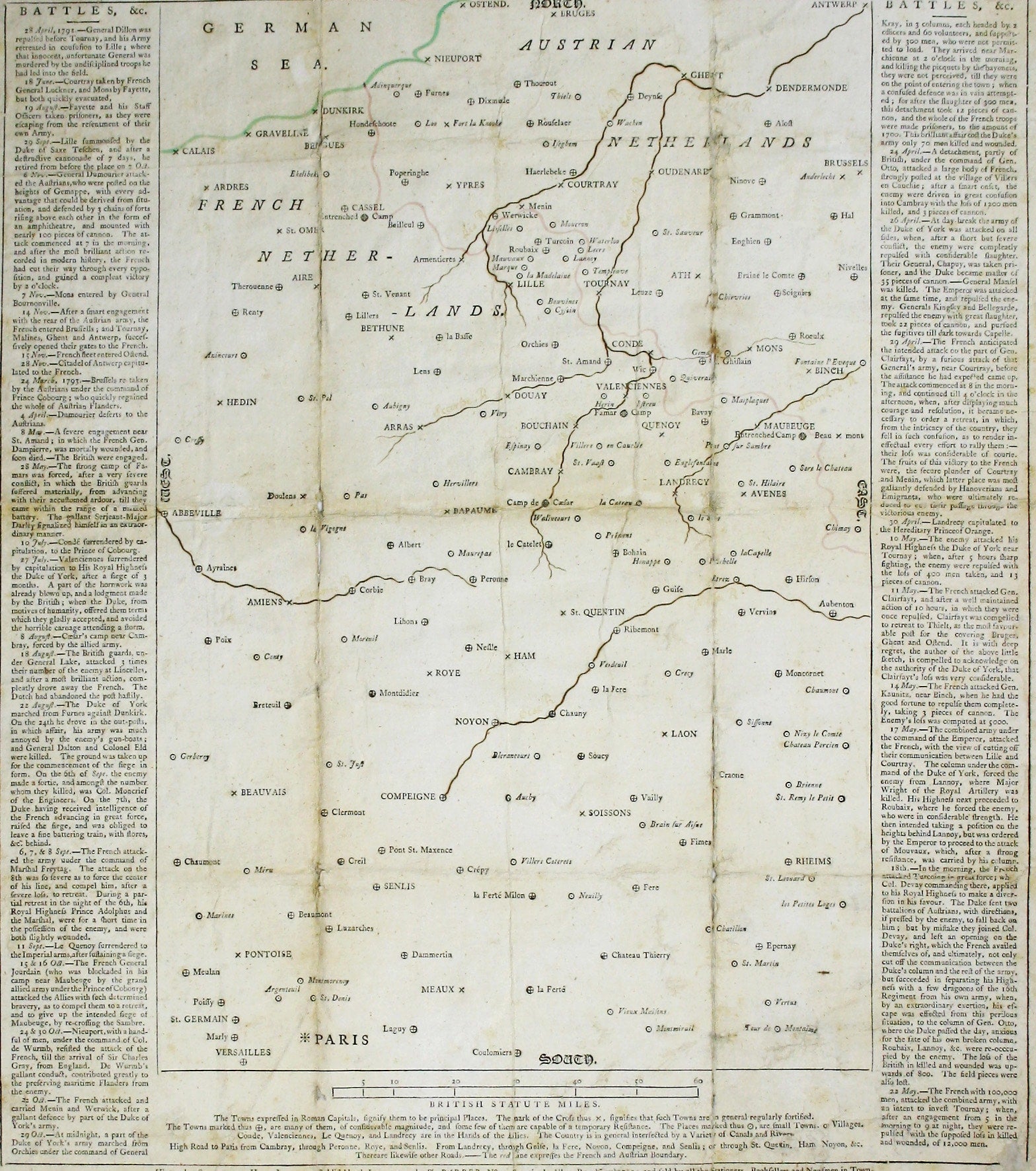
A correct sketch of the northern seat of war, exhibiting the whole of the country, wherein the British troops under the command of His Royal Highness The Duke of York, have been employed. Together with an account of the different battles and sieges, within the extent of this sketch. As the capital is probably the object of the combined army, now under the immediate command of the Emperor of Germany, the view is extended to Paris & Versailles. Improved edition.
The inclusion of Paris as the Allied objective proved somewhat premature. The Revolutionary French armies swept the Austrians and British back across the Rhine and as far north as Hanover. Read more
Austria lost control of the Spanish Netherlands (modern Belgium), and the Dutch Republic was toppled in favour of the Batavian Republic, a French client state. This unusual broadsheet map is recorded in states dated 29 May, 7 June, 23 June and 2 July 1794.
Condition & Materials
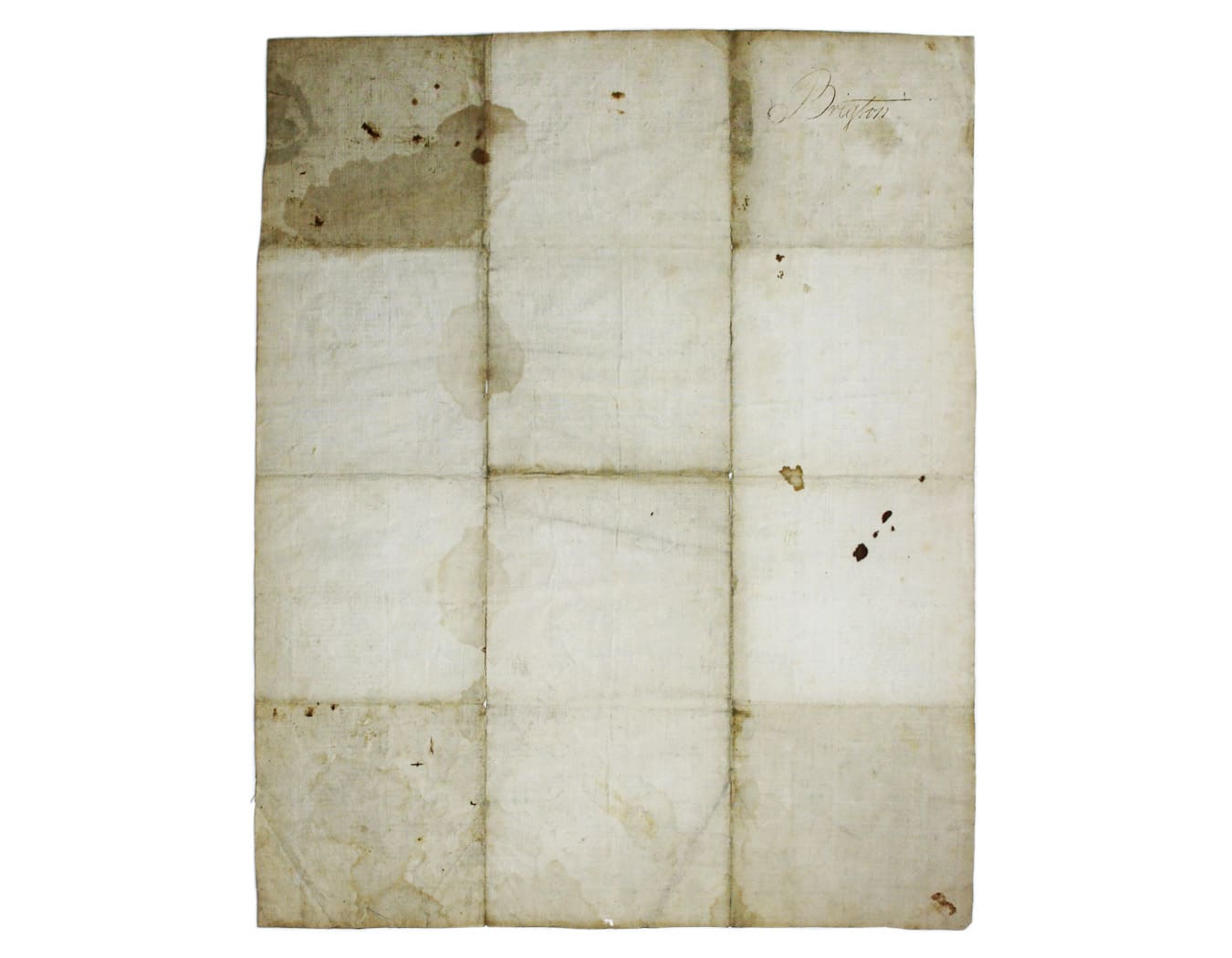
Broadsheet map, sheet size 54.5 x 43 cm; map 40.5 x 27 cm, within frame 44 x 39 cm. The frame, and the symbols for towns and cities are printed from a woodblock; placenames, the title and the text in the side-panels is letterpress; the coastline, rivers and the political border between Austrian and French territory have been inked in by hand. Laid on linen, very light staining and some wear at the folds, ‘Brigton’ in a contemporary hand on the cover. Read less