

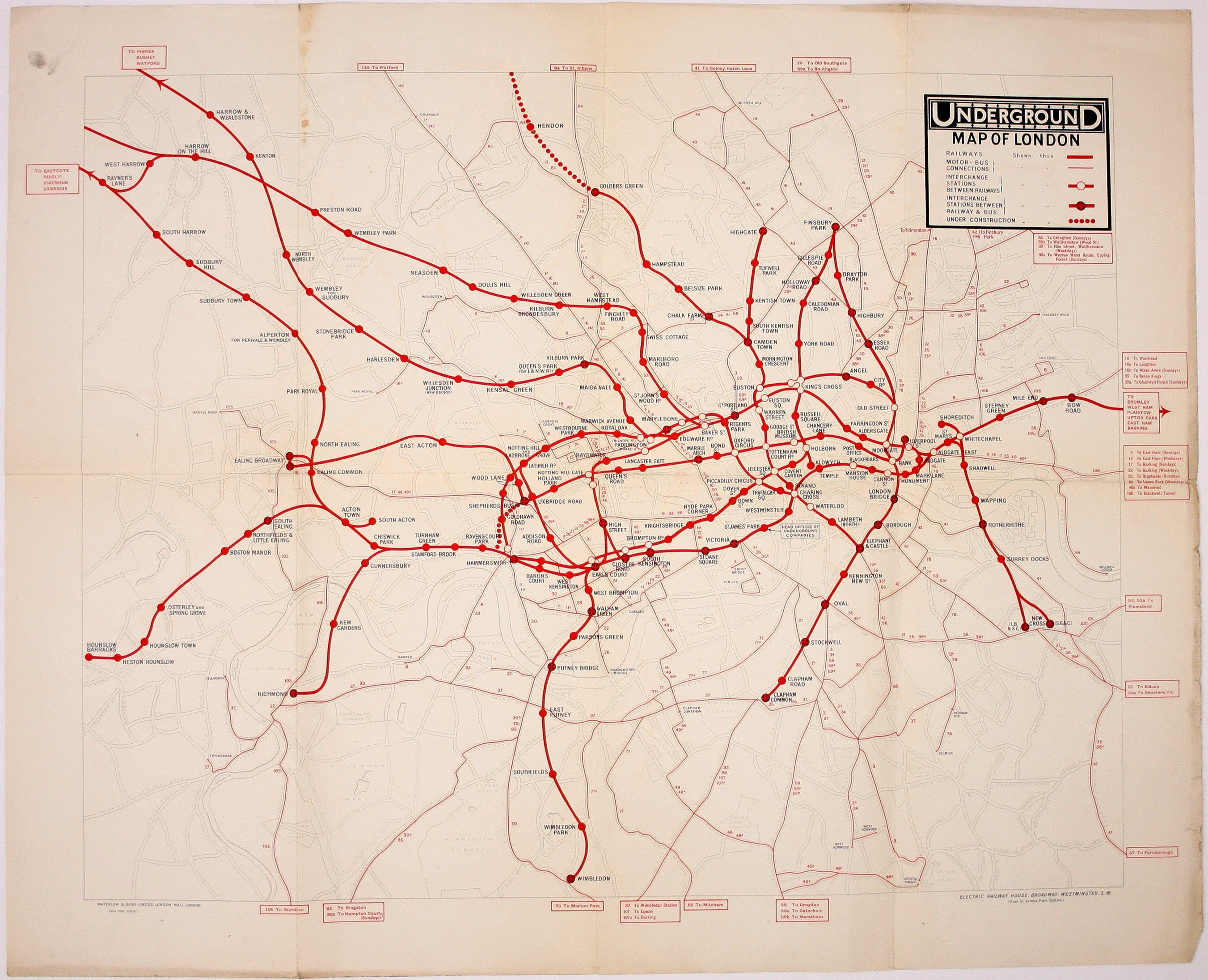
Underground Group’s 1921 Double Crown Station Map
SKU: 9235
Title:
Underground Group’s 1921 Double Crown Station Map
Date of publication:
Printed Measurement:
Publisher:
Colour:
Mapmaker:
Our map shows bus, tram and train services operated by the Underground Group and is very similar to the pocket map issued in guidebooks c. 1924.
The Hampstead Line beyond Golders Green is shown as under construction. Read more
Condition & Materials
Double crown station wall map, 61.5 x 76 cm (24 x 30 inches), print code 358-1000-9/6/21, printed in black and red, one or two minor blemishes and minor nicks and tears, slight dustiness to upper and right hand margins, blank verso.
References
Dodd’s Maps of London’s Transport p. 101
A quad royal poster version is illustrated by Leboff and Demuth (‘No need to ask!’ p. 64)
Read less