

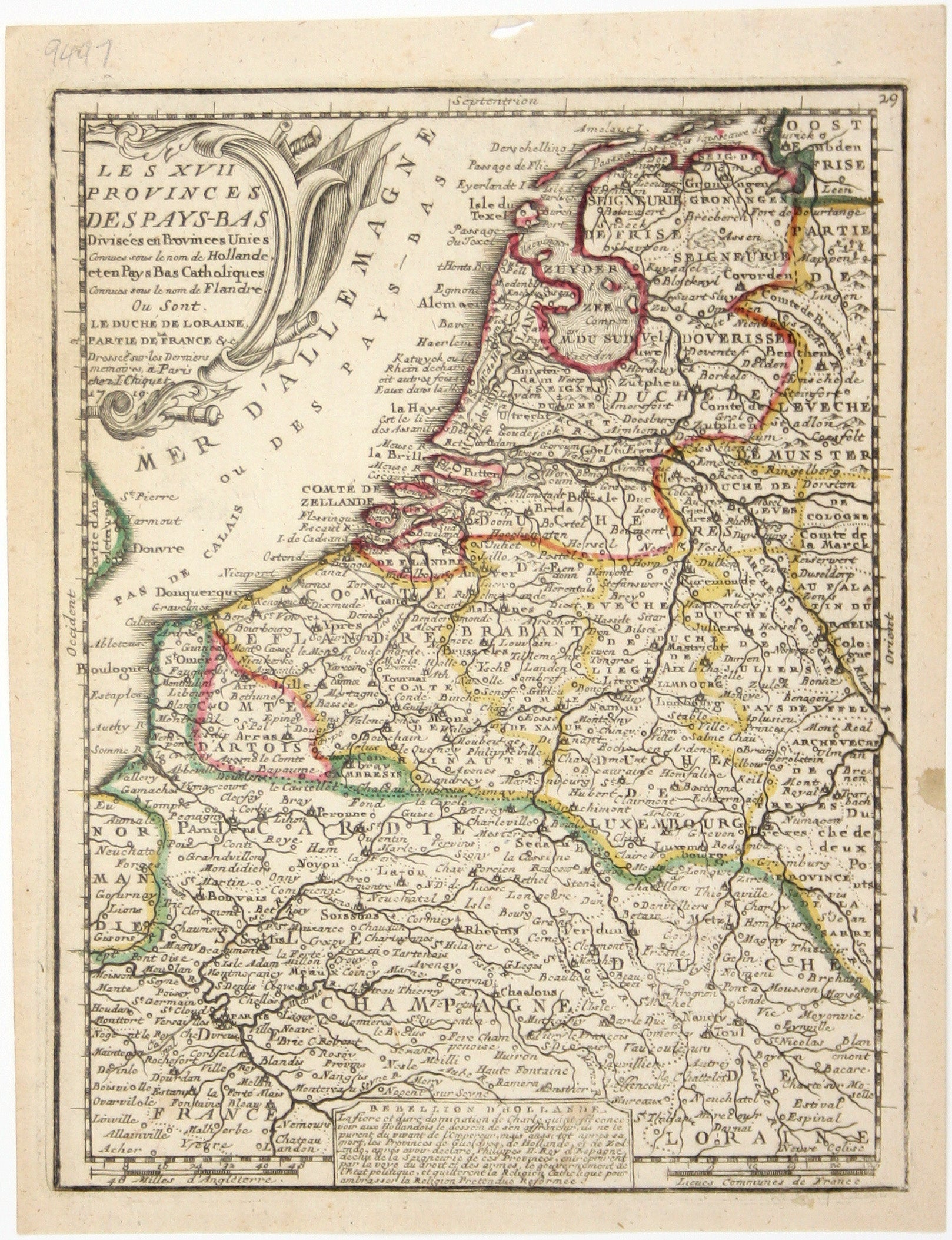
Chiquet’s Map of the Low Countries
SKU: 9497
Title:
Chiquet’s Map of the Low Countries
Date of publication:
Printed Measurement:
Colour:
Mapmaker:
Le XVII Provinces des Pays Bas divisées en Provinces Unies connues sous le nom de Hollande, et en Pays Bas Catholiques connues sous le nom de Flandre…
This map of the Low Countries includes a note on the Dutch Revolt at its foot, concluding with a remark about Dutch adherence to ‘la religion prétendue réformée’ which leaves no doubt about Chiquet’s sympathies. Read more
Our map was published in Chiquet’s ‘Le nouveau et curieux atlas géographique et historique ...’. Chiquet (1673-1721) was a relatively successful Parisian engraver, print and mapseller. He published Antoine Menard’s ‘Le nouveau et curieux atlas’ in 1711, and reprinted it with Menard’s name burnished from the plate and replaced with his own and a new date, 1719, as here.
Condition & Materials
Copper engraving, 21.5 x 16.7 cm, original hand colour in outline, blank verso. Read less