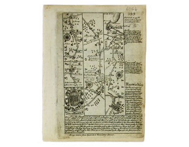
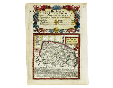
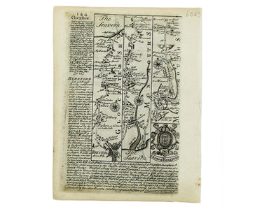
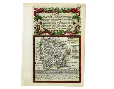
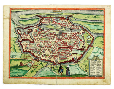
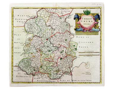
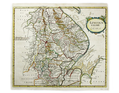
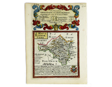
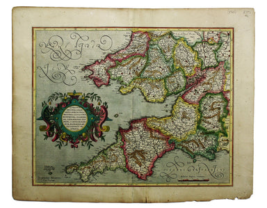
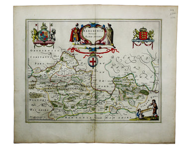
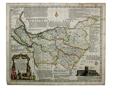
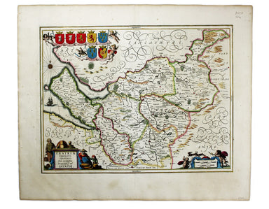
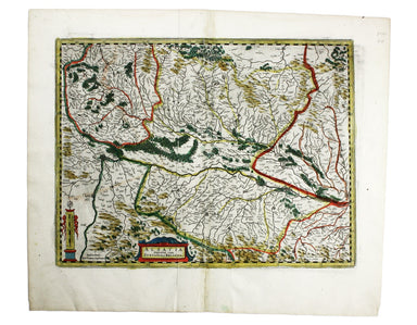
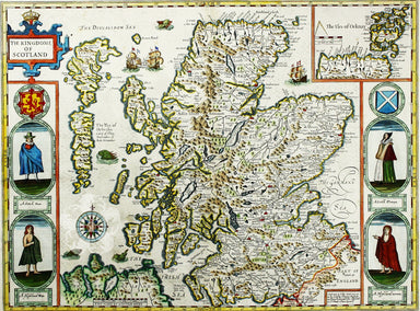
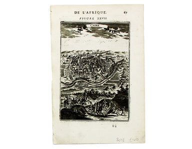
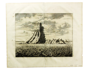
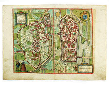
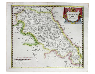
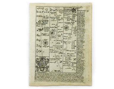
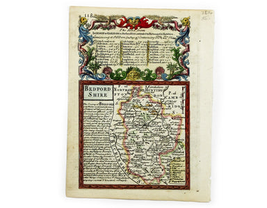
Morden’s Map of Shropshire
This map of Shropshire was engraved to accompany Gibson’s edition of Camden’s Britannia, first published in 1695. Condition & Materials Copper ...
View full details
This map of Shropshire was engraved to accompany Gibson’s edition of Camden’s Britannia, first published in 1695. Condition & Materials Copper ...
View full details
This map of Lincolnshire was engraved to accompany Gibson’s edition of Camden’s Britannia, first published in 1695. Condition & Materials Coppe...
View full details
This map of Northamptonshire was engraved by Emanuel Bowen for John Owen’s Britannia Depicta, a pocket road book derived from Ogilby’s innovative a...
View full details
This map of Norfolk was engraved by Emanuel Bowen for John Owen’s Britannia Depicta, a pocket road book derived from Ogilby’s innovative atlas of ...
View full details
This map of Herefordshire was engraved by Emanuel Bowen for John Owen’s Britannia Depicta, a pocket road book derived from Ogilby’s innovative atla...
View full details
Blome published the first new series of county maps since Speed. In the straightened financial environment of post-Restoration London he had to rep...
View full details
This map of Northern Scotland is from the first edition of Tabularum geographicarum contractarum libri, a geographical work which is normally catal...
View full details
This map of Radnorshire was engraved by Emanuel Bowen for John Owen’s “Britannia Depicta”, a pocket road book derived from Ogilby’s innovative atla...
View full details
Mappae Imperii Muscovitici pars Septentrionalis This detailed early 18th century map of Muscovy follows the cartography of De l’Isle, which include...
View full details
The first edition of this map was printed in 1932 but the introduction of Beck's diagram in 1933 did not obviate the need for geographically accura...
View full details
This is the southwestern sheet of Mercator’s five regional maps of England and Wales; Janssonius revised the decorative elements in the 1630s, but ...
View full details
Carte de la Mer d’Ecosse, Contenant les Isles et Costes Septentrionales et Occidentales d’Ecosse et les Costes Septentrionales d’Irlande This detai...
View full details
A Plan of the Town and Township of Liverpool, from an actual survey taken in the year 1785 by C. Eyes This map of Liverpool was surveyed and publis...
View full details
Blaeu and the rival Golden Age Dutch cartographic publishing house of Janssonius raced to bring out atlases of the British Isles in the 1630s and e...
View full details
An Accurate Map of the County Palatine of Chester […] Condition & Materials Copper engraving, 41.5 x 50.5 cm, map of Cheshire with original han...
View full details
This map of Merionethshire includes an inset town-plan of Harlech. John Speed (1552-1629) is unquestionably the most significant English map-maker ...
View full details
Cumbria & Westmoria. Vulgo Cumberland & Westmorland Joannes Janssonius II (1588-1664) married into the Hondius family and, with Henricus Ho...
View full details
This map of Ancient Gaul was engraved on the basis of Caesar’s commentaries on the Gallic Wars, his first hand account of the campaign. The text on...
View full details
Lincolnia Comitatus Anglis Lyncolneshire Joannes Janssonius II (1588-1664) married into the Hondius family and, with Henricus Hondius, worked on a ...
View full details
Cestria Comitatus Palatinatus. The Countye Palatine of Chester Joannes Janssonius II (1588-1664) married into the Hondius family and, with Henricus...
View full details
The Countie of Westmorland and Kendale the cheif towne described John Speed (1552-1629) is unquestionably the most significant English map-maker of...
View full details
L’Espagne dressée sur la Description qui en a eté faite par Rodrigo Mendez Sylva… par G. de l’Isle/Nova Regni Hispaniae accurata descriptio… Thus ...
View full details
Alsatia Superior cum Suntgoia et Brisgoia The original Mercator Atlas (parts published from 1585 onwards) was not a commercial success; the copper ...
View full details
A map of the French Alps, the Dauphiné, incuding Grenoble. The borders are those defined by the Treaty of Utrecht (1713) and the cartouche (putti m...
View full details
Saxonia Inferior et Mecklenborg Duc The original Mercator Atlas (parts published from 1585 onwards) was not a commercial success; the copper printi...
View full details
Terra Sancta, sive Promissionis, olim Palestina recens delineata, et in lucem edita per Nicolaum Visscher… Visscher’s influential map of the Holy L...
View full details
Cartographically Speed follows Mercator, but his is one of the most distinctive and decorative early maps of Scotland. The portraits in the borders...
View full details
Jerusalem, cum suburbiis, prout tempore Christi floruit, accurate notatis omnibus insgnibus et praecipuè iis locis, in quibis Christus passus est e...
View full details
Robert Morden's map of Sussex was engraved to illustrate Gibson's edition of William Camden's Britannia, first published in 1695 and reprinted in 1...
View full details
Tabula Prima Asiae continet Pontum, Bithyniam, Asiae propriae dictam, in qua Phyrgia Lyciam Pamphiliam, in qua Pisidia, Galatiam, in qua Paphlagoni...
View full details
This map of Cairo is from Mallet’s Description de l’Univers. It derives, ultimately, from Matteo Pagano’s magnificent 21 sheet wall map, published ...
View full details
Le Pik de Teneriffe/De Piek-Bergh op het Eilant Tenerifto The Anaga mountain range meets the sea in the northeastern part of Tenerife, close to the...
View full details
Carte des Isles du Cap-Verd This chart of the Cape Verde islands was engraved by Guillaume de la Haye. D’Après de Mannevillette (1707-1780) was a p...
View full details
This map of Augsburg was published by Merian and his heirs in various works, including the Archontologia cosmica, Theatrum Europaeum and the Topogr...
View full details
This plan of Metz in northeastern France is from the Civitates Orbis Terrarum, one of the most significant cartographic works of the late sixteenth...
View full details
This plan of Valenciennes in northern France is from the Civitates Orbis Terrarum, one of the most significant cartographic works of the late sixte...
View full details
Aquisgranum A plan of Aachen, or Aix-la-Chapelle, Germany. The Civitates Orbis Terrarum was one of the most significant cartographic works of the l...
View full details
Emuda vulgo Embden A plan of Emden in northern Germany. The Civitates Orbis Terrarum was one of the most significant cartographic works of the lat...
View full details
[Title-page] Anglorum Indoles Studia et Actiones In attempting to define the character of the English there is a strong emphasis on trade and disco...
View full details
This plan of Gouda in the Netherlands is from the Civitates Orbis Terrarum, one of the most significant cartographic works of the late sixteenth-ce...
View full details
Views of two towns on the Bay of Naples, Pozzuoli and Baia, are here presented on one sheet. The Civitates Orbis Terrarum was one of the most signi...
View full details
This map includes French town plans after Belleforest on one sheet: Autun in Burgundy and Nevers in Bourgogne. They are from the Civitates Orbis Te...
View full details
This map of Mons in Belgium is shown with Arras in northern France. It is from the Civitates Orbis Terrarum, one of the most significant cartograph...
View full details
Robert Morden's map of Northumberland was engraved to illustrate Gibson's edition of William Camden's Britannia, first published in 1695 and reprin...
View full details
This map of Bedforshire was engraved by Emanuel Bowen for John Owen’s Britannia Depicta, a pocket road book derived from Ogilby’s innovative atlas ...
View full details
This map of Huntingdonshire was prepared for Anglia Contracta, Seller's miniature county atlas. Seller's atlases are notoriously difficult to date ...
View full details
Das Irische und Kaledonische Meer mit Seinen Inseln This map focuses on the islands off the coast of Scotland and in the Irish Sea, and it's from f...
View full details
This map of Udrone from is the first edition of Tabularum geographicarum contractarum libri, a geographical work which is normally catalogued under...
View full details