

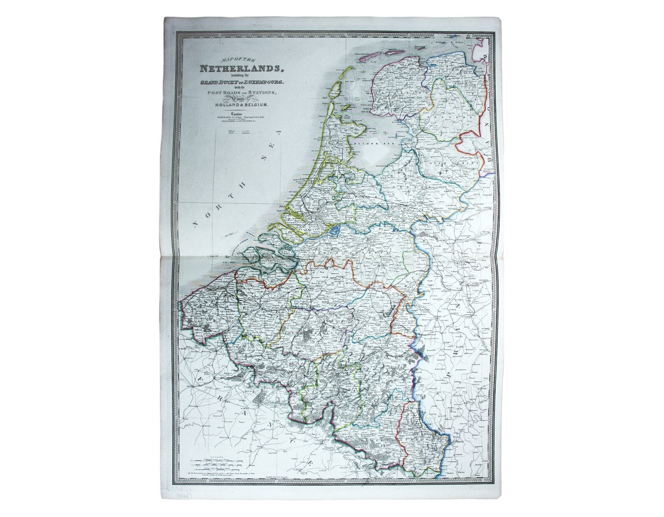
Wyld’s Map of the Low Countries
SKU: 8886
Title:
Wyld’s Map of the Low Countries
Date of publication:
Printed Measurement:
Colour:
Mapmaker:
Map of the Netherlands including the Grand Duchy of Luxembourg. With the post roads and stations and the limites of Holland and Belgium
This map of the Low Countries is from Wyld's New General Atlas. Read more
James Wyld senior established a highly successful firm of map publishers, which passed to his son when he died relatively young in 1836, apparently from 'overwork'. He introduced the new process of lithography to map printing, was a founder member of the Royal Geographical Society and was appointed Geographer to both George IV and William IV.
James Wyld junior inherited a thriving business. He was elected a fellow of the Royal Geographical Society and succeeded his father as Geographer to Queen Victoria and Prince Albert.
Condition & Materials
Copper engraving, 80 x 56.5 cm, original hand colour, blank verso. Read less