

Cheffins’ Grand Junction Railway Map
SKU: 9381
Title:
Cheffins’ Grand Junction Railway Map
Date of publication:
Printed Measurement:
Colour:
Mapmaker:
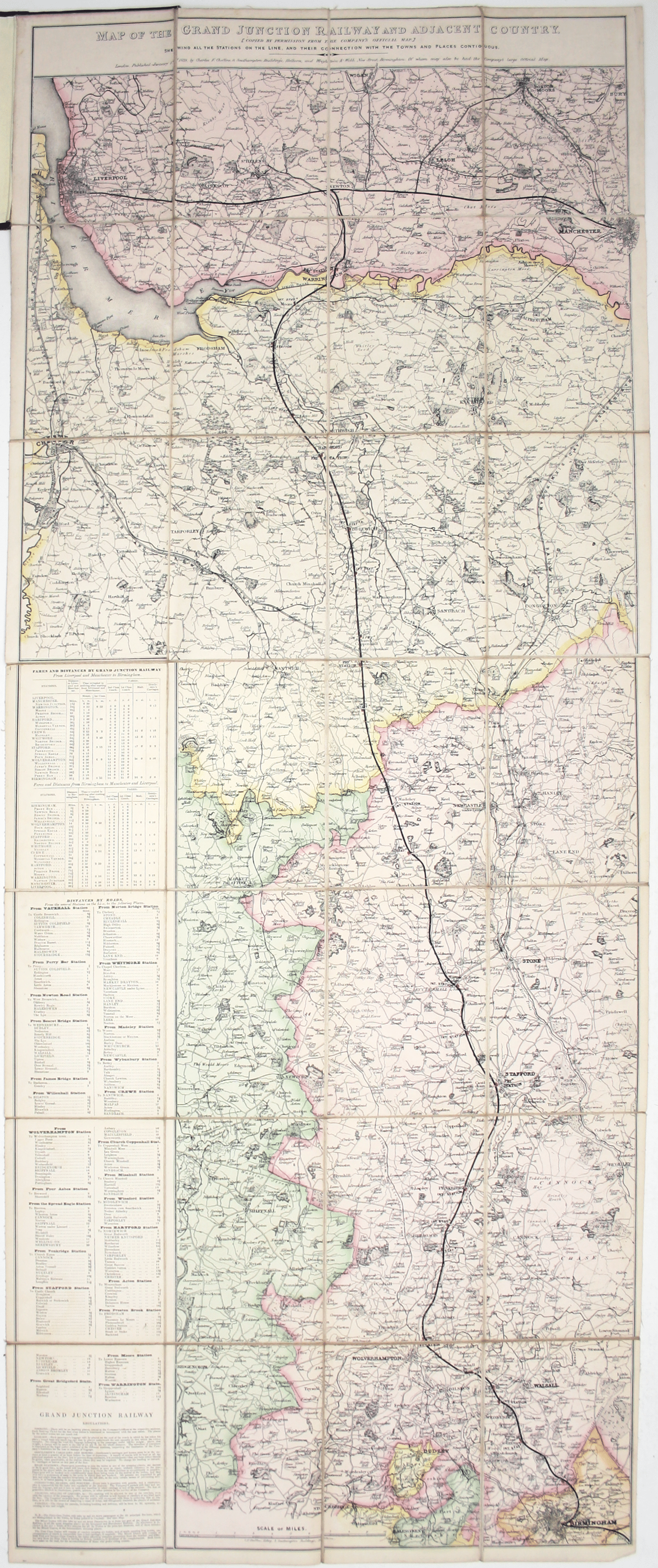
Map of the Grand Junction Railway and its Adjacent Country. [Copied by permission from the Company’s official map.] Shewing all the the stations on the line and their connection with the towns and places contiguous.
The Grand Junction Railway opened in 1837 and ran north from Birmingham to join the Liverpool and Manchester Railway at Newton, the first steam railway junction. The engraved date on our map is January 1st 1838. Read more
As an assistant to George Stephenson, Cheffins (1807-1861) prepared many of the original plans and sections for the Grand Junction c.1831-33. He then set up his own cartographic and drawing business, working as a surveyor on numerous early railway projects. Returning once more to the Grand Junction, this appears to be his first commercially published map, issued a few months after the line opened.
Condition & Materials
Lithographed folding map, 109.5 x 43.5 cm, dissected into 28 panels, original hand colour in outline; folding into original green pebble-cloth covers, lettered direct, rebacked, with advertisements for Cheffins’ lithographic printing office and other maps by the same publisher on the pastedown and panel facing the pastedown. Minor wear and signs of use to both map and covers. Read less