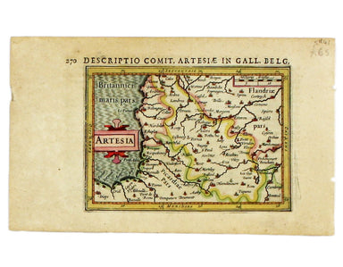
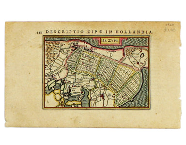
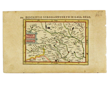
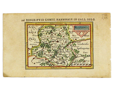
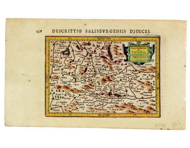
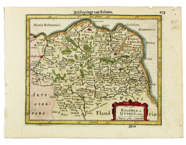
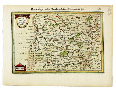
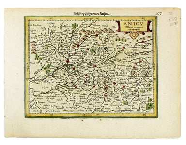
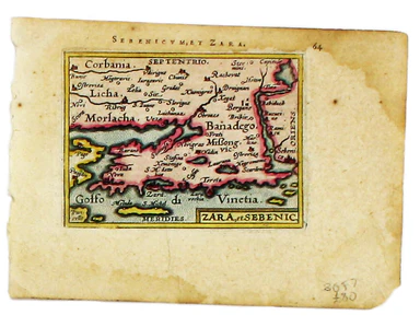
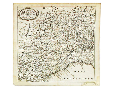
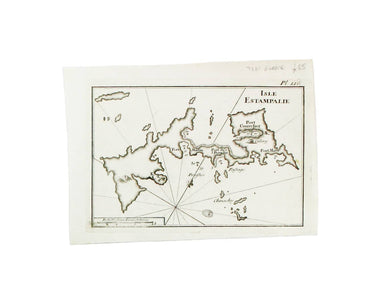
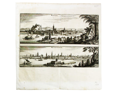
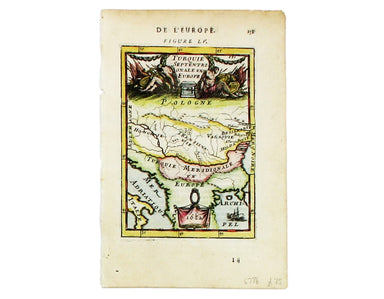
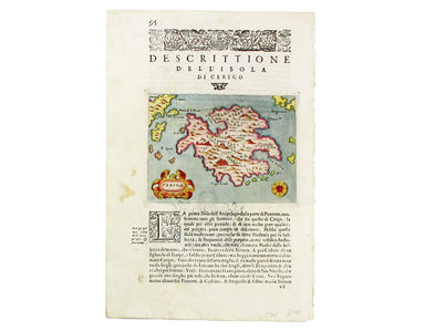
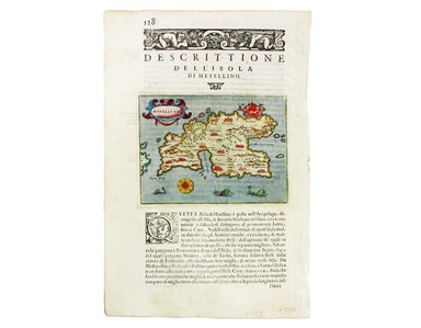
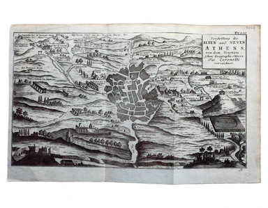
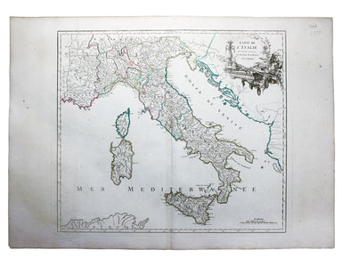
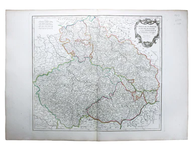
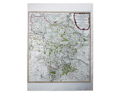
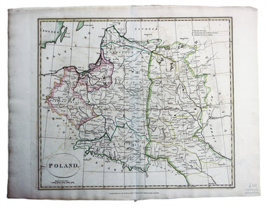
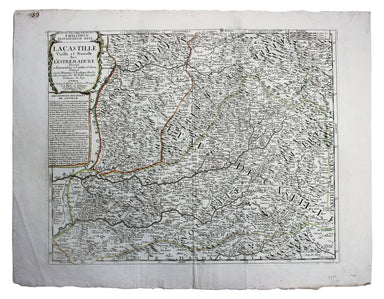
Mallet’s King Christian V of Sweden & Norway
Here's King Christian V, as he appears in Mallet’s ‘Description de l’Univers. Condition & Materials Copper engraving, 15 x 10.5 cm, recent han...
View full details
Here's King Christian V, as he appears in Mallet’s ‘Description de l’Univers. Condition & Materials Copper engraving, 15 x 10.5 cm, recent han...
View full details
Here are some lovely Swedes, from from Mallet’s ‘Description de l’Univers. Condition & Materials Copper engraving, 15 x 10.5 cm, recent hand-co...
View full details
France/Paîs Bas This map of France and the Low Countries is from Mallet’s ‘Description de l’Univers. Condition & Materials Copper engraving, 15...
View full details
This map of France is from Mallet’s Description de l’Univers. Condition & Materials Copper engraving, 15 x 10.5 cm, recent hand-colour, light ...
View full details
Condition & Materials Copper engraving, 23 x 32.5 cm, recent hand-colour, blank verso.
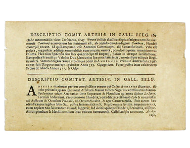
Condition & Materials Copper engraving, 9.5 x 13.4 cm, recent hand-colour, Latin text on verso; miniature map of Artois.
Condition & Materials Copper engraving, 9.5 x 13.4 cm, recent hand-colour, Latin text on verso; map of the Zijpe polder.
Veromandui This map of the modern Aisne is named here for the Viromandui, a Belgic tribal name. Condition & Materials Copper engraving, 9.5 x 1...
View full details
Condition & Materials Copper engraving, 9.5 x 13.4 cm, recent hand-colour, Latin text on verso; map of Hainault.
Condition & Materials Copper engraving, 9.5 x 13.4 cm, recent hand-colour, Latin text on verso; map of Liège.
A miniature map of Salzburg and Carinthia. Condition & Materials Copper engraving, 10 x 13.5 cm, recent hand-colour, Latin text on verso;
This is Mercator's map of Pays Boulonnais and Guînes from the Atlas Minor. The original plates were engraved by Jodocus Hondius, but after these we...
View full details
This map of Southern Lorraine is from the Atlas Minor. The original plates were engraved by Jodocus Hondius, but after these were sold to the Londo...
View full details
This map of Northern Lorraine is from the Atlas Minor. The original plates were engraved by Jodocus Hondius, but after these were sold to the Londo...
View full details
This map of Anjou is from the Atlas Minor. The original plates were engraved by Jodocus Hondius, but after these were sold to the London trade in t...
View full details
Condition & Materials Copper engraving, 39.5 x 49.5 cm, engraved by J. Basire, black and white as issued, blank verso; map of Mons.
The Babenburg Family Tree The March or Margraviate of Austria had been governed by the Babenburg family since the late tenth century. In 1156 Austr...
View full details
Kriechich Wyssenburg This map of Belgrade showing the confluence of the rivers Danube and Sava at Belgrade, Serbia, is from Sebastian Münster's Cos...
View full details
Zara et Sebenic This map of Zara and Sebinico on the Croatian coast is from the second series of maps engraved for the Epitome by Philip Galle. Con...
View full details
Rome Ancienne This plan of ancient Rome is from Mallet’s Description de l’Univers, first published in Paris in 1683 and reprinted with German text ...
View full details
Ligures, Taurini etc, item Rhaetiae pars Clüver is regarded as one of the founders of historical geography; his Introductionis in universam geograp...
View full details
This map includes a panoramic view of Parma at its foot, blank. The Society for the Diffusion of Useful Knowledge was founded in 1826 with the high...
View full details
This chart of Astypalaia in the Dodecanese is from the practical pocket sea atlas by Marseilles hydrographer Joseph Roux, charting the ports and ha...
View full details
This significant and original regional map of Padua is from Magini's great work, the first detailed national atlas of Italy, published posthumously...
View full details
This chart of Ios in the Cyclades is from the practical pocket sea atlas by Marseilles hydrographer Joseph Roux, charting the ports and harbours of...
View full details
This map of Dubrovnik and Chalcis waspublished by Merian and his heirs in various works, including the Archontologia Cosmica and Theatrum Europaeum...
View full details
Condition & Materials Copper engraving, 23 x 24.5 cm, black and white as issued, blank verso. Stadtplan of Napoleonic Venice.
Condition & Materials Copper engraving, 27.5 x 37 cm, black and white, blank verso. Map showing the Duchy of Mantua.
Turquie Septentrionale en Europe This map of the Northern Ottoman Territories is from Mallet’s Description de l’Univers. Condition & Materials ...
View full details
This map of the Balearics, Corsica, Sardinia and Valetta was published by the SDUK The Society for the Diffusion of Useful Knowledge was founded in...
View full details
This map of Turin was published by the SDUK. The Society for the Diffusion of Useful Knowledge was founded in 1826 with the high-minded aim of maki...
View full details
Scarpanto (Karpathos) This map of Karpathos was engraved by Girolamo Porro and is set in descriptive Italian text with a woodcut headpiece and hist...
View full details
Milo (Milos) This map of Milos was engraved by Girolamo Porro and is set in descriptive Italian text with a woodcut headpiece and historiated initi...
View full details
Negroponte (Euboea) This map of Negropoonte was engraved by Girolamo Porro and is set in descriptive Italian text with a woodcut headpiece and hist...
View full details
Il Sito de Curzolari (and Gulf of Lepanto) This map of the gulf of Lepanto was engraved by Girolamo Porro and is set in descriptive Italian text wi...
View full details
Cerigo (Kythera) This map of Kythera was engraved by Girolamo Porro and is set in descriptive Italian text with a woodcut headpiece and historiated...
View full details
Nicsia (Naxos) This map of Naxos was engraved by Girolamo Porro and is set in descriptive Italian text with a woodcut headpiece and historiated ini...
View full details
Metellino (Mytilene, Lesbos) This map of Mitilini was engraved by Girolamo Porro and is set in descriptive Italian text with a woodcut headpiece an...
View full details
Condition & Materials Copper engraving, 21 x 25.5 cm, original hand-colour, on a folio leaf 37 x 29 cm, blank verso.
Scandinavia complectens Sveciae, Daniae et Norvegiae Regna ex novissimis subsidiis delineata et ad Leges Projectionis Stereographicae legitimae red...
View full details
Graeciae Pars Meridionalis / Graciae Antiquae Tabula Nova in qua locorum situs tum ad distantias itinerarias tum ad Observationes Astronomicas exac...
View full details
At the foot of this map are architectural elevations of some of Rome’s most famous post-classical buildings, dominated by St Peter’s. Rome was then...
View full details
Vorstellung des Alten und Neven Athens, von dem Venetiani – schen Geographo Herrn Pat. Coronelli verzeichnet Coronelli’s plan retains features of t...
View full details
Two English printers dipped a toe in the vernacular atlas market at approximately the same time with pocket editions of the Ortelius atlas: ‘These ...
View full details
Carte de l’Italie, dans laquelle sont tracées les Routes des Postes This is a later state of Robert de Vaugondy’s road map of Italy, showing the Ve...
View full details
Le Royaume de Boheme, le Duche de Silesie, et les Marquisats de Moravie et Lusace, dressés d’apres les cartes de Muller The second state of Robert ...
View full details
Le Royaume de Hongrie, Principaute de Transilvanie, Sclavonie, Croatie, et partie de la Principaute de Valaquie, de la Bosnie, de la Servie et de l...
View full details
La Bataille de Lens en Flandre gaignee par l’Armee du tres Chres[tien] Louys XIIII Roy de France ed de Navarre, Comandee par Monseigneur le Prince ...
View full details