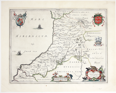

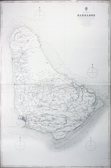
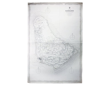
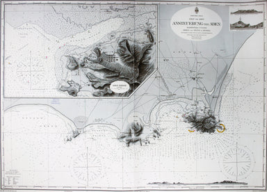
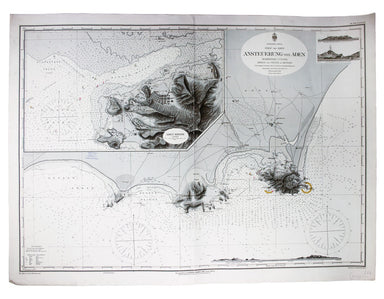
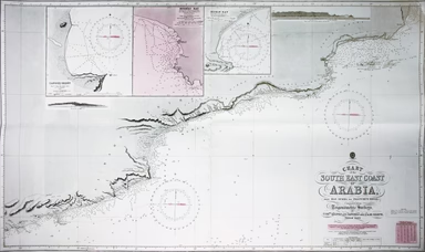
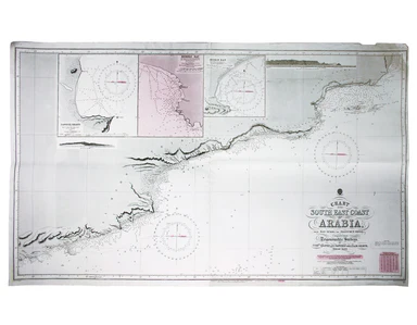
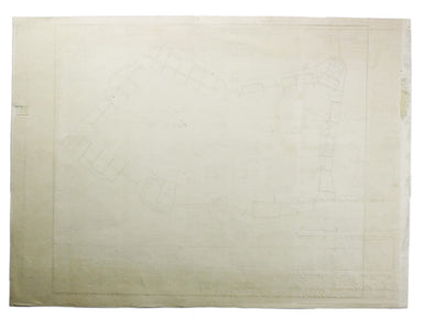
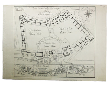
Admiralty Chart Barbados
Preliminary Chart – West Indies – Barbados This chart of Barbados shows sands and soundings etc, with interior detail of relief, roads and settleme...
View full detailsPreliminary Chart – West Indies – Barbados This chart of Barbados shows sands and soundings etc, with interior detail of relief, roads and settleme...
View full detailsIndsicher Ozean – Golf von Aden – Ansteuerung von Aden This German naval chart of Aden shows breakwaters and lights highlighted in colour. It detai...
View full detailsBlaeu and the rival Golden Age Dutch cartographic publishing house of Janssonius raced to bring out atlases of the British Isles in the 1630s and e...
View full detailsChart of the South East Coast of Arabia from Ras Sukra to Palinurus Shoal, compiled from trigonometric Surveys First published in 1860 with correct...
View full detailsTerrae Yemen maxima Pars seu Imperii Imami, Principatus Kaukebân, nec non ditionum Haschid u Bekîl, Nehhm, Chaulân, Abu Arîsch Et Aden, Tabula ex o...
View full detailsRobert Morden's maps were engraved to illustrate Gibson's edition of William Camden's Britannia, first published in 1695 and reprinted in various e...
View full detailsDaciarum, Moesiarumque, vetus descriptio This map of Ancient Dacia and Moesia, modern Romania and Bulgaria on the Black Sea was published by Baltha...
View full detailsBacon’s Large Scale Plan of the City of London –Bacon’s Coloured Plan of the City of London… “Blitzed” areas shown A highly detailed map of London ...
View full detailsThis map of Burma was published in the second trade edition of Stanford’s London Atlas. Edward Stanford (senior) acquired Arrowmsith's stock in 187...
View full detailsThis map attempts full integration of bus and coach routes, tramways, the Underground and main-line railways, and is possibly the first issue showi...
View full detailsIn 1933 the Met became part of the LPTB. Here though, the Tube and other railways fade into the background. The emphasis is on work/life balance, c...
View full detailsThis map of Reading is from Hermannides' Magna Britannia. Nearly all of the plans are based on the small inset plans shown on John Speed's county m...
View full detailsBlaeu’s map of Herefordshire. Blaeu and the rival Golden Age Dutch cartographic publishing house of Janssonius raced to bring out atlases of the Br...
View full detailsThe Bay of Gibraltar. With a plan of the Town, Rocks and Fortifications of Gibraltar as they now are. Also a plan of Algezira… Copied from the Drau...
View full detailsTrans-Isula D. Condition & Materials Copper engraving, 9.5 x 13.4 cm, recent hand-colour, Latin text on verso; map of Overjissel.
The Seven United Provinces This map of the Netherlands was prepared for Playfair’s New General Atlas. Condition & Materials Copper engraving, ...
View full detailsThis map of Poland is from Mallet’s Description de l’Univers. Condition & Materials Copper engraving, 14.5 x 10.5 cm, recent hand-colour, Fren...
View full detailsThis plan of Tienen in Flanders is from the Civitates Orbis Terrarum, one of the most significant cartographic works of the late sixteenth-century,...
View full detailsPlan du Dock ou du Bassin ‡ flot ‡ Londres dit Katarinen Dock ou Dock St. Katharine. Condition & Materials Lithograph, 35 x 40.5 cm, black and ...
View full detailsMappa Totius Mundi adornata juxta Observationes dnn. Academiae Regalis Scientiarum et nonnullorum aliorum secundum annotationes recentissimas edita...
View full detailsAfbeeldinge van’t zeer vermaarde Eiland Geks-Kop This Dutch ‘fool’s cap’ map satirises the bursting of the financial bubbles of 1720. Cartographic ...
View full detailsTopographia Repraesentio Barbarici Portus et Urbis Munitae Oran … Oran, an important trading port and now Algeria’s second city, was governed by th...
View full details“Hell on Wheels” War Against the Axis 1942 – 1943 – 1944 The lower panel of this map deals with operations in North Africa and Sicily, with the uni...
View full detailsFirst published in 1914, this revised edition highlights administrative boundaries. Though technically administered jointly by Egypt and Britain be...
View full detailsThis map of Frankfurt, view of the city at the foot of the map, was published by the SDUK. The Society for the Diffusion of Useful Knowledge was fo...
View full detailsCeretica sive Cardiganensis Comitatus; Anglis Cardigan Shire Blaeu and the rival Golden Age Dutch cartographic publishing house of Janssonius raced...
View full detailsBusca, near Cuneo in Piedmont. Blaeu’s townbook of Savoy and Piedmont was first published by the Blaeu heirs in 1682, but the plates were purchased...
View full details