

Sayer's Pictorial Map of Oxford
SKU: 9578
Title:
Sayer's Pictorial Map of Oxford
Date of publication:
Printed Measurement:
Publisher:
Colour:
Mapmaker:
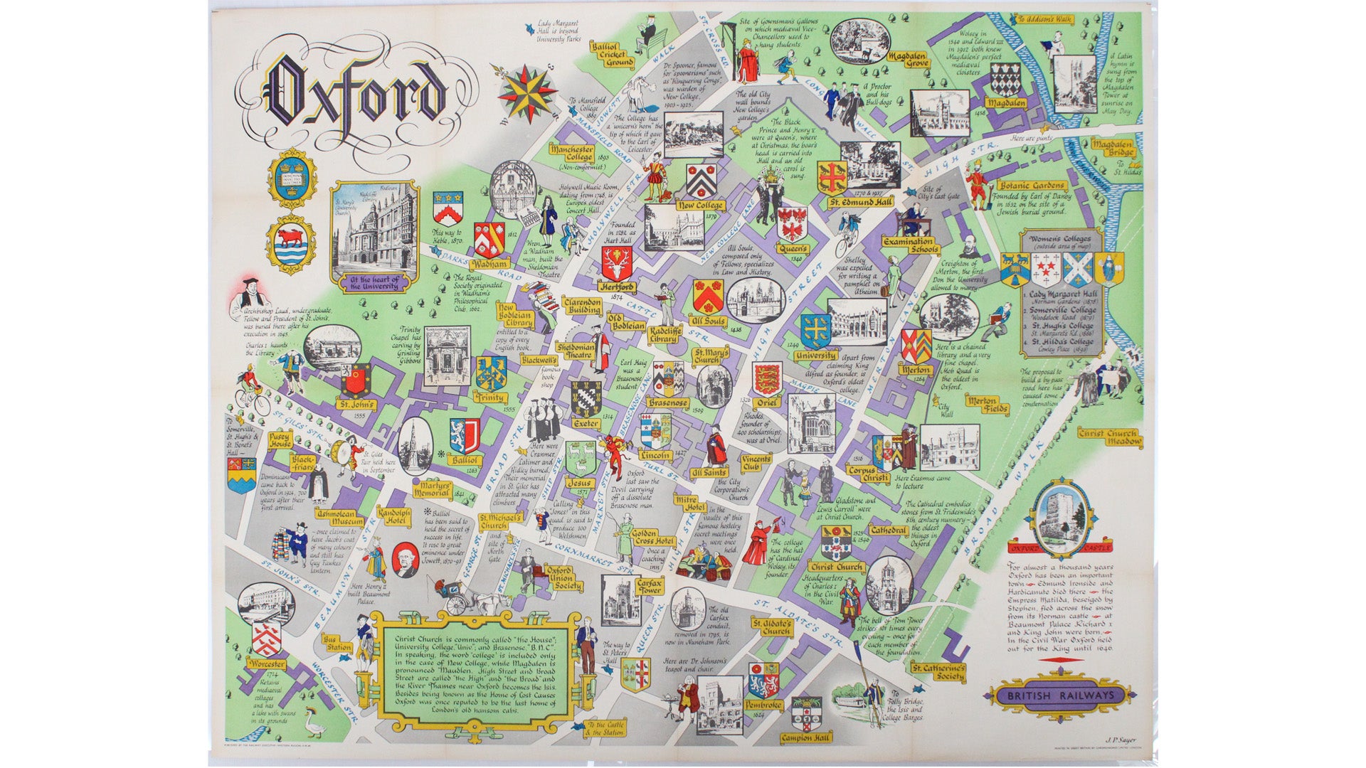
This pictorial plan of central Oxford was printed for the recently nationalised British Railways (Western Region).
The arms of the University and town are below the title; the colleges are marked with their crests and – in some cases – with black and white vignettes of their quads or other striking architectural details. An inset lists four women’s colleges located beyond the extent of the map (all are now co-educational). Read more
The map is populated with figures of Oxford types (such as ‘a Proctor and his Bull dogs’) and historical figures associated with Oxford, including Shelley, Lewis Carroll, Dr Johnson and a spectral Charles I. The map also features the divisive proposals to build an inner relief road across Christ Church Meadow, sparking a debate which lasted thirty years.
Jack Sayer (1901-1984) was a commercial artist and graphic designer active from the early 1930s onward. He produced pictorial map posters (mostly of counties and towns) for the GWR and LMS, and after the war for British Railways. He also created a series of small pictorial plans for a 'Survey of London and other historic towns' which was issued in monthly parts by the Strand Magazine, and then reissued in book form.
Condition & Materials
Quad royal station map, 102 x 126.5 cm (approx. 40 x 50 inches), printed in colours, lined on paper and linen. Published in London.
A Note on Shipping
Shipping rates are not available for this item. Select ‘pick up’ at checkout to collect it from the shop, or contact us for a custom quote. We will email you an invoice for the item price plus shipping, and you can complete the transaction securely online. Read less