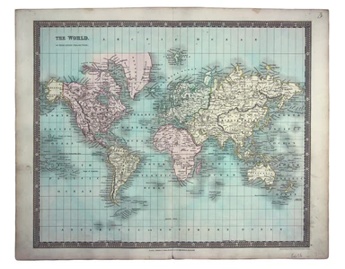
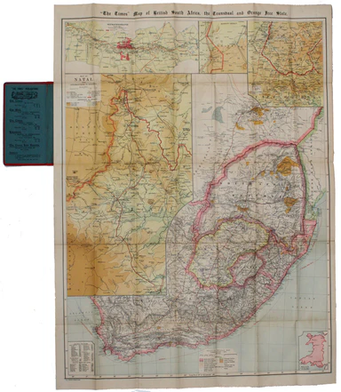
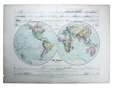
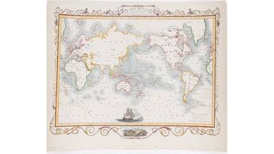
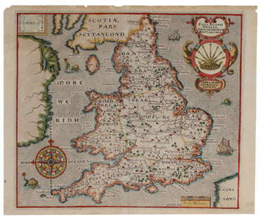
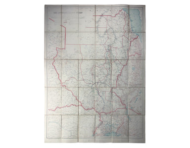
Stanford’s Double Hemisphere World Map
This double hemisphere world map was published in the second trade edition of Stanford’s London Atlas. Edward Stanford (senior) acquired Arrowmsith...
View full detailsThis double hemisphere world map was published in the second trade edition of Stanford’s London Atlas. Edward Stanford (senior) acquired Arrowmsith...
View full detailsA Map of the Metropolitan Boroughs within the County of London The date of publication in the lower margin of this map is significant: 25th October...
View full detailsThis map of New Zealand was published in the second trade edition of Stanford’s London Atlas. Edward Stanford (senior) acquired Arrowmsith's stock ...
View full detailsCondition & Materials Lithograph, 34 x 51 cm, colour printed, blank verso; a map of South East London prepared for the second edition of the Lo...
View full detailsThe Falkland Islands, surveyed by Captains Robert Fitz Roy R.N., William Robinson R.N. and Bartholomew James Sulivan R.N. This map of the Falkland...
View full detailsA chart of part of the coast of Cochin-China including Turon Harbour and the island Callao from an actual survey in June 1793. By HW Parish of the ...
View full detailsHet Beloofde Landt Canaan door wandelt van onfen Salichmaeker Iesu Christo, nessens syne Apostelen Oriented to the west, this map of the Holy Land ...
View full detailsEngraved by John Rapkin for John Tallis' ‘Illustrated Atlas’, this map of the world shows tracks for all three of Cook’s voyages and includes a vig...
View full detailsThis map of Edinburgh is one of the town plans in Tallis’ hugely popular ‘Illustrated Atlas’ which was published serially from the mid 1840s onward...
View full detailsThis map of Glasgow is one of the town plans published in Tallis’ hugely popular ‘Illustrated Atlas’ which was published serially from the mid 1840...
View full detailsThis map of the world is coloured by continent, with the exception of Russian America which is coloured as an extension of Asia. It was published i...
View full detailsThis pictorial map of Liverpool is folded into a souvenir record-sleeve style pack which comprises: ‘Nothing to get hung up about’, a 30 page shor...
View full detailsThis simplified map of Cyprus was a visual aid published as sheet 4 in a portfolio titled ‘Empire Information Project. The island is surrounded by ...
View full detailsCome for the Stone Age remains, stay for the rawhide... This simplified map of Malta and Gozo is surrounded by views, statistics and historical inf...
View full detailsThe Evening News was responsible for coining the name ‘Bakerloo Line’ for the Baker Street and Waterloo Railway, and here the newspaper makes a rel...
View full detailsAn Accurate Description of The Liverpool and Manchester Rail-Way, the tunnel, the bridges, and other works throughout the line; with a sketch objec...
View full detailsSigned limited edition screenprint Colour screenprint, sheet size 78 x 57.5 cms, signed by the artist and inscribed 'AP' (Artist’s Proof) in pencil...
View full detailsFrom ‘Sketches at Home and Abroad’, printed by Charles Hullmandel for Charles Tilt. London Bridge and the Monument can be glimpsed through a forest...
View full detailsSold by John Bowles, Print and Map Seller over against Stocks Market This print was issued in ‘London Described’ but like so many of the views in t...
View full detailsThis map of the Heptarchy, or seven Anglo-Saxon kingdoms, was engraved by William Hole for the first illustrated edition of William Camden's Britan...
View full detailsThis map of South Africa was published by The Times during the Second Anglo-Boer War, for the benefit of members of the British public following th...
View full detailsThis map of the British Isles and northwestern Europe charts George Edwards's travels between 1716 and 1730 and features male and female stag beetl...
View full detailsCassiodorus (Flavius Magnus Aurelius Cassiodorus Senator): Opera Omnia Quae Extant, ex fide manuscr. auctiora & locupletiora. Collatis etiam ex...
View full details[Greek title] Characteres Ethici: ex recensione Petri Needham cum versione Latina Isaaci Casauboni. Glasguae [Glasgow]: In Aedibus Academicis. Excu...
View full detailsJohn Thomson's map of Korea and Japan was engraved by John and George Menzies in 1814 and published in his ‘New General Atlas’ in 1815. Walter sugg...
View full detailsGezigt van den Tuin van Somerset’s Paleis, Langs den Theems tot op de Brug van Londen This view was engraved by . Philips after Antonio Canaletto’s...
View full details[Title page: Atlas Novus, volume IV] This is an architectural title page, engraved for the fourth volume of Blaeu’s Atlas Novus. The central panel ...
View full details[Title-page] Atlas Novus This title-page shows Europe, seated, accepting tribute from the other continents: Asia, Africa and America. In the foregr...
View full details[Title-Page] Mercurio Geografico […] Tomo Secondo […] Condition & Materials Copper engraved title-page, 42 x 26.5 cm, black and white as issue...
View full details[Title-page] Le Nouveau Theatre du Monde ou Nouvel Atlas, Tome second Through groups of allegorical figures the atlas makers ‘sought to promise the...
View full details[Title-page] The English Atlas, Volume II Pitt worked in partnership with Janssonius’ heir Joannes van Waesbergen, and this title-page for the Germ...
View full details[Title-page] Le Nouveau Theatre du Monde ou Nouvel Atlas, Tome Troisieme Copper engraved title-page, 37.5 x 23.5 cm, later hand-colour, blank verso...
View full detailsThis is an unusually nice example of the second, October issue of this geographic style map. It is often browned: in the months after the Armistice...
View full detailsSouth America – Magellan Strait – Western part from Punta Arenas to Cape Pillar This US naval chart of the Magellan Strait shows soundings, anchora...
View full detailsSigned limited edition screenprint Colour screenprint, sheet size 78 x 57.5 cms, signed by the artist and inscribed 'AP' (Artist’s Proof) in pencil...
View full detailsA new gradually encreasing Compass-Map of part of the Sea Coasts of England, in which is contained the Coasts of Sussex, extending from Eastwards o...
View full detailsQuae Supersunt ex Historiae Romanae voluminibus duobus. Cum integris scholiis, notis, variis lectionibus, et animadversionibus doctorum, curante Pe...
View full detailsPlan du Dock ou du Bassin ‡ flot ‡ Londres dit Katarinen Dock ou Dock St. Katharine. Condition & Materials Lithograph, 35 x 40.5 cm, black and ...
View full detailsVorst, Johannes: De Latinitate merito suspecta, deque vitiis sermonis Latini, quae vulgo fere non animadvertuntur, liber, quem alter, De Latinitate...
View full detailsProspectus majoris viae, et Ecclesiae Sanctae Mariae in Londino / La Grande Ruë et l’Eglise Ste. Marie Jean François Daumont (fl. 1740-1775) was a ...
View full detailsFirst published in 1914, this revised edition highlights administrative boundaries. Though technically administered jointly by Egypt and Britain be...
View full detailsIn the 1920s Valletta was the location of the Royal Navy's Mediterranean Fleet's headquarters. Prepared on the island, this map of Malta has a grid...
View full detailsRegni Hiberniae accurata tabula Christoph Weigel's map of Ireland was engraved by Michael Kauffer after Herman Moll and published in Samuel Faber’s...
View full detailsGraeciae Pars Meridionalis / Graciae Antiquae Tabula Nova in qua locorum situs tum ad distantias itinerarias tum ad Observationes Astronomicas exac...
View full detailsWernsdorf, Johann Christian (ed.): Poetae Latini Minores […] Curavit Io. Christianus Wernsdorf. Altenburgi [Altenburg], Ex Officina Richteria (vol....
View full detailsExtracts from the Minutes of the Epping and Ongar Highway Trust. From its Commencement in 1769 to its Termination in 1870. London: Harrison and Son...
View full detailsThis map of America is from Wyld's New General Atlas. James Wyld senior established a highly successful firm of map publishers, which passed to his...
View full detailsThis map of Scandinavia is from Wyld's New General Atlas. James Wyld senior established a highly successful firm of map publishers, which passed to...
View full details