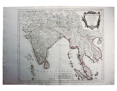
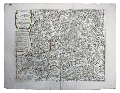
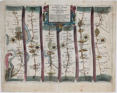
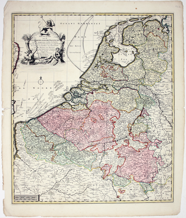
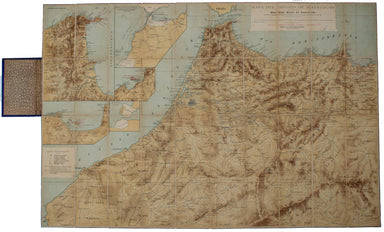
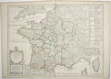
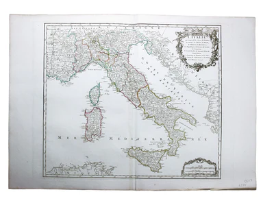
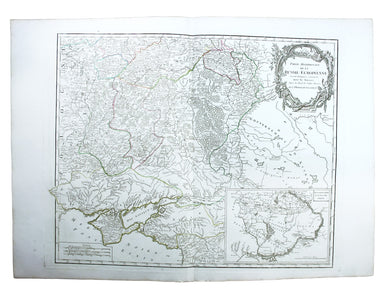
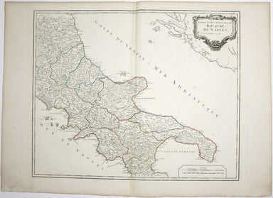
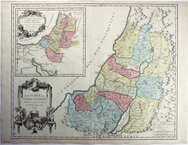
Ogilby's Road from Oxford to Cambridge
Our journey takes us along the road between the university towns of Oxford and Cambridge, via Bedford. Thousands of miles of roads were surveyed fo...
View full detailsOur journey takes us along the road between the university towns of Oxford and Cambridge, via Bedford. Thousands of miles of roads were surveyed fo...
View full detailsThe Russian Shores of the Black Sea in the autumn of 1852. With a voyage down the Volga and a tour through the country of the Don Cossacks. Second ...
View full detailsBraunsvicensis, et Luneburgensis dvcatvvm vera delineat… Norimberg. Agri, Fidissima descrip… Here we see two maps on one sheet, the Duchy of Brunsw...
View full detailsPomeraniae Wandalicae Regionis Typ. [on sheet with] Livoniae Nova descriptio [and] Ducatus Oswieczensis et Zatoriensis Descriptio An early example ...
View full detailsNatoliae quae olim Asia Minor nova descriptio / Aegypti recentior descriptio / Carthaginis celeberrimi sinus typus Here on one sheet we have three ...
View full detailsNieuwe Kaarte van der XVII Nederlandsche Provincien: waar in aangewezen worden de landen door den Koning van Vrankryk geconquesteerd als mede die v...
View full detailsIf thou art worn and hard beset with sorrows that thou wouldst forget… Go to the woods and hills; no tears dim the sweet look that nature wears. He...
View full detailsSigned limited edition screenprint Colour screenprint, sheet size 78 x 57.5 cms, signed by the artist and inscribed 'AP' (Artist’s Proof) in pencil...
View full detailsDe Maginot – En Siegfried Line. Met alle steden, germeenten, spoorwegen, verstingen en versterkingen, bosschen, heuvels, enz. This map was publishe...
View full detailsSigned limited edition screenprint Colour screenprint, sheet size 78 x 57.5 cms, signed by the artist and inscribed 'AP' (Artist’s Proof) in pencil...
View full detailsConstantinopoli / Descrittione di Constantinopoli First published in 1572, our example of Porcacchi’s map of Constantinople is from the second edit...
View full detailsIsola Hebride, et Orcade First published in 1572, our map of the Hebrides and Orkney islands is from the second edition of L’Isole piu famose del M...
View full detailsFolding map showing the post roads of the Austro-Hungarian Empire. Condition & Materials 4 folding engraved map sheets, which can be joined, e...
View full detailsProctor, Robert: Narrative of a journey across the Cordillera of the Andes and of a residence in Lima and other parts of Peru in the years 1823 and...
View full detailsSigned limited edition screenprint Colour screenprint, sheet size 78 x 57.5 cms, signed by the artist and inscribed 'AP' (Artist’s Proof) in pencil...
View full detailsDistrict within ¼ mile radius [of] Turnpike Lane Stanford’s was a firm of map publishers as well as map retailers until after the Second World War,...
View full detailsThis educational handkerchief (why not?) is in the same format as the series of thirteen 'mouchoirs militaire d'instructions' patented by the comma...
View full detailsThe 'Revoltas da Armada', the Brazilian naval mutinies of 1893-1894, were linked with the Federalist Rebellion against the recently-formed First Br...
View full detailsNew Map of London with the recent improvements Condition & Materials Folding map, 51.5 x 77.5 cm, dissected into 32 panels and laid on linen as...
View full detailsCondition & Materials Rider, Cardanus: Riders (1737.) British Merlin: adorn'd with many delightful varieties and useful verities, for the year ...
View full detailsThe Empire of Morocco, since 1912, had been divided between the Spanish and French. Our map dates to the period of the Rif War, 1921-26, in which a...
View full detailsRiver Thames Wharf Chart, Sheet 3, showing tiers, moorings, etc. between Barking Creek & Hole Haven. Condition & Materials Folding map, 75...
View full detailsLa France divisée suivant ses Provinces ou Gouvernemens Militaires This map of France is coloured by departments, with a table listing different fo...
View full detailsLe Royaume de Hongrie, Principaute de Transilvanie, Sclavonie, Croatie, et partie de la Principaute de Valaquie, de la Bosnie, de la Servie et de l...
View full detailsL’Italie qui comprend les Etats de Piémont, les Duchés de Milan, de Parme, de Modene, de Mantoue etc., les Républiques de Genes, de Venise, de Luqu...
View full detailsPartie Méridionale de la Russie Européenne This is a late state of Robert de Vaugondy’s map of southern Russia, Ukraine and parts of Poland. The or...
View full detailsLe Royaume de Boheme, le Duche de Silesie, et les Marquisats de Moravie et Lusace, dressés d’apres les cartes de Muller The second state of Robert ...
View full detailsPartie Septentrionale du Royaume de Naples This is a later state of Robert de Vaugondy’s map of the northern part of the Kingdom of Naples. The ori...
View full detailsEtat de l’Eglise, Grand Duché de Toscane, et Isle de Corse This is a later state of Robert de Vaugondy’s map of the Papal States, Tuscany and Corsi...
View full detailsLa Judée ou Terre Sainte, divisée en ses douze Tribus This is the second state of Robert de Vaugondy’s Old Testament map of the Holy Land. The map ...
View full detailsCarte de l’Italie, dans laquelle sont tracées les Routes des Postes This is a later state of Robert de Vaugondy’s road map of Italy, showing the Ve...
View full detailsRocque’s traveller’s assistant; being the most general and compleat director extant, to all the post, principal and cross roads in England, Wales, ...
View full detailsLes Indes Orientales This is Santini’s edition of Robert de Vaugondy’s map of the Indian subcontinent and mainland southeast Asia. Venetian map-mak...
View full detailsQuintus Horatius Flaccus: [Opera]. Birminghamiae [Birmingham]; typis S[arah]. Baskerville. 1772 John Baskerville's widow Sarah is known to have pri...
View full detailsHertfordiae Comitatus This map of Hertfordshire is from the second edition of Philemon Holland’s translation of Camden’s Britannia into English, th...
View full detailsLincolniae Comitatus ubi olim insederunt Coritani This map of Lincolnshire is from the second edition of Philemon Holland’s translation of Camden’s...
View full detailsThis map of Merionethshire is from the second edition of Philemon Holland’s English translation of Camden’s Britannia, the third printing from the ...
View full detailsWilliam Camden was an Elizabethan historian who wrote a county by county description of England. He continued to revise and expand his work, which ...
View full detailsWesmorlandia e comitatis. This map of Westmorland is from the second edition of Philemon Holland’s translation of Camden’s Britannia into English, ...
View full detailsKarte von dem groessten theil des landes Jemen, Imame, Kaukeban &. &. […] This map of Yemen and the Red Sea follows the detailed maps by Ge...
View full detailsGros Britanni[en] oder Engelland Schottland und Irrland The cartouche of this map is dominated by the Hanoverian coat of arms, and the legend on th...
View full detailsMappae Imperii Muscovitici pars Septentrionalis This detailed early 18th century map of Muscovy follows the cartography of De l’Isle, which include...
View full detailsSmith’s New Map of Europe, with the great roads, carefully drawn from the latest authorities Brothers John and Gilbert Jesser Pickett worked in par...
View full detailsCardigan Shyre described with the due forme of the Shiretown as it was surveyed by JS. Anno 1610 John Speed (1552-1629) is unquestionably the most ...
View full detailsThis map of Merionethshire includes an inset town-plan of Harlech. John Speed (1552-1629) is unquestionably the most significant English map-maker ...
View full details‘London as it is’ was printed for Boys by the pioneering lithographer Charles Hullmandel in two distinct versions: ours was originally sepia tinted...
View full detailsCondition & Materials Copper engraving, 23 x 24.5 cm, black and white as issued, blank verso. Stadtplan of Napoleonic Venice.
Since its first publication in 1862, and before the detailed Ordnance Survey map of London, Stanford's scrupulously revised and updated Library Map...
View full details