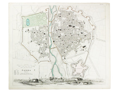
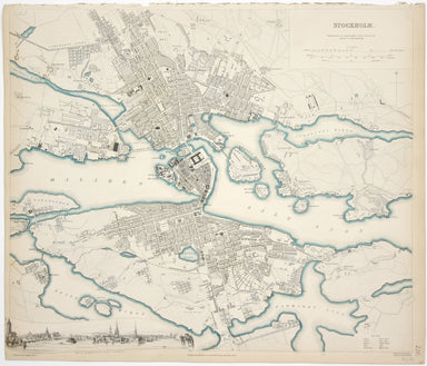
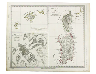
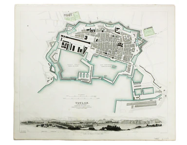
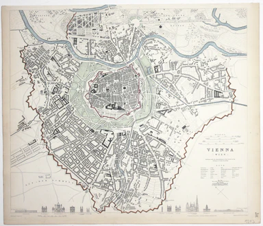
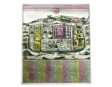
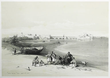
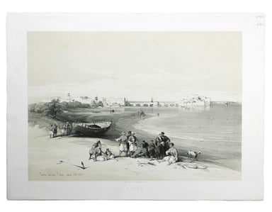
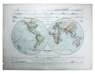
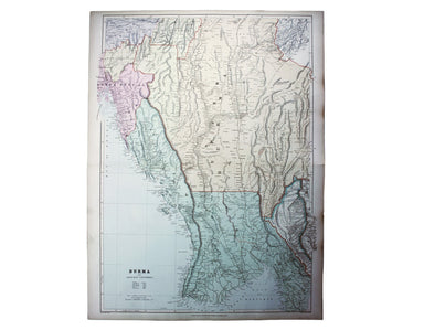
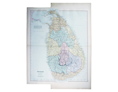
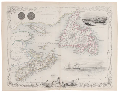
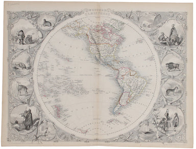
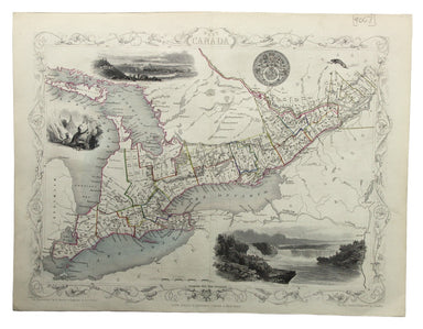
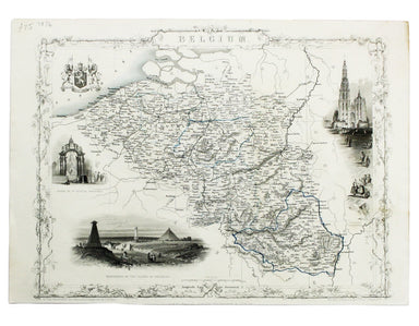
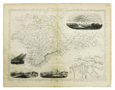
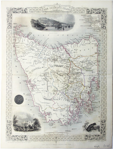
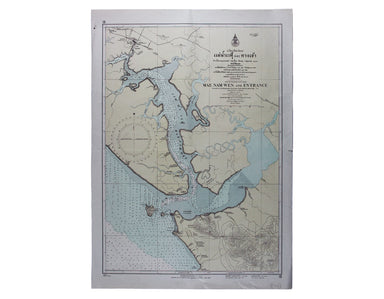
Robert de Vaugondy’s Map of Southern Russia in Europe
Partie Méridionale de la Russie Européenne This is a late state of Robert de Vaugondy’s map of southern Russia, Ukraine and parts of Poland. The or...
View full detailsPartie Méridionale de la Russie Européenne This is a late state of Robert de Vaugondy’s map of southern Russia, Ukraine and parts of Poland. The or...
View full detailsCarte des Royaumes d’Espagne et de Portugal dans laquelle sont tracées les routes de postes This is a later state of Robert de Vaugondy’s road map ...
View full detailsLe Royaume de Boheme, le Duche de Silesie, et les Marquisats de Moravie et Lusace, dressés d’apres les cartes de Muller The second state of Robert ...
View full detailsPartie Septentrionale du Royaume de Naples This is a later state of Robert de Vaugondy’s map of the northern part of the Kingdom of Naples. The ori...
View full detailsEtat de l’Eglise, Grand Duché de Toscane, et Isle de Corse This is a later state of Robert de Vaugondy’s map of the Papal States, Tuscany and Corsi...
View full detailsPresqu’Isle des Indes Orientales, comprenant l’Indostan ou Empire du Mogol, differens Royaumes ou Etats, les vastes possessions des Anglais, et les...
View full detailsLa Judée ou Terre Sainte, divisée en ses douze Tribus This is the second state of Robert de Vaugondy’s Old Testament map of the Holy Land. The map ...
View full detailsCarte de l’Italie, dans laquelle sont tracées les Routes des Postes This is a later state of Robert de Vaugondy’s road map of Italy, showing the Ve...
View full details[Map of] Afghanistan, political, phisical [sic], roads and distances, important historical sites According to the online resource Encyclopaedia Ira...
View full detailsSarmatia utraque Europaea et Asiatica This map shows parts of European Russia and Ukraine in antiquity. For Greco-Roman geographers and ethnographe...
View full detailsLes Indes Orientales This is Santini’s edition of Robert de Vaugondy’s map of the Indian subcontinent and mainland southeast Asia. Venetian map-mak...
View full detailsThis pictorial plan of central Oxford was printed for the recently nationalised British Railways (Western Region). The arms of the University and t...
View full detailsSyriae sive Soriae, nova et accurata descriptio Petrus Schenk and Gerard Valk often worked in partnership, towards the end of the Dutch Golden Age,...
View full detailsSinus Gangeticus; vulgo Golfo de Bengale nova descriptio This is a map of the Bay of Bengal with north oriented to the right. Petrus Schenk and Ger...
View full detailsKarte von dem groessten theil des landes Jemen, Imame, Kaukeban &. &. […] This map of Yemen and the Red Sea follows the detailed maps by Ge...
View full detailsGros Britanni[en] oder Engelland Schottland und Irrland The cartouche of this map is dominated by the Hanoverian coat of arms, and the legend on th...
View full detailsThis map of Africa reflects the state of European knowledge of the interior before the mid 19th century search for the sources of the Nile. It mark...
View full detailsThis map of Antwerp, engraved by Benjamin Rees Davies after William Barnard Clarke, includes elevations of principal buildings and a view of the ci...
View full detailsThis map of Australia has a table in the bottom left, showing the European population (supposedly revised to 1846 but with the original figure give...
View full detailsThis map of Dresden engraved by William Henshall after William Barnard Clarke. Condition & Materials Steel engraving, 33 x 37 cm, original han...
View full detailsThis map of France was engraved by J & C Walker after T Hewett Key. Condition & Materials Steel engraving, approx 33 x 35 cm, original hand...
View full detailsThis map of Frankfurt, view of the city at the foot of the map, was published by the SDUK. The Society for the Diffusion of Useful Knowledge was fo...
View full detailsThis map of Lisbon was engraved by Josiah Henshall after William Barnard Clarke. It was published by the Society for the Diffusion of Useful Knowle...
View full detailsAt the foot of this map are architectural elevations of some of Rome’s most famous post-classical buildings, dominated by St Peter’s. Rome was then...
View full detailsThis map of Naples was published by the SDUK. The Society for the Diffusion of Useful Knowledge was founded in 1826 with the high-minded aim of mak...
View full details
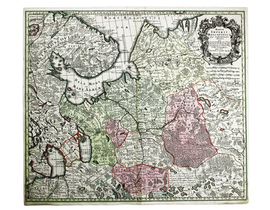
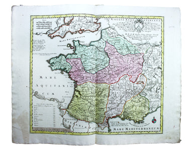
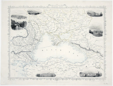
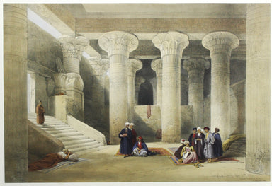
This map includes a panoramic view of Parma at its foot, blank. The Society for the Diffusion of Useful Knowledge was founded in 1826 with the high...
View full detailsA Map of the Principal Rivers shewing their courses, countries and comparative lengths The Society for the Diffusion of Useful Knowledge was founde...
View full detailsThis map of South Africa, including an inset of Cape Town, was engraved by John & Charles Walker. It was published by the SDUK. The Society for...
View full detailsThis map of Stockholm, with a view of of the city on a scroll bottom left, was published by the SDUK. The Society for the Diffusion of Useful Knowl...
View full detailsThis map of the Balearics, Corsica, Sardinia and Valetta was published by the SDUK The Society for the Diffusion of Useful Knowledge was founded in...
View full detailsThis map of Toulon was engraved by BR Davies after WB Clarke. Condition & Materials Steel engraving, 33 x 40 cm, original hand colour, blank ve...
View full detailsThis map of Turin was published by the SDUK. The Society for the Diffusion of Useful Knowledge was founded in 1826 with the high-minded aim of maki...
View full detailsThis map of Vienna was published by the SDUK. The Society for the Diffusion of Useful Knowledge was founded in 1826 with the high-minded aim of mak...
View full detailsThe Stars in Six Maps, on the the Gnomonic Projection, revised by the Rev. WR Dawes These star charts show allegorical images of the various conste...
View full detailsThis map of Huntingdonshire was prepared for Anglia Contracta, Seller's miniature county atlas. Seller's atlases are notoriously difficult to date ...
View full detailsThis map of Merionethshire was prepared for Anglia Contracta, Seller's miniature county atlas. Seller's atlases are notoriously difficult to date b...
View full detailsJerusalem, cum suburbiis, prout tempore Christi floruit, accurate notatis omnibus insgnibus et praecipuè iis locis, in quibis Christus passus est e...
View full detailsMappae Imperii Muscovitici pars Septentrionalis This detailed early 18th century map of Muscovy follows the cartography of De l’Isle, which include...
View full detailsGallia Augustiniana in suas provincias divisa… A map of Roman Gaul, with Lotter’s imprint. In 1756 Lotter succeeded his father-in-law, Georg Mattha...
View full detailsLondon: Day & Son for FG Moon, 1842-45. Tinted lithograph by Louis Haghe after Roberts, 35.5 x 51 cm, minor spotting. From the first edition o...
View full detailsMary Sims and Mary Camidge, both signing as 'of Maps and Guides, Ltd', each produced posters for British Railways (Eastern Region) in 1960. They th...
View full detailsSince its first publication in 1862, and before the detailed Ordnance Survey map of London, Stanford's scrupulously revised and updated Library Map...
View full detailsThis double hemisphere world map was published in the second trade edition of Stanford’s London Atlas. Edward Stanford (senior) acquired Arrowmsith...
View full detailsA Map of the Metropolitan Boroughs within the County of London The date of publication in the lower margin of this map is significant: 25th October...
View full detailsThis map of Burma was published in the second trade edition of Stanford’s London Atlas. Edward Stanford (senior) acquired Arrowmsith's stock in 187...
View full detailsThis map of New Zealand was published in the second trade edition of Stanford’s London Atlas. Edward Stanford (senior) acquired Arrowmsith's stock ...
View full detailsCondition & Materials Lithograph, 34 x 51 cm, colour printed, blank verso; a map of South East London prepared for the second edition of the Lo...
View full detailsThis map of Sri Lanka was published in the first trade edition of Stanford’s ‘London Atlas’. Edward Stanford (senior) acquired Arrowmsith's stock i...
View full details