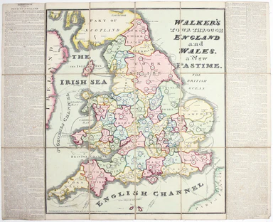
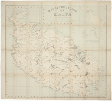
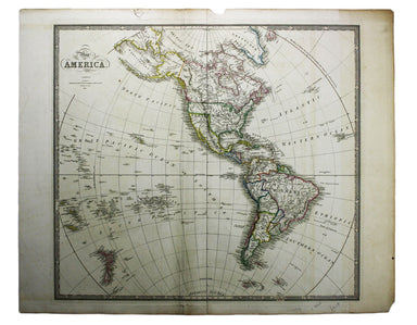
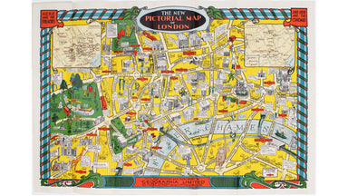
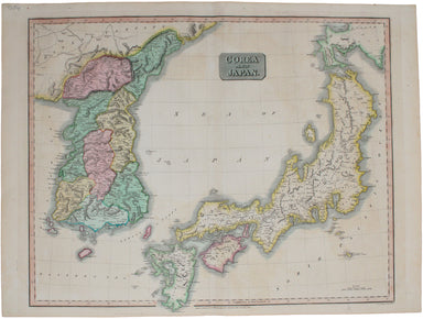
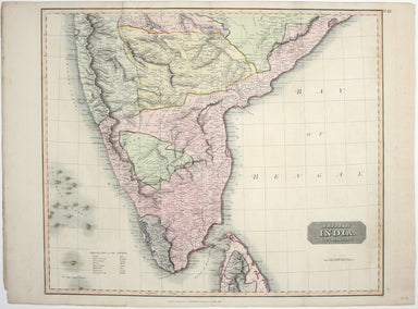
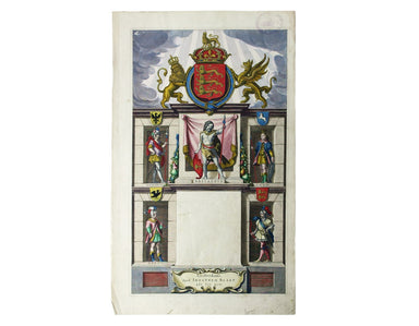
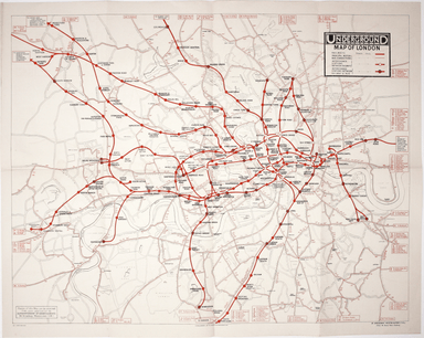
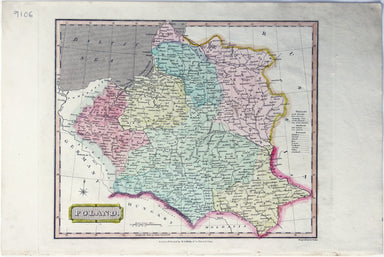
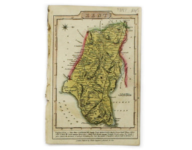
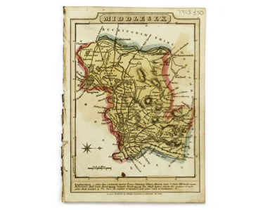
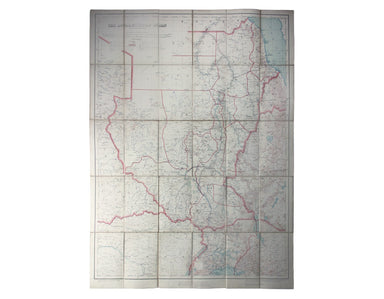
Stanford's Map of Africa
Also published in Stanford’s London Atlas, our example of this map of Africa was separately issued and illustrates the speed and scale of the Scram...
View full details
Also published in Stanford’s London Atlas, our example of this map of Africa was separately issued and illustrates the speed and scale of the Scram...
View full details
This double hemisphere world map was published in the second trade edition of Stanford’s London Atlas. Edward Stanford (senior) acquired Arrowmsith...
View full details
A Map of the Metropolitan Boroughs within the County of London The date of publication in the lower margin of this map is significant: 25th October...
View full details
This map of Burma was published in the second trade edition of Stanford’s London Atlas. Edward Stanford (senior) acquired Arrowmsith's stock in 187...
View full details
This map of New Zealand was published in the second trade edition of Stanford’s London Atlas. Edward Stanford (senior) acquired Arrowmsith's stock ...
View full details
This map of Sri Lanka was published in the first trade edition of Stanford’s ‘London Atlas’. Edward Stanford (senior) acquired Arrowmsith's stock i...
View full details
The Falkland Islands, surveyed by Captains Robert Fitz Roy R.N., William Robinson R.N. and Bartholomew James Sulivan R.N. This map of the Falkland...
View full details
Chart of the World on Mercator’s Projection, shewing the principal Ocean Steam Routes, the Submarine Telegraph &c This world map was published ...
View full details
Map showing the Western/Eastern Half of Equatorial Africa and the Explorations by Land and Water of Henry M. Stanley in the Years 1874-77 This map ...
View full details
The May 1925 issue of Stingemore’s passenger map shows Wembley Exhibition Grounds, and its covers advertise the number of escalators and other amen...
View full details
Our map of the London underground is the second edition in a series designed by Fred Stingemore, issued free to passengers from May 1925 onwards an...
View full details
Underground Map of Central London/A Guide to Underground Travel, Through Service Sth. Harrow and the West End Leboff and Demuth draw attention to t...
View full details
This map of Central America was engraved by John Rapkin for John Tallis' popular ‘Illustrated Atlas’. It includes black and white vignettes of Beli...
View full details
This map of Jamaica includes vignettes of Kingston, Port Royal, Port Antonio, and a sugar mill. The map was engraved by John Rapkin for John Tallis...
View full details
This map of Nova Scotia was engraved by John Rapkin for John Tallis' popular ‘Illustrated Atlas’; it includes black and white vignettes of Halifax,...
View full details
The map of the Eastern Hemisphere tracks the overland route to India (subject of a separate map in the series) and on to Australia. John Tallis the...
View full details
Victoria or Port Phillip Engraved by John Rapkin for the Illustrated Atlas, this map includes vignettes of Melbourne, the River Glenelg, a kangaroo...
View full details
This map of West Canada was engraved by John Rapkin for the ‘Illustrated Atlas’. The map also includes black and white vignettes of Kingston, Ontar...
View full details
This map of Belgium was engraved by John Rapkin for the Illustrated Atlas. Vignettes including Antwerp cathedral and monuments on the plains of Wat...
View full details
This map of Crimea was engraved by John Rapkin for the Illustrated Atlas. The inset is described as ‘Sebastopol before its investment’ (i.e. before...
View full details
This map of Germany was engraved by John Rapkin for the Illustrated Atlas. John Rogers engraved a number of vignettes: the Palace at Saxe Gotha, bi...
View full details
This map of Tasmania was engraved by John Rapkin for the ‘Illustrated Atlas'. John Rogers engraved the black and white vignettes including Hobart T...
View full details
This map of the Baltic Sea was engraved by John Rapkin for the Illustrated Atlas. Vignettes including Kronstadt and St Petersburg were engraved by ...
View full details
This map of the Black Sea has been updated to show the 300 miles of submarine telegraph cable laid between Varna and Balaclava by Robert Stirling N...
View full details
Thibet, Mongolia, and Mandchouria This map was engraved by John Rapkin for the ‘Illustrated Atlas’; with vignettes including Leh in Ladakh, a stret...
View full details
This map of the world is coloured by continent, with the exception of Russian America which is coloured as an extension of Asia. It was published i...
View full details
London: Day & Son for FG Moon, 1846-49. Subscribers’ edition. Lithograph by Louis Haghe after Roberts, 32 x 47.5 cm, with original hand colou...
View full details
Mae Nam Wen and Entrance, Surveyed by the Hydrographic Department, Royal Thai Navy, March-May 1944 This is a Thai chart of the Mae Nam Welu estuary...
View full details
This pictorial map of Liverpool is folded into a souvenir record-sleeve style pack which comprises: ‘Nothing to get hung up about’, a 30 page shor...
View full details
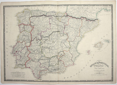
Course of the River Mole. From Box Hill Bridge to Leatherhead shewing the situation of the various apertures called Swallows This map charting the ...
View full details
Brittische Übermacht zur See wieder Franckreich Ao. 1759... Superiorite Britannique par Mer contre La France l'An 1759... This map is a contemporar...
View full details
This simplified map of Cyprus was a visual aid published as sheet 4 in a portfolio titled ‘Empire Information Project. The island is surrounded by ...
View full details
Come for the Stone Age remains, stay for the rawhide... This simplified map of Malta and Gozo is surrounded by views, statistics and historical inf...
View full details
The Evening News was responsible for coining the name ‘Bakerloo Line’ for the Baker Street and Waterloo Railway, and here the newspaper makes a rel...
View full details
This is a collection of 61 intelligence handbooks, 1943-1945, covering enemy and occupied countries and compiled by the Foreign Office and Ministry...
View full details
This pictorial map of London is generally dated 1931 in institutional catalogues, but here Geographia’s date-code for November 1934 is worked into ...
View full details
Signed limited edition screenprint Colour screenprint, sheet size 78 x 57.5 cms, signed by the artist and inscribed 'AP' (Artist’s Proof) in pencil...
View full details
From ‘Sketches at Home and Abroad’, printed by Charles Hullmandel for Charles Tilt. London Bridge and the Monument can be glimpsed through a forest...
View full details
This map of South Africa was published by The Times during the Second Anglo-Boer War, for the benefit of members of the British public following th...
View full details
This map of the British Isles and northwestern Europe charts George Edwards's travels between 1716 and 1730 and features male and female stag beetl...
View full details
John Thomson's map of Korea and Japan was engraved by John and George Menzies in 1814 and published in his ‘New General Atlas’ in 1815. Walter sugg...
View full details
Our example of the map has been annotated in ink to show the early expansion of the railway system, with railways completed and under construction....
View full details
This map covers the southern part of the subcontinent (Mumbai is near the upper border), and includes the northern part of Sri Lanka. Pink denotes ...
View full details
John Thomson's maps, like this one of the Channel, are characteristic of the Edinburgh school of cartography. It flourished at the beginning of the...
View full details
[Title page: Atlas Novus, volume IV] This is an architectural title page, engraved for the fourth volume of Blaeu’s Atlas Novus. The central panel ...
View full details
The earliest versions of this map advertised the Franco-British Exhibition which closed at the end of October 1908, marked here as ‘Exhibition’. In...
View full details
This iteration of the UERL common design marks George Philip & Son’s first official map for the Underground Group; the firm had designed the fi...
View full details
London: Day & Son for FG Moon, 1846-49. Subscribers’ edition. Lithograph by Louis Haghe after Roberts, 50 x 35 cm, with original hand colour,...
View full details