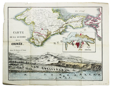
Crimean War Broadsheet Map
Carte de la Guerre de la Crimèe. Editèe par Lèmèrey et E. Gratier This Crimean War broadsheet map includes an inset of Sebastopol and a view of the...
View full details

Carte de la Guerre de la Crimèe. Editèe par Lèmèrey et E. Gratier This Crimean War broadsheet map includes an inset of Sebastopol and a view of the...
View full details
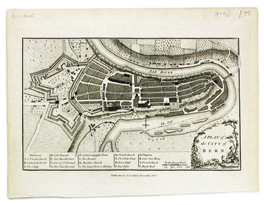
This map of Berne was first published in 'A collection of plans of the capital cities of Europe' in 1771. The plates seem to have been acquired by ...
View full details
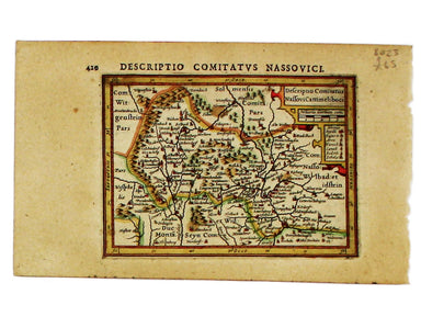
This miniature map of Nassau is from the first edition of Tabularum geographicarum contractarum libri, a geographical work which is normally catalo...
View full details
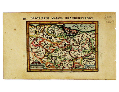
This miniature map of Brandenburg is from the first edition of Tabularum geographicarum contractarum libri, a geographical work which is normally c...
View full details
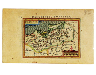
This miniature map of Prussia is from the first edition of Tabularum geographicarum contractarum libri, a geographical work which is normally catal...
View full details
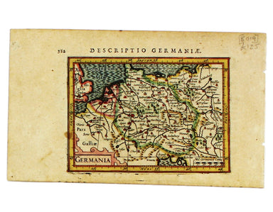
This map of Germany is from the first edition of Tabularum geographicarum contractarum libri, a geographical work which is normally catalogued unde...
View full details
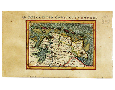
This map of Eastern Friesland is from the first edition of Tabularum geographicarum contractarum libri, a geographical work which is normally catal...
View full details
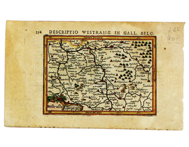
This map of Southwestern Germany is from the first edition of Tabularum geographicarum contractarum libri, a geographical work which is normally ca...
View full details
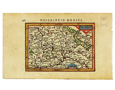
This map of Northen Bavaria is from the first edition of Tabularum geographicarum contractarum libri, a geographical work which is normally catalog...
View full details
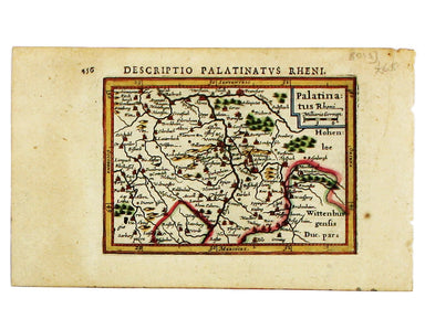
This miniature map of the Electoral Palatinate is from the first edition of Tabularum geographicarum contractarum libri, a geographical work which ...
View full details
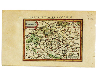
This map of Franconia, including Frankfurt and Nuremberg in modern Bavaria, is from the first edition of Tabularum geographicarum contractarum libr...
View full details
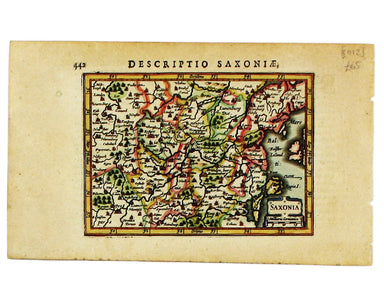
This miniature map of Saxony is from the first edition of Tabularum geographicarum contractarum libri, a geographical work which is normally catalo...
View full details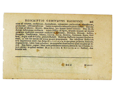
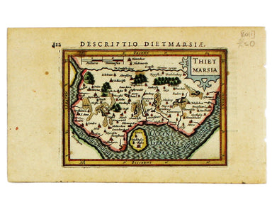
Thus miniature map of Dithmarschen in Holstein, flanked by the Eider and the Elbe isfrom the first edition of Tabularum geographicarum contractarum...
View full details
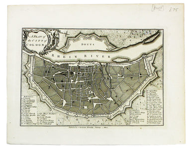
This plan of Cologne was first published in 'A collection of plans of the capital cities of Europe' in 1771. The plates seem to have been acquired ...
View full details
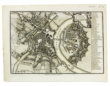
Thus plan of Dresden was first published in 'A collection of plans of the capital cities of Europe' in 1771. The plates seem to have been acquired ...
View full details
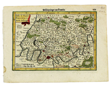
This map of Île-de-France, the Paris region north of the Seine, is from the Atlas Minor. The original plates were engraved by Jodocus Hondius, but ...
View full details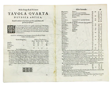
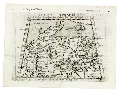
This map of Ptolemaic Germany and Denmark is from the fourth edition of Ruscelli’s Italian translation of the Geographia. It is illustrated with de...
View full details
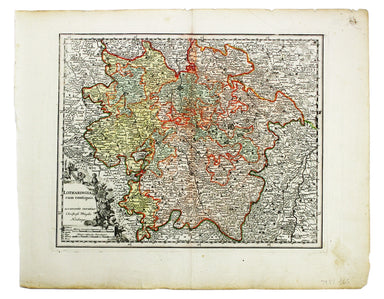
Condition & Materials Copper engraving, 28.5 x 35 cm, original hand-colour map of the Duchy of Lorraine, blank verso.
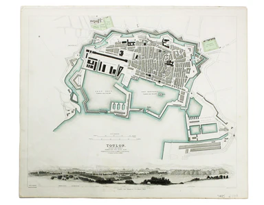
This map of Toulon was engraved by BR Davies after WB Clarke. Condition & Materials Steel engraving, 33 x 40 cm, original hand colour, blank ve...
View full details
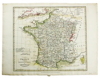
France divided into Metropolitan Circles and Departments This map was engraved by Samuel John Neele for the atlas volume to Cruttwell’s Gazeteer, p...
View full details
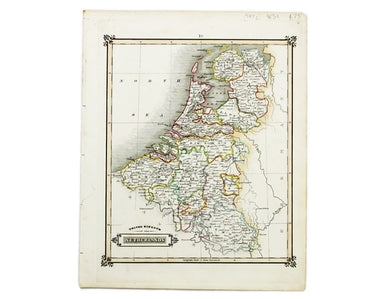
This map of the United Kingdom of the Netherlands is from 'A Modern and Ancient General Atlas, comprehending all the Empires, Kingdoms, States in t...
View full details
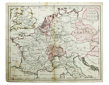
A Plain Map of the Central Part of Europe. According to the Method of the Abbé Gaultier by Mr Wauthier his Pupil This map of Central Europe is from...
View full details
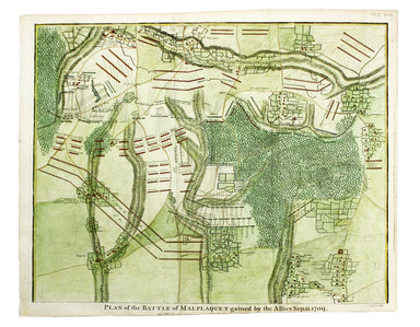
Plan of the Battle of Malplaquet gained by the Allies Sep. 11 1709 Marlborough’s bloodiest victory was often regarded as pyrrhic even by contempora...
View full details
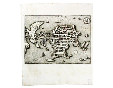
This map of Gallipoli in Apulia was published by Merian and his heirs in various works, including the Itinerarium Italiae of 1640, the Archontologi...
View full details

Plan of Cardona, a strong City and Castle of Catalonia, upon the River Cardoner as besieged by the French and defended by the Allies This plan of t...
View full details
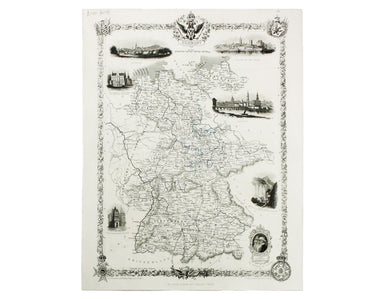
This map of Germany was engraved by John Rapkin for the Illustrated Atlas. John Rogers engraved a number of vignettes: the Palace at Saxe Gotha, bi...
View full details
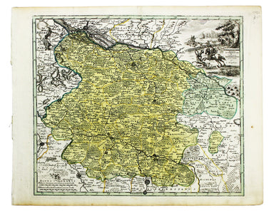
This map of the Principality of Lüneburg incorporates the former County of Dannenberg. The cartouche illustrates a stag hunting scene, perhaps on ...
View full details
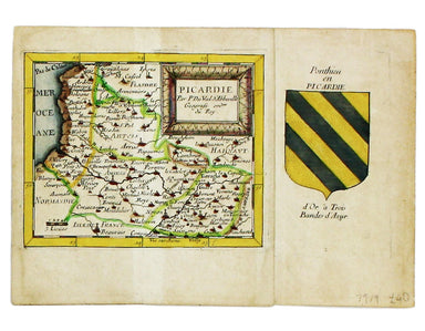
Condition & Materials Copper engraving, 10.5 x 12.6 cm, original hand-colour, lightly browned, blank verso; leaf from the same work, with the ...
View full details
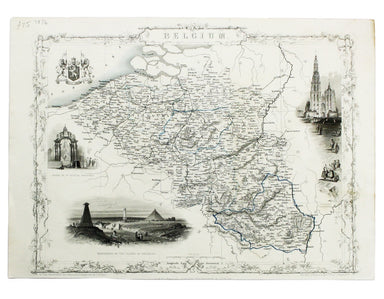
This map of Belgium was engraved by John Rapkin for the Illustrated Atlas. Vignettes including Antwerp cathedral and monuments on the plains of Wat...
View full details
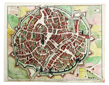
Mechelin, or Malines, the Capital of one of the ten Provinces of the Netherlands in Brabant This map of Mechelen was engraved by James Basire and p...
View full details
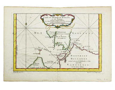
Carte du Dètriot de Waeigats, ou de Nassau This is map of the Yugorsky Strait in the Arctic Sea, separating Vaygach Island from the mainland. It il...
View full details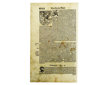
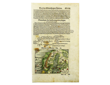
This map of Scandinavia is from Sebastian Münster's Cosmographia. A compendium of topographical information, folklore and travels, it was first pub...
View full details
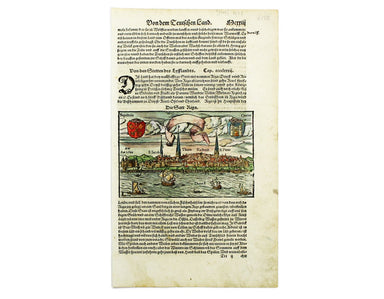
This view of the Latvian capital Riga is fromfrom Sebastian Münster's Cosmographia. A compendium of topographical information, folklore and travels...
View full details
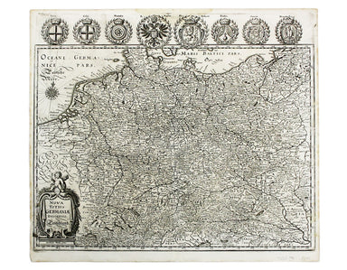
Nova Totius Germania Descriptio. Deutschland This map of Germany was published by Merian and his heirs in various works, including editions of the ...
View full details
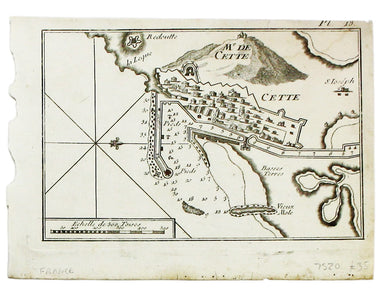
Condition & Materials A chart of Sète in southern France, copper engraving, 14 x 20 cm, black and white as issued, blank verso.
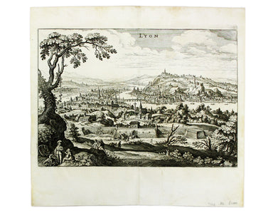
This map of Lyons was published by Merian and his heirs in various works, including the Archontologia Cosmica and Theatrum Europaeum. Condition &am...
View full details
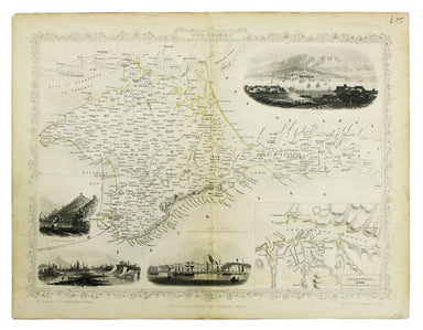
This map of Crimea was engraved by John Rapkin for the Illustrated Atlas. The inset is described as ‘Sebastopol before its investment’ (i.e. before...
View full details
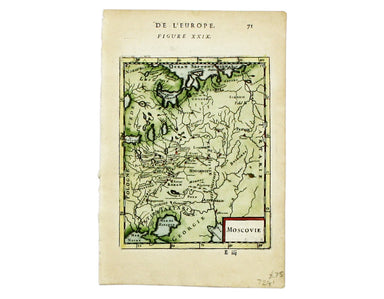
Condition & Materials Copper engraving, 14.5 x 10.5 cm, recent hand-colour, French text on verso; a map of Muscovy from Mallet’s Description de...
View full details
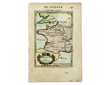
This regional map of France is from Mallet’s Description de l’Univers. Condition & Materials Copper engraving, 15 x 10.5 cm, recent hand-colo...
View full details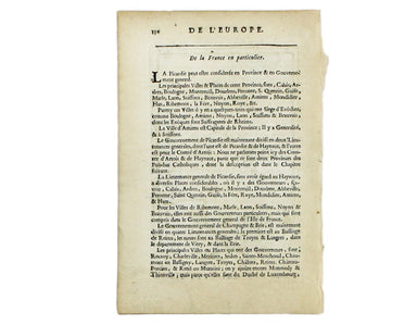
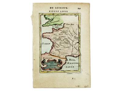
This map of France is from Mallet’s Description de l’Univers. Condition & Materials Copper engraving, 15 x 10.5 cm, recent hand-colour, French...
View full details
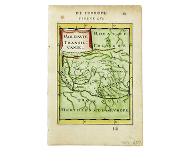
This map of Moldavia and Transylvania is from Mallet’s Description de l’Univers. Condition & Materials Copper engraving, 15 x 11.5 cm, recent ...
View full details
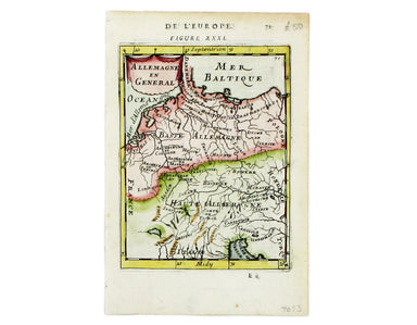
Allemagne en General This map of Northern Germany is from Mallet’s Description de l’Univers. Condition & Materials Copper engraving, 15.5 x 11....
View full details
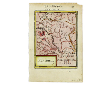
This map of Hungary is from Mallet’s Description de l’Univers. Condition & Materials Copper engraving, 15 x 11.5 cm, recent hand-colour, Frenc...
View full details
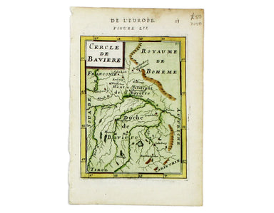
Cercle de Baverie This map of Bavaria is from Mallet’s Description de l’Univers. Condition & Materials Copper engraving, 15 x 11.5 cm, recent h...
View full details
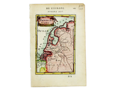
This map of the Netherlands is from Mallet’s Description de l’Univers. Condition & Materials Copper engraving, 15 x 10 cm, recent hand-colour, ...
View full details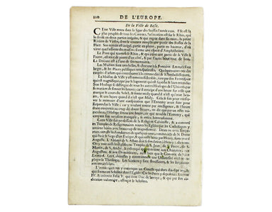
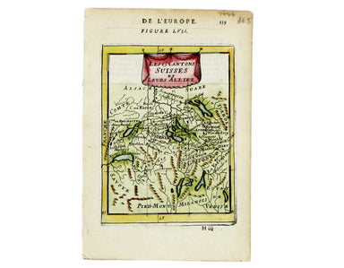
Les 13 Cantons Suisses et leurs Alliez This map of 13 Swiss Canton is from Mallet’s Description de l’Univers. Condition & Materials Copper engr...
View full details
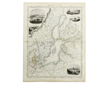
This map of the Baltic Sea was engraved by John Rapkin for the Illustrated Atlas. Vignettes including Kronstadt and St Petersburg were engraved by ...
View full details
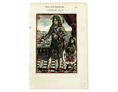
Here's King Christian V, as he appears in Mallet’s ‘Description de l’Univers. Condition & Materials Copper engraving, 15 x 10.5 cm, recent han...
View full details
