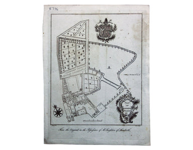
18th Century Plan of Lambeth Palace
Plan of Lambeth Palace 1750… from the original in the possession of Mr Singleton of Lambeth This plan of Lambeth Palace published in Ducarels’s ‘Th...
View full details

Plan of Lambeth Palace 1750… from the original in the possession of Mr Singleton of Lambeth This plan of Lambeth Palace published in Ducarels’s ‘Th...
View full details
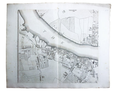
Sheet C4 from Horwood’s ‘Plan of the Cities of London and Westminster…’ Horwood’s plan is a landmark in London mapping on a number of counts. It wa...
View full details
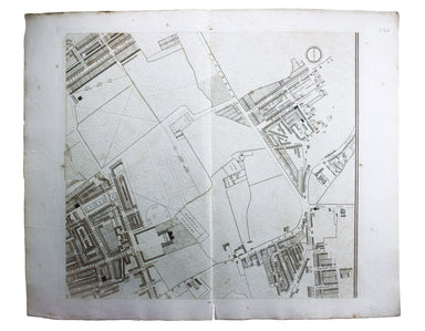
Sheet C1 from Horwood’s ‘Plan of the Cities of London and Westminster…’ Horwood’s plan is a landmark in London mapping on a number of counts. It wa...
View full details
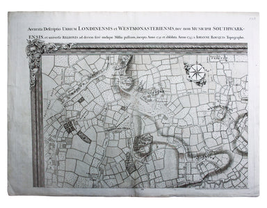
Environs of Wembley from Rocque’s ‘An Exact Survey of the City’s of London, Westminster, ye Borough of Southwark and the Country Near Ten Miles Rou...
View full details
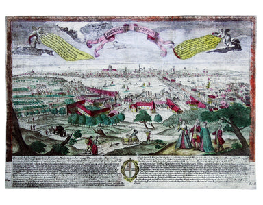
This is a view showing London before the Great Fire, from the South Bank of the Thames, including London Bridge and old St Paul’s. Principal buildi...
View full details
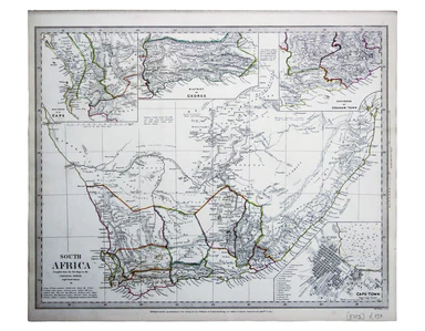
This map of South Africa, including an inset of Cape Town, was engraved by John & Charles Walker. It was published by the SDUK. The Society for...
View full details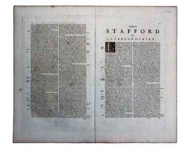
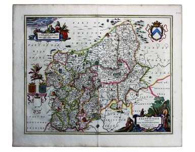
These maps of Staffordshire and Shropshire are presented on one sheet. Unlike Kip and Hole, Speed and Blaeu – who all devoted an entire map-sheet t...
View full details
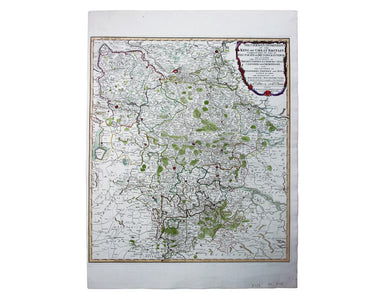
German Dominions of the King of Great Britain; Comprized under the name of Electorate of Brunswick-Luneburg and including the Dutchies of Bremen, V...
View full details
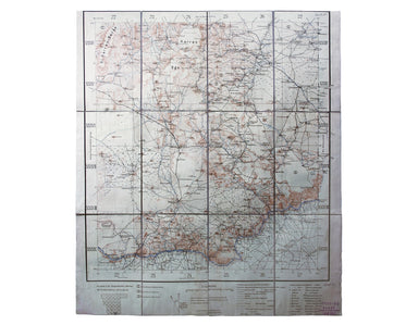
Blatt 29. Warmbad This map covers the Karas region in modern Namibia (then German South West Africa), which was the scene of one of the earliest at...
View full details
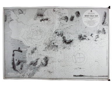
China – East Coast – Province of Shan Tung – Kyau Chau Bay This is a British chart of Jiaozhou Bay on the southern coast of the Shandong Peninsula....
View full details
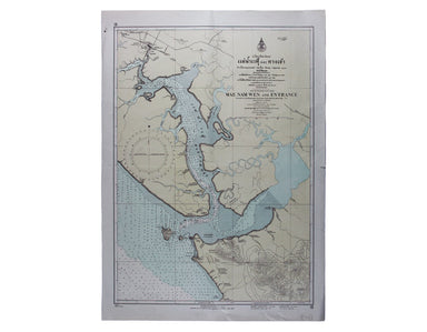
Mae Nam Wen and Entrance, Surveyed by the Hydrographic Department, Royal Thai Navy, March-May 1944 This is a Thai chart of the Mae Nam Welu estuary...
View full details
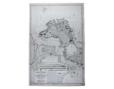
China Sea – Banka Strait This chart of the Bangka Strait was first published in 1858, but revised from British and Dutch surveys. Bangka and Sumatr...
View full details
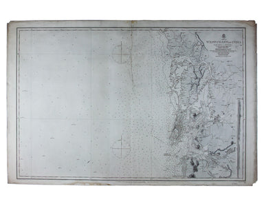
Sheet III – West Coast of India – from Arnol I. to Kundari I This chart shows the approaches to Bombay harbour, modern Mumbai, with significant det...
View full details
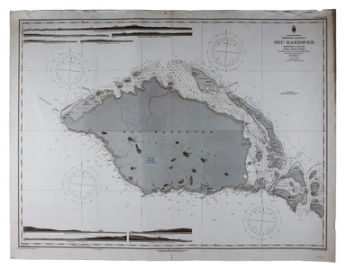
Bismark Archipel – Neu Hannover This is a German chart of New Hanover Island or Lavongai in the Bismarck Archipelago of Papua New Guinea. German Ne...
View full details
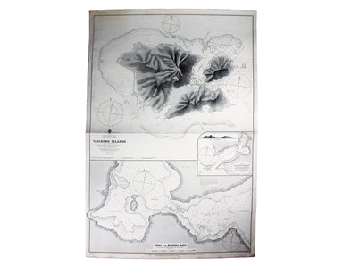
South Pacific Ocean – Santa Cruz Islands – Vanikoro Islands (La Pérouse) This British chart of Vanikoro was first published in 1873, with correctio...
View full details
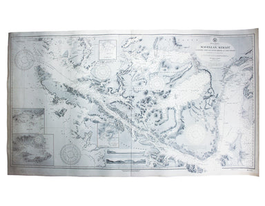
South America – Magellan Strait – Western part from Punta Arenas to Cape Pillar This US naval chart of the Magellan Strait shows soundings, anchora...
View full details
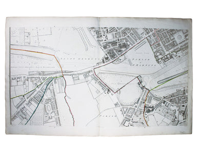
This map (two sheets from Horwood's magnificent 32 sheet survey) includes St James’s Square, the western part of Piccadilly, Green Park, Buckingham...
View full details
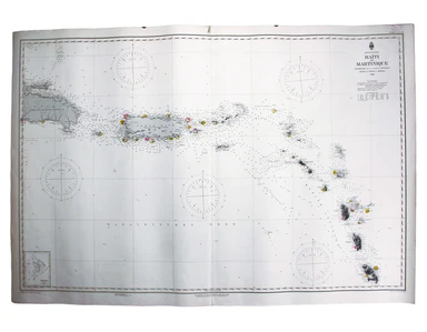
West Indien – Haïti bis Martinique This Imperial German Naval Office chart shows sands, soundings and interior detail of relief. Condition & Ma...
View full details
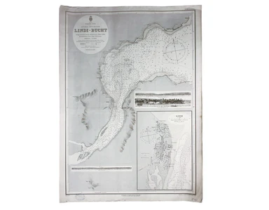
Indischer Ocea – Afrika, Ost Küst – Lindi-Bucht This Imperial German Naval Office chart shows sands, soundings etc, with interior detail of relief,...
View full details

Stiller Ozean – Hermit Inseln This is a German chart of the Hermit Islands in the Bismarck Archipelago of Papua New Guinea. German New Guinea, a Ge...
View full details
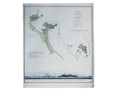
A chart of part of the coast of Cochin-China including Turon Harbour and the island Callao from an actual survey in June 1793. By HW Parish of the ...
View full details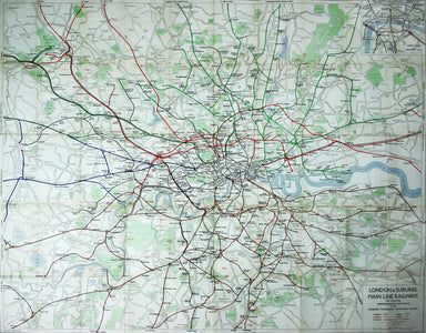
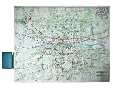
Published in March 1935, this is a commercially available map showing the operating area of the recently formed London Passenger Transport Board, a...
View full details
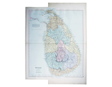
This map of Sri Lanka was published in the first trade edition of Stanford’s ‘London Atlas’. Edward Stanford (senior) acquired Arrowmsith's stock i...
View full details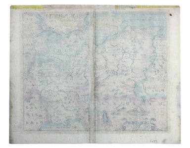
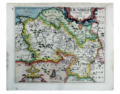
This map of Denbighshire was published in the second edition of Philemon Holland’s translation of Camden’s Britannia into English, the third printi...
View full details
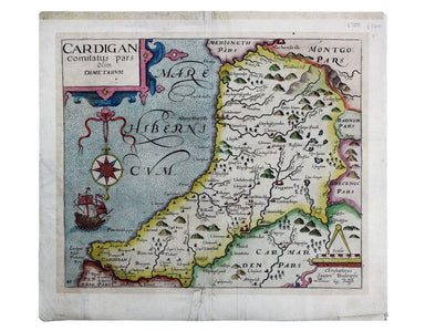
This map of Cardiganshire was published in the second edition of Philemon Holland’s translation of Camden’s Britannia into English, the third print...
View full details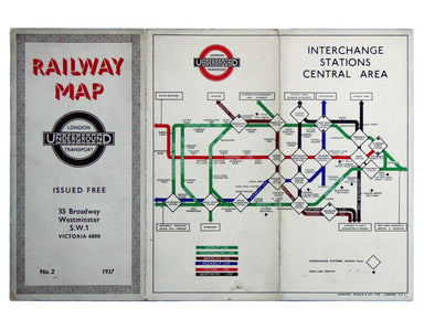
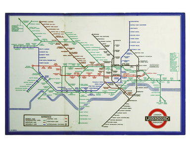
Beck’s diagram is possibly one of the most innovative and influential designs of the twentieth century. First published in 1933, Beck remained dire...
View full details
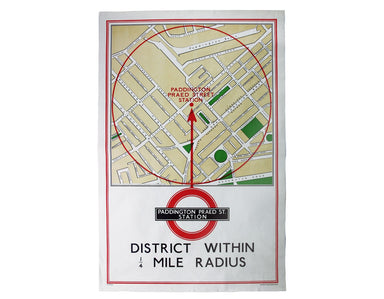
District within ¼ mile radius [of] Paddington Praed Street Stanford’s was a firm of map publishers as well as map retailers until after the Second ...
View full details
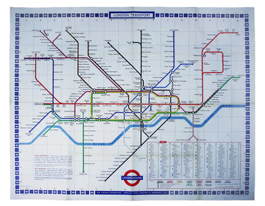
Garbutt believed he had ‘rescued’ the London Underground map from the clutches of Harold Hutchison and his ‘ham-fisted parody’ of Beck’s designs. H...
View full details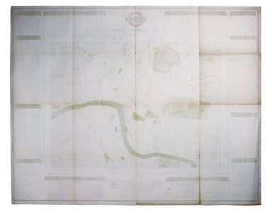
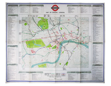
The introduction of Beck's diagram did not obviate the need for geographically accurate maps, which pinpointed the location of Underground stations...
View full details
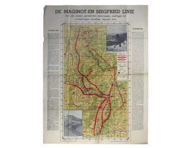
De Maginot – En Siegfried Line. Met alle steden, germeenten, spoorwegen, verstingen en versterkingen, bosschen, heuvels, enz. This map was publishe...
View full details
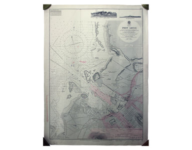
Port Louis is the capital and principal port of Mauritius, which remained a British colony until 1968. Condition & Materials Engraved British c...
View full details
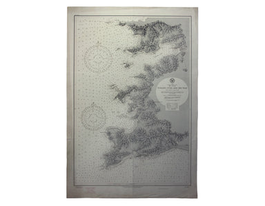
Japan – Honshu – South Coast – Kii Suido – Yurano Uchi and Hii Wan This sea chart covers a stretch of coastline to the south of Osaka and Wakayama ...
View full details
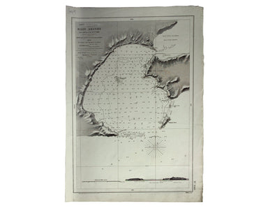
Japón – Cote Est de Yesso – Baie Akishi This is a French chart of Akkeshi Bay, located in Kushiro Subprefecture on the east coast of Hokkaido, the ...
View full details
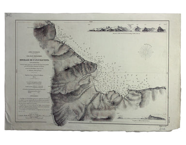
Océan Pacifique – Ile Juan Fernandez – Mouillage de San Juan Bautista This French naval chart shows the anchorage at San Juan Bautista located on C...
View full details
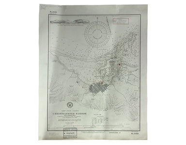
West Indies – St Croix Island – Christiansted Harbour This is a US naval chart of Christiansted, the largest town on St Croix in the United States ...
View full details
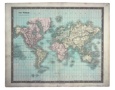
This map of the world is coloured by continent, with the exception of Russian America which is coloured as an extension of Asia. It was published i...
View full details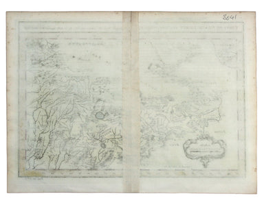
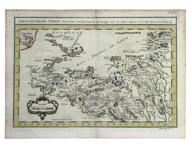
Carte du Grand Thibet. Pour Servir à l’Histoire Generale des Voyages. Tirée des Auteurs Anglois… Bellin notes that his map of Tibet was compiled fr...
View full details
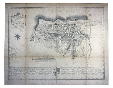
“To the Right Honourable Anthony, Ashley Cooper, Earl of Shaftesbury; Baron Ashley of Winborne St. Giles; Baron Cooper of Powlett in the County of ...
View full details
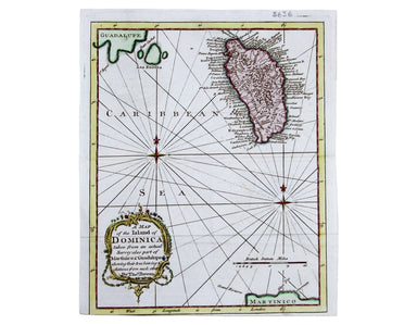
This map of Dominica is from 'The Gentleman's Magazine'. It was published after the French recaptured the island during the Anglo-French War of 177...
View full details
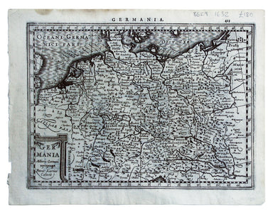
This map shows the ‘Germanic’ regions of Europe, including the Low Countries, Poland and Austria, engraved by Pieter van den Keere. The 'Atlas Mino...
View full details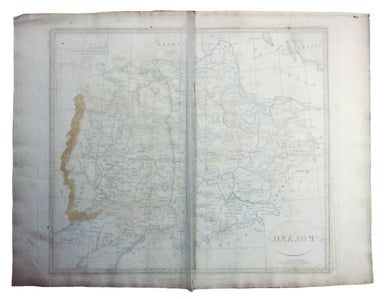
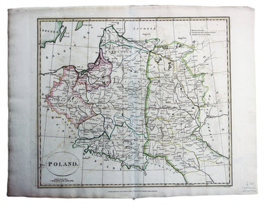
This map of Poland was engraved by Samuel John Neele for the atlas volume to ‘Cruttwell’s Gazeteer’, published by G & JJ Robinson. Condition &a...
View full details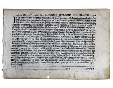
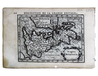
This map of the British Isles with west at the top was published in the French text edition of Tabularum geographicarum contractarum libri, a geogr...
View full details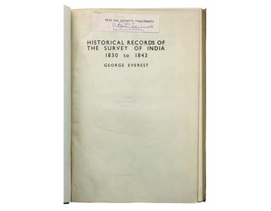
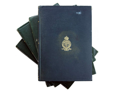
Phillimore, Colonel Reginald Henry: Historical Records of the Survey of India. Volumes 1 to 4... alas not including the suppressed fifth volume Col...
View full details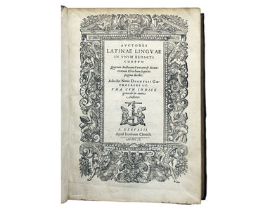
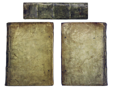
Gothofredus, Dionysius (ed.): Auctores Latinae linguae in unum redacti corpus: quorum auctorum veterum & neotericorum Elenchum sequens pagina d...
View full details
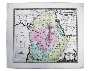
Syriae sive Soriae, nova et accurata descriptio Petrus Schenk and Gerard Valk often worked in partnership, towards the end of the Dutch Golden Age,...
View full details
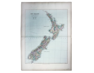
This map of New Zealand was published in the second trade edition of Stanford’s London Atlas. Edward Stanford (senior) acquired Arrowmsith's stock ...
View full details
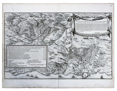
Pianta del Nuovo Aquedotto che conduce l’acqua a Civita Vechia fabricato in parte sopra le ruuine dell’ antico construtto da Traiano Imperatore Thi...
View full details
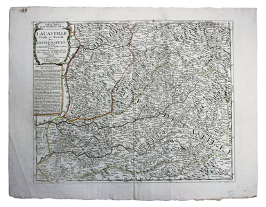
La Castille Vieille et Nouvelle This map shows Old and New Castile in central Spain. Condition & Materials Copper engraving, 44.5 x 55.5 cm, or...
View full details
