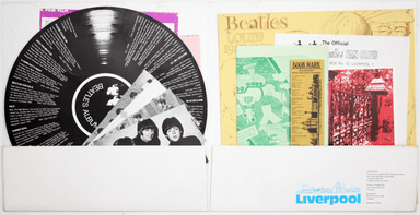
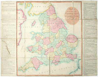
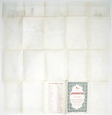
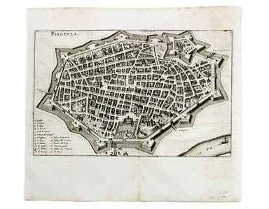
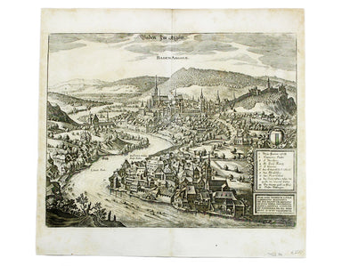
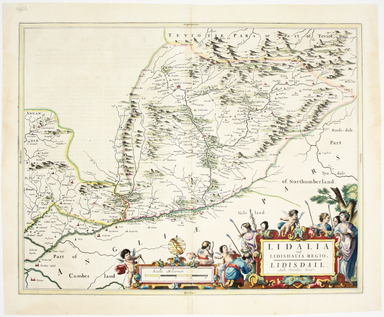
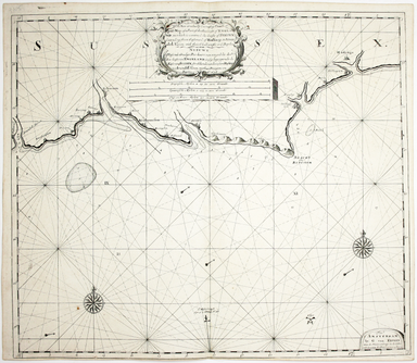
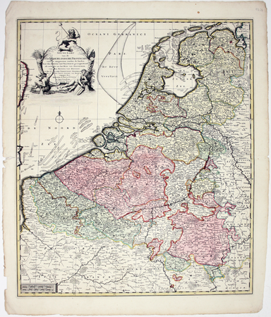
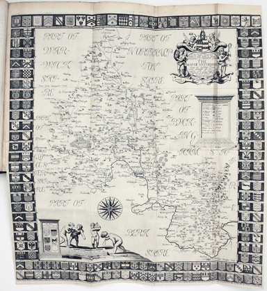
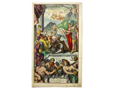
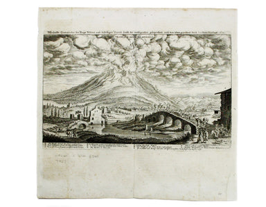
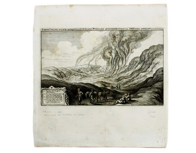
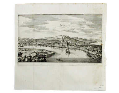
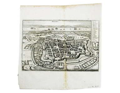
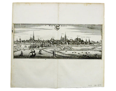
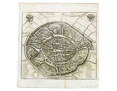
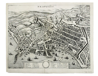
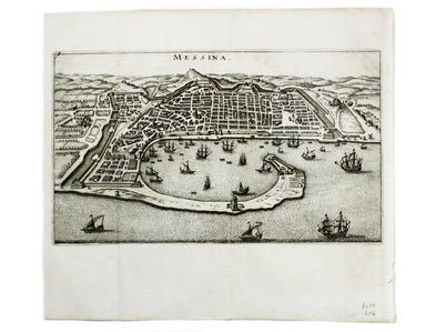
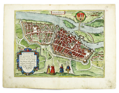
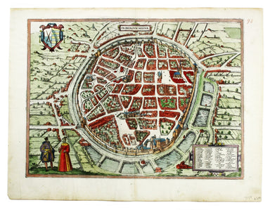
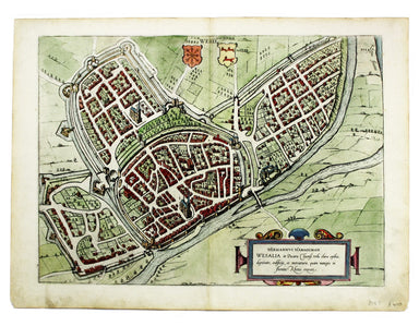
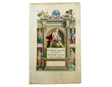
Great War Souvenir Map of Europe
This wartime souvenir handkerchief map of Europe was issued ‘by permission of the Manchester Guardian’, who printed the map over a full broadsheet ...
View full details
This wartime souvenir handkerchief map of Europe was issued ‘by permission of the Manchester Guardian’, who printed the map over a full broadsheet ...
View full details
This map of the continent of Asia was prepared for the Homann firm by Johann Matthias Hase, professor of mathematics in Wittemberg, on his stereogr...
View full details
This map of Africa reflects the state of European knowledge of the interior before the mid 19th century search for the sources of the Nile. It mark...
View full details
This map of Antwerp, engraved by Benjamin Rees Davies after William Barnard Clarke, includes elevations of principal buildings and a view of the ci...
View full details
A New and Correct Map of North Wales Robert Morden's maps were engraved to illustrate Gibson's edition of William Camden's Britannia, first publish...
View full details
Camaldulensium, nondum omnino absoluta ad Lancei oppidum eremus This is the Camaldolese hermitage near Lanzo Torinese in Piedmont (which is visible...
View full details
This is a map of Revello, near Cuneo in Piedmont. Blaeu’s townbook of Savoy and Piedmont was first published by the Blaeu heirs in 1682, but the pl...
View full details
This is a map of Ormea, near Cuneo in Piedmont. Blaeu’s townbook of Savoy and Piedmont was first published by the Blaeu heirs in 1682, but the plat...
View full details
Spain and Portugal. Reduced from the large map in four sheets James Wyld senior established a highly successful firm of map publishers, which passe...
View full details
Cartusia Vallis Pisii, fundata 1173 This is the Charterhouse of Pesio, a Carthusian foundation near Cuneo in Piedmont. Blaeu’s townbook of Savoy an...
View full details
Pomerania, running along the Baltic coast between Rostock and Gdansk, is now divided between Germany and Poland. The 'Atlas Minor’ was a pocket atl...
View full details
This map of Stockholm, with a view of of the city on a scroll bottom left, was published by the SDUK. The Society for the Diffusion of Useful Knowl...
View full details
This map shows the ‘Germanic’ regions of Europe, including the Low Countries, Poland and Austria, and was engraved by Jodocus Hondius for the ‘Atla...
View full details
Britannia et Normandia cum consiniis This map of Brittany and Normandy was engraved by Jodocus Hondius for the ‘Atlas Minor’. Condition & Mater...
View full details
Le Royaume de Hongrie, ou se trouvent la Transilvanie, la Moldavie, la Valaquie, la Bosnie la Servie et la Bulgarie, &c Our map of Hungary and ...
View full details
Partie Septentrionale du Royaume de Naples This is a later state of Robert de Vaugondy’s map of the northern part of the Kingdom of Naples. The ori...
View full details
Partie Septentrionale de la Couronne de Castille où se trouvent les Royaumes de Castille Vieille, de Leon, de Gallice, des Asturies, la Biscaye et ...
View full details
Etat de l’Eglise, Grand Duché de Toscane, et Isle de Corse This is a later state of Robert de Vaugondy’s map of the Papal States, Tuscany and Corsi...
View full details
Environs de Paris This is a later state of Robert de Vaugondy’s road map of Italy, showing the Venetian Republic, Papal States, Kingdom of Naples e...
View full details
La France divisée suivant ses Provinces ou Gouvernemens Militaires This map of France is coloured by departments, with a table listing different fo...
View full details
West Indies – Tobago – Scarborough – Rockly Bay This chart of Rockly Bay shows soundings etc, with interior detail of relief, roads and settlements...
View full details
This chart of Jamaica shows soundings etc, with interior detail of relief, roads and settlements, and an inset of Morant Cays. First published in 1...
View full details
Antilles – Ile de la Grenade This detailed chart of Grenada was derived from British Admiralty surveys. Condition & Materials French naval char...
View full details
Antilles – Ile de Culebra ou du Passage This detailed chart of Isla Culebra (now an island-municipality of Puerto Rico) was derived from British Ad...
View full details
Map of the Grand Junction Railway and its Adjacent Country. [Copied by permission from the Company’s official map.] Shewing all the the stations on...
View full details
This map of Liddesdale, in the Scottish borders, is from Golden Age Dutch cartographer Blaeu’s Scottish atlas. First published in 1654, the atlas w...
View full details
A new gradually encreasing Compass-Map of part of the Sea Coasts of England, in which is contained the Coasts of Sussex, extending from Eastwards o...
View full details
This map of Edinburgh is one of the town plans in Tallis’ hugely popular ‘Illustrated Atlas’ which was published serially from the mid 1840s onward...
View full details
A New Geographical Pastime: Walker’s Tour through England and Wales Most games of this nature were educational, and in this case players learn as t...
View full details
G. Bradshaw’s Map of Canals, Navigable Rivers, Rail Roads etc. in the Southern Counties of England. From actual survey shewing heights of the ponds...
View full details
Nieuwe Kaarte van der XVII Nederlandsche Provincien: waar in aangewezen worden de landen door den Koning van Vrankryk geconquesteerd als mede die v...
View full details
This is a collection of 61 intelligence handbooks, 1943-1945, covering enemy and occupied countries and compiled by the Foreign Office and Ministry...
View full details
In the 1920s Valletta was the location of the Royal Navy's Mediterranean Fleet's headquarters. Prepared on the island, this map of Malta has a grid...
View full details
Carte de L’Arabie, du Golfe Persique et de la Mer Rouge, avec L’Egypte, La Nubie et L’Abissinie This map of Arabia was published in an Italian edit...
View full details
This pictorial map of Liverpool is folded into a souvenir record-sleeve style pack which comprises: ‘Nothing to get hung up about’, a 30 page shor...
View full details
A New Geographical Pastime The elder John Wallis (c. 1745-1818) recovered from bankruptcy to become one of the major publishers of children’s games...
View full details
[Map of] Afghanistan, political, phisical [sic], roads and distances, important historical sites According to the online resource Encyclopaedia Ira...
View full details
Blaeu and the rival Golden Age Dutch cartographic publishing house of Janssonius raced to bring out atlases of the British Isles in the 1630s and e...
View full details
The framing device used by this children’s atlas is a little dark: Filip and his sister Cora are orphans, living with their aunt and uncle and cous...
View full details
Bradshaw’s Railway Companion, containing the times of departure, fares &c., of the railways in England, and also hackney coach fares from the p...
View full details
[Title in Greek and Latin] Stephani Byzantini Gentilia per epitomen, antehac… De urbibus inscripta [with] Notae et castigationes postumae in Stepha...
View full details
Mary Sims and Mary Camidge, both signing as 'of Maps and Guides, Ltd', each produced posters for British Railways (Eastern Region) in 1960. They th...
View full details
Map of the Great Western Railway and Connections This map illustrates how the Great Western Railway connected resources such as coal fields, china ...
View full details
The map shows bus, tram and train services operated by the Underground Group and is very similar to the pocket map issued in guidebooks c.1924 (ill...
View full details
This pictorial map grouping the three counties northeast of London was published by British Railways (Eastern Region) to promote leisure travel jus...
View full details
Les Vignobles de France – Vins de Champagne Government and national wine trade bodies sponsored Louis Larmat’s regional wine atlases in the 1940s a...
View full details
Plot, Robert: The natural history of Oxford-shire, being an essay toward the natural history of England. By R.P. LL.D. Oxford: Printed at the Theat...
View full details
This is a map of the Italian island of Sardinia, oriented with north to the left of the map. Condition & Materials Copper engraving, sheet size...
View full details